- Glenrio, New Mexico and Texas
Infobox Settlement
official_name = Glenrio, New Mexico
Glenrio, Texas
settlement_type = Unincorporated comumunity
nickname =
motto =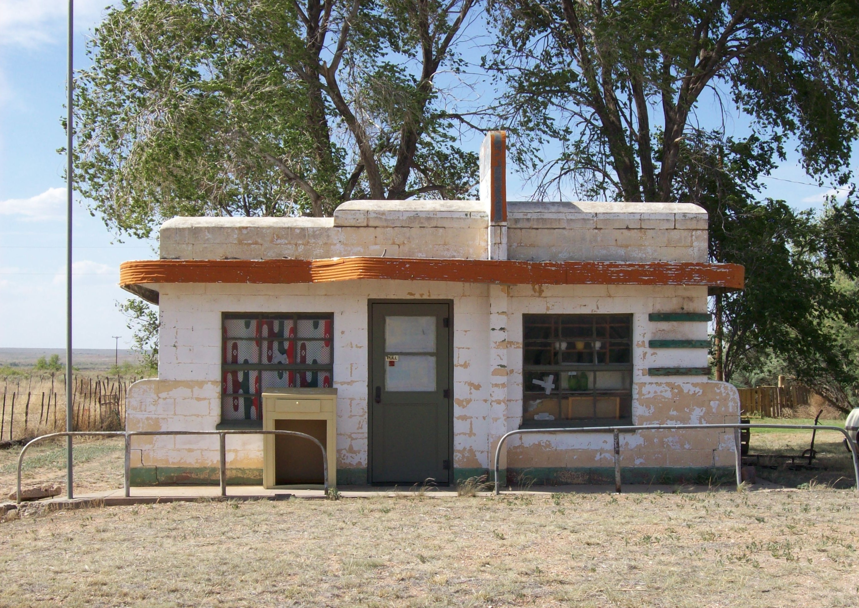
imagesize = 250px
image_caption = Closed diner in Glenrio
image_
mapsize =
map_caption =
mapsize1 =
map_caption1 =subdivision_type = Country
subdivision_name =United States
subdivision_type1 = State
subdivision_name1 =New Mexico Texas
subdivision_type2 = County
subdivision_name2 =Quay County, New Mexico Deaf Smith County, Texas
government_footnotes =
government_type =
leader_title =
leader_name =
leader_title1 =
leader_name1 =
established_title =
established_date =unit_pref = Imperial
area_footnotes =area_magnitude =
area_total_km2 =
area_land_km2 =
area_water_km2 =
area_total_sq_mi =
area_land_sq_mi =
area_water_sq_mi =population_as_of =
population_footnotes =
population_total =
population_density_km2 =
population_density_sq_mi =timezone =
utc_offset =
timezone_DST =
utc_offset_DST =
elevation_footnotes =
elevation_m =
elevation_ft =
latd = |latm = |lats = |latNS =
longd = |longm = |longs = |longEW =postal_code_type =
ZIP Code
postal_code = 88434
area_code =
blank_name =
blank_info =
blank1_name =
blank1_info =
website =
footnotes =Glenrio (also Rock Island) [gnis|915829] is an unincorporated community in both Deaf Smith County,
Texas , and Quay County,New Mexico in theUnited States . Located on Route 66, it sits on the Texas/New Mexico state line.Glenrio was the site for the "First Motel in Texas" / "Last Motel in Texas" and an old post office that straddled the state line along with other businesses along U.S. Route 66 for many years until Interstate 40 bypassed the community in 1973, rendering it a ghost town. The ghost town consists of the remains of the courtyard motel and related Texas Longhorn Cafe and Phillips 66 service station, the post office, a few other buildings including an old diner and adjacent Texaco service station, the old Route 66 roadbed and the former roadbed of the Rock Island Railroad whose tracks were removed in the 1980s. A few homes still exist here. It sits just a few yards to the south of
Interstate 40 at Texas Exit 0 on Business I-40, a road which turns into a local gravel road at the state line. Mail was formerly served by a post office on the New Mexico side of the town.The community was founded in 1903 as a railroad siding on the
Rock Island Railroad . Its name comes from Scots "glen " + Spanish "rio " (meaning "river").Glenrio Welcome Center
On
June 25 ,2008 , the State of New Mexico opened the Glenrio Welcome Center onInterstate 40 at the Texas state line. The center includes such things as a pet walk, a livestock corral, wireless Internet-access, a movie theater, and information kiosks. Built to accommodate one million visitors per year, it includes green features such as recycling ofgreywater for groundsirrigation , and awind turbine that will generate 20 percent of the center’s energy. [ [http://www.qcsunonline.com/news/new_6208___article.html/center_glenrio.html Glenrio Welcome Center officially opened] ]Notes
References
* Fugate, Francis L. and Roberta B. "Roadside History of New Mexico". Missoula, MT: Mountain Press, 1989, p. 356. ISBN 0-87842-242-0.
External links
* [http://www.texasescapes.com/TexasPanhandleTowns/GlenrioTexas.htm Pictures]
Wikimedia Foundation. 2010.