- National Register of Historic Places listings in Goliad County, Texas
-
List of Registered Historic Places in Goliad County, Texas
This is intended to be a complete list of properties and districts listed on the National Register of Historic Places in Goliad County, Texas. The locations of National Register properties and districts (at least for all showing latitude and longitude coordinates below) may be seen in a Google map by clicking on "Map of all coordinates".[1]
-
- This National Park Service list is complete through NPS recent listings posted November 10, 2011.[2]
[3] Landmark name[4] Image Date listed Location City or Town Summary 1 Charles H. and Catherine B. Baker House July 25, 1985 401 S. Commercial St.
28°39′39″N 97°23′38″W / 28.66083°N 97.39389°WGoliad 2 Dr. L.W. and Martha E.S. Chilton House April 9, 1998 242 N. Chilton St.
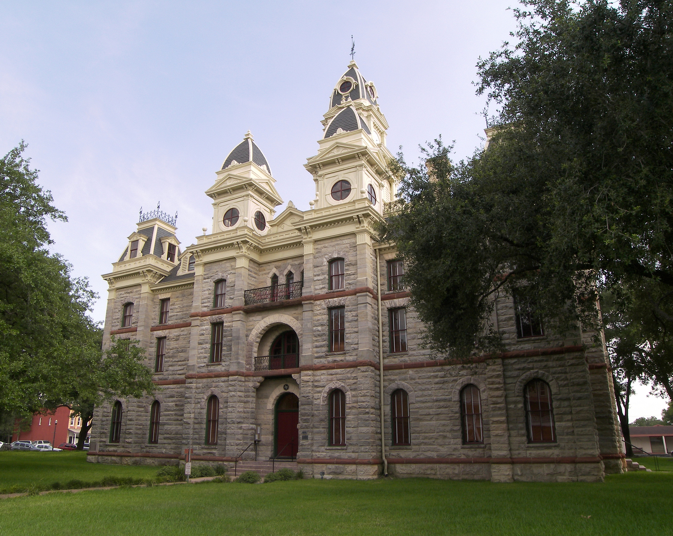
28°40′12″N 97°23′38″W / 28.67°N 97.39389°WGoliad 3 Fair Oaks Ranch March 8, 2007 14509 US 59 S Berclair 4 Goliad County Courthouse Historic District 
June 29, 1976 Roughly bounded by E. Franklin, S. Washington, E. Fannin, and S. Chilton Sts.
28°39′57″N 97°23′31″W / 28.66583°N 97.39194°WGoliad 5 Goliad State Park Historic District March 12, 2001 US 183 at San Antonio River
28°39′17″N 97°23′4″W / 28.65472°N 97.38444°WGoliad 6 Mission Nuestra Señora del Espíritu Santo de Zúñiga Site 
August 22, 1977 US 183 at San Antonio River
28°39′17″N 97°23′4″W / 28.65472°N 97.38444°WGoliad 7 Old Market House Museum October 18, 1972 S. Market and Franklin Sts.
28°40′0″N 97°23′26″W / 28.666667°N 97.39056°WGoliad 8 Capt. Barton Peck House February 23, 1979 W of Goliad at Hill and Post Oak St.
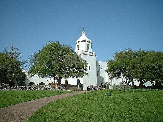
28°39′59″N 97°24′5″W / 28.66639°N 97.40139°WGoliad 9 Presidio Nuestra Senora De Loreto De La Bahia 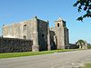
December 24, 1967 1 mi (1.6 km). S of Goliad State Park on U.S. 183
28°38′51″N 97°22′57″W / 28.6475°N 97.3825°WGoliad 10 Ruins of Mission Nuestra Senora del Rosario de los Cujanes September 22, 1972 Address Restricted Goliad 11 San Antonio River Valley (West of Goliad) Rural Historic District December 14, 1995 Address Restricted Goliad 12 Jessie W. Stoddard House January 29, 1992 Jct. of US 183, Fannin and Hord Sts.
28°39′53″N 97°23′17″W / 28.66472°N 97.38806°WGoliad See also
- Registered Historic Places in Texas, Counties A-C
References
- ^ The latitude and longitude information provided in this table was derived originally from the National Register Information System, which has been found to be fairly accurate for about 99% of listings. For about 1% of NRIS original coordinates, experience has shown that one or both coordinates are typos or otherwise extremely far off; some corrections may have been made. A more subtle problem causes many locations to be off by up to 150 yards, depending on location in the country: most NRIS coordinates were derived from tracing out latitude and longitudes off of USGS topographical quadrant maps created under the North American Datum of 1927, which differs from the current, highly accurate WGS84 GPS system used by Google maps. Chicago is about right, but NRIS longitudes in Washington are higher by about 4.5 seconds, and are lower by about 2.0 seconds in Maine. Latitudes differ by about 1.0 second in Florida. Some locations in this table may have been corrected to current GPS standards.
- ^ "National Register of Historic Places: Weekly List Actions". National Park Service, United States Department of the Interior. Retrieved on November 10, 2011.
- ^ Numbers represent an ordering by significant words. Various colorings, defined here, differentiate National Historic Landmark sites and National Register of Historic Places Districts from other NRHP buildings, structures, sites or objects.
- ^ "National Register Information System". National Register of Historic Places. National Park Service. 2008-04-24. http://nrhp.focus.nps.gov/natreg/docs/All_Data.html.
U.S. National Register of Historic Places Topics Lists by states Alabama • Alaska • Arizona • Arkansas • California • Colorado • Connecticut • Delaware • Florida • Georgia • Hawaii • Idaho • Illinois • Indiana • Iowa • Kansas • Kentucky • Louisiana • Maine • Maryland • Massachusetts • Michigan • Minnesota • Mississippi • Missouri • Montana • Nebraska • Nevada • New Hampshire • New Jersey • New Mexico • New York • North Carolina • North Dakota • Ohio • Oklahoma • Oregon • Pennsylvania • Rhode Island • South Carolina • South Dakota • Tennessee • Texas • Utah • Vermont • Virginia • Washington • West Virginia • Wisconsin • WyomingLists by territories Lists by associated states Other Categories:- Goliad County, Texas
- National Register of Historic Places in Texas
- Buildings and structures in Goliad County, Texas
-

Wikimedia Foundation. 2010.