- National Register of Historic Places listings in Denton County, Texas
-
List of Registered Historic Places in Angelina County, Texas
This is intended to be a complete list of properties and districts listed on the National Register of Historic Places in Denton County, Texas. The locations of National Register properties and districts (at least for all showing latitude and longitude coordinates below) may be seen in a Google map by clicking on "Map of all coordinates".[1]
-
- This National Park Service list is complete through NPS recent listings posted November 10, 2011.[2]
[3] Landmark name[4] Image Date listed Location City or Town Summary 1 Central Roanoke Historic District 
May 29, 2008 100 & 200 blks. of N. Oak St., Roanoke 2 Cranston Site August 21, 1982 Address Restricted Denton 3 Denton County Courthouse 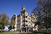
December 20, 1977 Public Sq.
33°12′54″N 97°7′58″W / 33.215°N 97.13278°WDenton 4 Denton County Courthouse Square Historic District 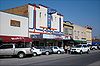
December 28, 2000 Area bounded by Pecan, Austin, Walnut, and Cedar Sts.
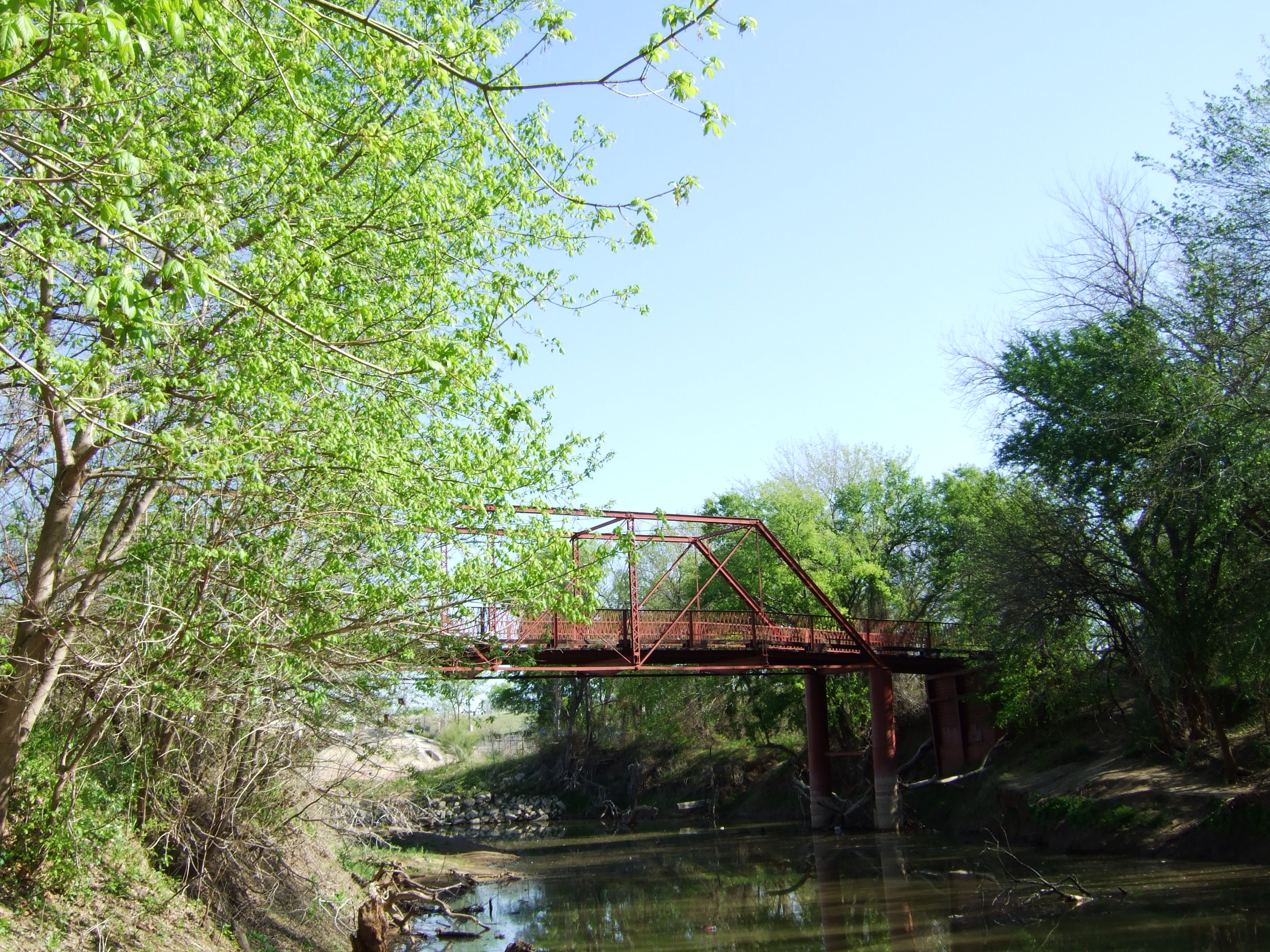
33°13′26″N 97°8′0″W / 33.22389°N 97.133333°WDenton 5 Gregory Road Bridge at Duck Creek January 14, 2004 Approx. 0.5 mi (0.80 km). W of Lois Rd., near the N Denton County line
33°25′29″N 97°13′59″W / 33.42472°N 97.23306°WSanger 6 Johnson Farm November 17, 1994 Johnson Branch Park
33°25′3″N 97°2′53″W / 33.4175°N 97.04806°WLake Ray Roberts 7 Jones Farm December 7, 1994 Johnson Branch Park, Lake Ray Roberts
33°24′53″N 97°2′38″W / 33.41472°N 97.04389°WSanger 8 J. C. Lambert Site August 21, 1982 Address Restricted Denton 9 Old Alton Bridge 
July 8, 1988 Copper Canyon Rd.
33°7′45″N 97°6′13″W / 33.12917°N 97.10361°WCopper Canyon 10 Old Continental State Bank July 22, 1986 109 N Oak St.
32°59′57″N 97°13′45″W / 32.99917°N 97.22917°WRoanoke 11 Pilot Point Commercial Historic District August 30, 2007 Portions of eight blks in downtown Pilot Point centered around the public square Pilot Point 12 Rector Road Bridge at Clear Creek January 14, 2004 Approx. 2.5 mi (4.0 km). SE of Sanger
33°19′50″N 97°8′56″W / 33.33056°N 97.14889°WSanger 13 Roark-Griffith Site August 21, 1982 Address Restricted Denton 14 A. H. Serren Site August 21, 1982 Address Restricted Denton 15 Wilson-Donaldson Site August 21, 1982 Address Restricted Denton See also
- Registered Historic Places in Texas, Counties A-C
References
- ^ The latitude and longitude information provided in this table was derived originally from the National Register Information System, which has been found to be fairly accurate for about 99% of listings. For about 1% of NRIS original coordinates, experience has shown that one or both coordinates are typos or otherwise extremely far off; some corrections may have been made. A more subtle problem causes many locations to be off by up to 150 yards, depending on location in the country: most NRIS coordinates were derived from tracing out latitude and longitudes off of USGS topographical quadrant maps created under the North American Datum of 1927, which differs from the current, highly accurate WGS84 GPS system used by Google maps. Chicago is about right, but NRIS longitudes in Washington are higher by about 4.5 seconds, and are lower by about 2.0 seconds in Maine. Latitudes differ by about 1.0 second in Florida. Some locations in this table may have been corrected to current GPS standards.
- ^ "National Register of Historic Places: Weekly List Actions". National Park Service, United States Department of the Interior. Retrieved on November 10, 2011.
- ^ Numbers represent an ordering by significant words. Various colorings, defined here, differentiate National Historic Landmark sites and National Register of Historic Places Districts from other NRHP buildings, structures, sites or objects.
- ^ "National Register Information System". National Register of Historic Places. National Park Service. 2008-04-24. http://nrhp.focus.nps.gov/natreg/docs/All_Data.html.
U.S. National Register of Historic Places Topics Lists by states Alabama • Alaska • Arizona • Arkansas • California • Colorado • Connecticut • Delaware • Florida • Georgia • Hawaii • Idaho • Illinois • Indiana • Iowa • Kansas • Kentucky • Louisiana • Maine • Maryland • Massachusetts • Michigan • Minnesota • Mississippi • Missouri • Montana • Nebraska • Nevada • New Hampshire • New Jersey • New Mexico • New York • North Carolina • North Dakota • Ohio • Oklahoma • Oregon • Pennsylvania • Rhode Island • South Carolina • South Dakota • Tennessee • Texas • Utah • Vermont • Virginia • Washington • West Virginia • Wisconsin • WyomingLists by territories Lists by associated states Other Categories:- Denton County, Texas
- National Register of Historic Places in Texas
- Buildings and structures in Denton County, Texas
-


Wikimedia Foundation. 2010.