- National Register of Historic Places listings in Denali National Park and Preserve
-
This is a list of the National Register of Historic Places listings in Denali National Park and Preserve.
This is intended to be a complete list of the properties and districts on the National Register of Historic Places in Denali National Park and Preserve, Alaska, United States. The locations of National Register properties and districts for which the latitude and longitude coordinates are included below, may be seen in a Google map.[1]
There are 15 properties and districts listed on the National Register in the park.
-
- This National Park Service list is complete through NPS recent listings posted November 10, 2011.[2]
Current listings
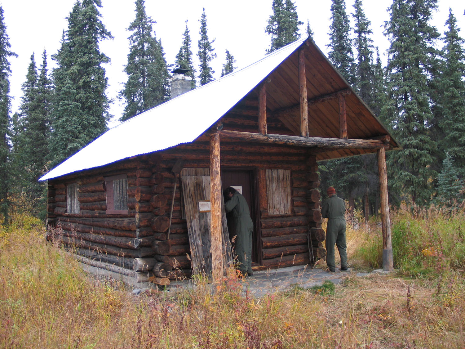
[3] Landmark name[4] Image Date listed Location City or Town Summary 1 Ewe Creek Ranger Cabin No. 8 November 25, 1986 5 miles (8.0 km) downstream on the Savage River from Park Highway near Ewe Creek
63°48′2″N 149°20′42″W / 63.80056°N 149.345°WDenali National Park and Preserve 2 Igloo Creek Cabin No. 25 
November 25, 1986 Near Igloo Creek at Mile 34.1 north of Park Rd.
63°36′35″N 149°34′55″W / 63.60972°N 149.58194°WDenali National Park and Preserve 3 Lower East Fork Ranger Cabin No. 9 
November 25, 1986 25 miles (40 km) downstream on the eastern fork of the Toklat River from Park Rd.
63°48′3″N 149°58′52″W / 63.80083°N 149.98111°WDenali National Park and Preserve 4 Lower Toklat River Ranger Cabin No. 18 
November 25, 1986 30 miles (48 km) north on the Toklat River from Park Rd.
63°48′20″N 150°15′13″W / 63.80556°N 150.25361°WDenali National Park and Preserve 5 Lower Windy Creek Ranger Cabin No. 15 
November 25, 1986 East of Mile 324 on the Alaska Railroad
63°27′53″N 148°49′38″W / 63.46472°N 148.82722°WDenali National Park and Preserve 6 Moose Creek Ranger Cabin No. 19 
November 25, 1986 5 miles (8.0 km) north of Mile 73.8 on Park Rd.
63°28′59″N 150°36′53″W / 63.48306°N 150.61472°WDenali National Park and Preserve 7 Mount McKinley National Park Headquarters District 
October 23, 1987 Mile 3.4 on the McKinley Park Highway
63°43′18″N 148°57′47″W / 63.72167°N 148.96306°WDenali National Park and Preserve 8 Riley Creek Ranger Cabin No. 20 
November 25, 1986 5 miles (8.0 km) cross-country and west of Mile 336 on the Alaska Railroad
63°34′59″N 148°57′12″W / 63.58306°N 148.95333°WDenali National Park and Preserve 9 Sanctuary River Cabin No. 31 
November 25, 1986 On the Sanctuary River at Mile 22.7 south of Park Rd.
63°43′21″N 149°28′15″W / 63.7225°N 149.47083°WDenali National Park and Preserve 10 Sushana River Ranger Cabin No. 17 
November 25, 1986 10 miles (16 km) cross-country and north of Mile 25 on Park Rd.
63°47′55″N 149°44′49″W / 63.79861°N 149.74694°WDenali National Park and Preserve 11 Teklanika Archeological District January 31, 1976 On a knoll overlooking the Teklanika River
63°40′35″N 149°45′20″W / 63.67639°N 149.75556°W[5]Toklat 12 Toklat Ranger Station-Pearson Cabin No. 4 
November 25, 1986 Near the main branch of the Toklat River at Mile 53.8 west of Park Rd.
63°31′6″N 150°2′44″W / 63.51833°N 150.04556°WDenali National Park and Preserve 13 Upper East Fork Cabin No. 29 
November 25, 1986 Near the eastern fork of the Toklat River at Mile 43 south of Park Rd.
63°33′30″N 149°46′41″W / 63.55833°N 149.77806°WDenali National Park and Preserve 14 Upper Toklat River Cabin No. 24 November 25, 1986 Near the main branch of the Toklat River at Mile 53.7 west of Park rd.
63°31′9″N 150°2′45″W / 63.51917°N 150.04583°WDenali National Park and Preserve 15 Upper Windy Creek Ranger Cabin No. 7 
November 25, 1986 6 miles (9.7 km) west of Cantwell and south of Windy Creek
63°26′11″N 149°1′25″W / 63.43639°N 149.02361°WDenali National Park and Preserve See also
- National Register of Historic Places listings in Denali Borough, Alaska
- National Register of Historic Places listings in Yukon–Koyukuk Census Area, Alaska
- List of National Historic Landmarks in Alaska
- National Register of Historic Places listings in Alaska
References
- Evans, Gail. National Register of Historic Places Inventory - Nomination Form: Patrol Cabins: Mount McKinley National Park. National Park Service 1985 [1]
- ^ The latitude and longitude information provided in this table was derived originally from the National Register Information System, which has been found to be fairly accurate for about 99% of listings. For about 1% of NRIS original coordinates, experience has shown that one or both coordinates are typos or otherwise extremely far off; some corrections may have been made. A more subtle problem causes many locations to be off by up to 150 yards, depending on location in the country: most NRIS coordinates were derived from tracing out latitude and longitudes off of USGS topographical quadrant maps created under the North American Datum of 1927, which differs from the current, highly accurate WGS84 GPS system used by Google maps. Chicago is about right, but NRIS longitudes in Washington are higher by about 4.5 seconds, and are lower by about 2.0 seconds in Maine. Latitudes differ by about 1.0 second in Florida. Some locations in this table may have been corrected to current GPS standards.
- ^ "National Register of Historic Places: Weekly List Actions". National Park Service, United States Department of the Interior. Retrieved on November 10, 2011.
- ^ Numbers represent an ordering by significant words. Various colorings, defined here, differentiate National Historic Landmark sites and National Register of Historic Places Districts from other NRHP buildings, structures, sites or objects.
- ^ "National Register Information System". National Register of Historic Places. National Park Service. 2008-04-24. http://nrhp.focus.nps.gov/natreg/docs/All_Data.html.
- ^ Location derived from West, Frederick H. "Teklanika West" in American Beginnings: The Prehistory and Palaeoecology of Beringia, Frank Hadleigh West, ed. Chicago: U of Chicago P, 1996, 332. The NRIS lists the site as "Address Restricted".
National Register of Historic Places in Denali National Park Historic districts Mount McKinley National Park Headquarters District | Teklanika Archeological District
NRHP properties Ewe Creek Ranger Cabin No. 8 | Igloo Creek Cabin No. 25 | Lower East Fork Ranger Cabin No. 9 | Lower Toklat River Ranger Cabin No. 18 | Lower Windy Creek Ranger Cabin No. 15 | Moose Creek Ranger Cabin No. 19 | Riley Creek Ranger Cabin No. 20 | Sanctuary River Cabin No. 31 | Sushana River Ranger Cabin No. 17 | Toklat Ranger Station-Pearson Cabin No. 4 | Upper East Fork Cabin No. 29 | Upper Toklat River Cabin No. 24 | Upper Windy Creek Ranger Cabin No. 7
See also: National Register of Historic Places listings in Denali National Park and PreserveU.S. National Register of Historic Places Topics Lists by states Alabama • Alaska • Arizona • Arkansas • California • Colorado • Connecticut • Delaware • Florida • Georgia • Hawaii • Idaho • Illinois • Indiana • Iowa • Kansas • Kentucky • Louisiana • Maine • Maryland • Massachusetts • Michigan • Minnesota • Mississippi • Missouri • Montana • Nebraska • Nevada • New Hampshire • New Jersey • New Mexico • New York • North Carolina • North Dakota • Ohio • Oklahoma • Oregon • Pennsylvania • Rhode Island • South Carolina • South Dakota • Tennessee • Texas • Utah • Vermont • Virginia • Washington • West Virginia • Wisconsin • WyomingLists by territories Lists by associated states Other Categories:- National Register of Historic Places lists in the National Park Service
- Buildings and structures in Denali National Park and Preserve
-


Wikimedia Foundation. 2010.