- National Register of Historic Places listings in Lancaster County, Nebraska
-
 Location of Lancaster County in Nebraska
This is a list of the National Register of Historic Places listings in Lancaster County, Nebraska.
This is intended to be a complete list of the properties and districts on the National Register of Historic Places in Lancaster County, Nebraska, United States. The locations of National Register properties and districts for which the latitude and longitude coordinates are included below, may be seen in a Google map.[1]
There are 93 properties and districts listed on the National Register in the county, including 2 National Historic Landmarks. Another 3 properties were once listed but have been removed.
-
- This National Park Service list is complete through NPS recent listings posted November 10, 2011.[2]
Current listings
[3] Landmark name Image Date listed Location City or town Summary 1 Agricultural Hall December 10, 2010 Lincoln's State Fairgrounds
40°49′53″N 96°41′34″W / 40.831389°N 96.692778°WLincoln 2 Antelope Grocery March 17, 1988 2406 J St.
40°48′30″N 96°41′09″W / 40.808333°N 96.685833°WLincoln 3 Barr Terrace October 1, 1979 627-643 S. 11th, and 1044 H St.
40°48′25″N 96°42′20″W / 40.806944°N 96.705556°WLincoln 4 Beal Slough Bridge June 29, 1992 W. Pioneers Boulevard over Beal Slough, 0.5 miles west of Lincoln
40°46′13″N 96°42′46″W / 40.770278°N 96.712778°WLincoln 5 James A. Beattie House December 4, 1990 6706 Colby St.
40°50′02″N 96°37′49″W / 40.833889°N 96.630278°WLincoln 6 Jasper Newton Bell House June 21, 1984 2212 Sheldon St.
40°49′22″N 96°41′21″W / 40.822778°N 96.689167°WLincoln 7 Boulevards Historic District December 10, 2008 Roughly bounded by South St., Calvert and High Sts., S. 22nd and S. 24th Sts., Rock Island Trail, and Sheridan Boulevard
40°47′04″N 96°41′05″W / 40.784444°N 96.684722°WLincoln 8 Guy A. Brown House March 5, 1998 219-221 S. 27th St.
40°48′43″N 96°40′58″W / 40.811944°N 96.682778°WLincoln 9 Burckhardt House June 25, 1999 1236 Washington St.
40°47′51″N 96°42′05″W / 40.7975°N 96.701389°WLincoln 10 Edgar A. Burnett House July 12, 2006 3256 Holdrede St.
40°49′42″N 96°40′27″W / 40.828333°N 96.674167°WLincoln 11 Burr Block May 18, 1979 1206 O St.
40°48′50″N 96°42′13″W / 40.813889°N 96.703611°WLincoln 12 James D. Calhoun House April 26, 2002 1130 Plum St.
40°47′31″N 96°42′15″W / 40.791944°N 96.704167°WLincoln 13 William H. Charlton House January 25, 1997 U.S. Route 77, approximately 1 mile south of its junction with Nebraska Highway 33
40°38′13″N 96°42′21″W / 40.636944°N 96.705833°WRoca 14 Chicago, Burlington & Quincy Steam Locomotive No. 710 June 20, 1997 Near the junction of 7th and Q Sts.
40°48′59″N 96°44′50″W / 40.816389°N 96.747222°WLincoln 15 Christian Record Building December 1, 1986 3705 S. 48th St.
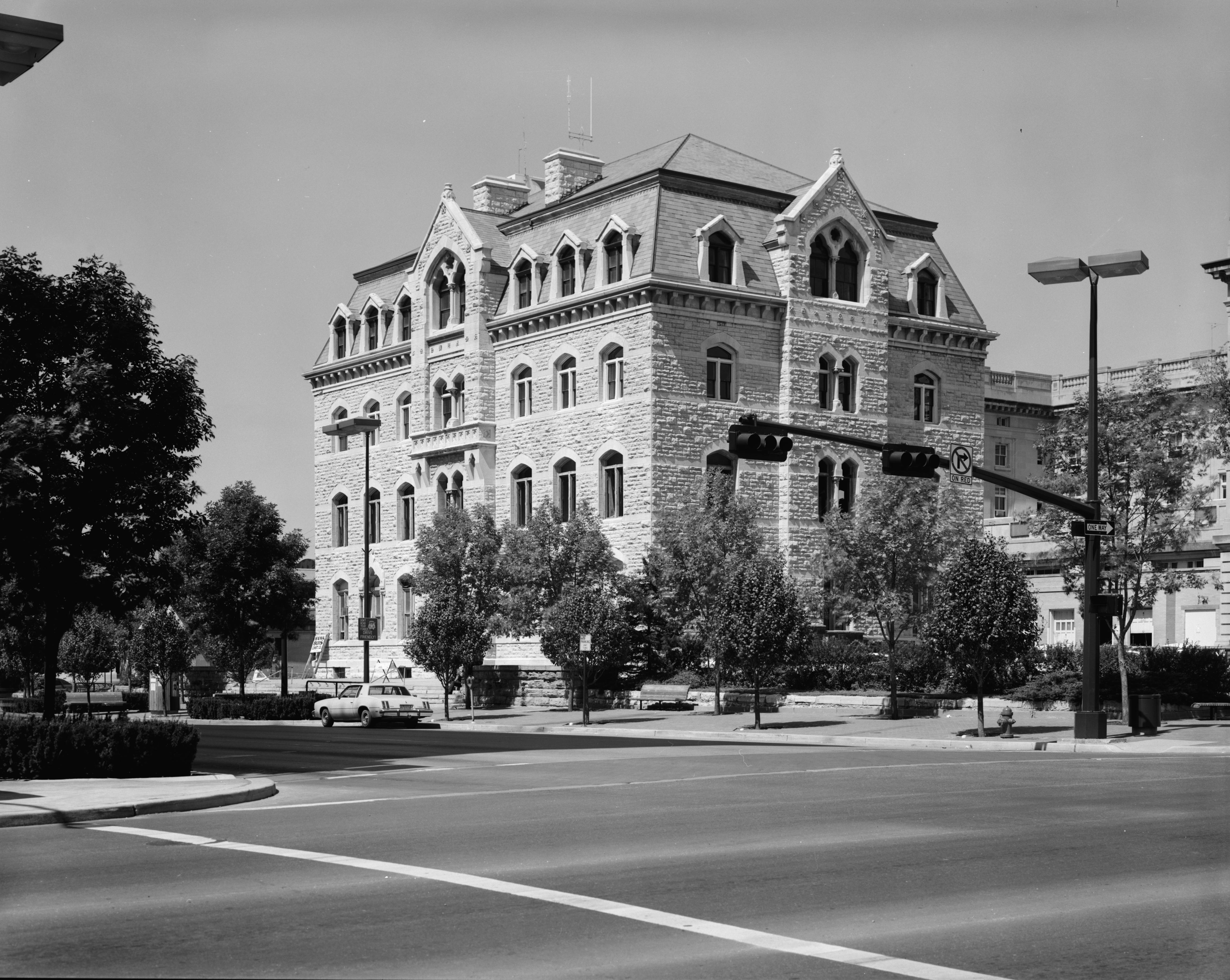
40°46′35″N 96°39′12″W / 40.776389°N 96.653333°WLincoln 16 City Hall 
October 15, 1969 920 O St.
40°48′50″N 96°42′27″W / 40.813889°N 96.7075°WLincoln 17 College View Public Library June 28, 1984 3800 S. 48th St.
40°46′23″N 96°39′12″W / 40.773056°N 96.653333°WLincoln 18 Eddy-Taylor House July 21, 1983 435 N. 25th
40°49′19″N 96°41′06″W / 40.821944°N 96.685°WLincoln 19 Ehlers Round Barn June 30, 1995 South of Nebraska Highway 2, northeast of Roca
40°41′32″N 96°34′20″W / 40.692222°N 96.572222°WRoca 20 Fairview 
October 15, 1966 4900 Sumner St.
40°47′45″N 96°39′05″W / 40.795833°N 96.651389°WLincoln 21 Federal Trust Building April 25, 2002 134 S. 13th St.
40°48′46″N 96°42′05″W / 40.812778°N 96.701389°WLincoln 22 William H. Ferguson House November 29, 1972 700 S. 16th St.
40°48′24″N 96°41′51″W / 40.806667°N 96.6975°WLincoln 23 First National Bank Building March 5, 1998 1001 O St.
40°48′44″N 96°42′16″W / 40.812222°N 96.704444°WLincoln 24 First State Bank of Bethany July 24, 1986 1551 N. Cotner Boulevard
40°49′43″N 96°37′55″W / 40.828611°N 96.631944°WLincoln 25 Frank E. and Emma A. Gillen House March 5, 1998 2245 A St.
40°47′54″N 96°41′01″W / 40.798333°N 96.683611°WLincoln 26 Gold and Company Store Building October 19, 1982 1033 O St.
40°48′15″N 96°42′23″W / 40.804167°N 96.706389°WLincoln 27 Government Square April 15, 2004 N. 9th to N. 10th St., O to P Sts.
40°48′50″N 96°42′38″W / 40.813889°N 96.710556°WLincoln 28 Greek Row Historic District June 25, 1997 Roughly, R St. from 14th to 17th Sts. and 16th St. from R toVine Sts.
40°49′06″N 96°41′55″W / 40.818333°N 96.698611°WLincoln 29 Harris House September 2, 1982 1630 K St.
40°48′34″N 96°41′49″W / 40.809444°N 96.696944°WLincoln 30 Hayward School August 23, 1985 1215 N. 9th
40°49′36″N 96°43′13″W / 40.826667°N 96.720278°WLincoln 31 Helmer-Winnett-White Flats October 1, 1979 1022-1028 K St.
40°48′34″N 96°42′21″W / 40.809444°N 96.705833°WLincoln 32 Herter Farmstead July 24, 2000 4949 S. 148th
40°45′51″N 96°31′16″W / 40.764167°N 96.521111°WWalton 33 W.F. Hitchcok House December 5, 2002 2733 Sheridan Boulevard
40°47′27″N 96°41′03″W / 40.790833°N 96.684167°WLincoln 34 Hotel Capital 
December 5, 1983 139 N. 11th St.
40°48′52″N 96°42′20″W / 40.814444°N 96.705556°WLincoln 35 Aeneas Yates-Charles Hurlbut House September 17, 1999 720 S. 16th St.
40°48′24″N 96°41′46″W / 40.806667°N 96.696111°WLincoln 36 Thomas P. Kennard House 
April 16, 1969 1627 H St.
40°48′24″N 96°41′49″W / 40.806667°N 96.696944°WLincoln 37 Theodore A. Kiesselbach House July 1, 1994 3232 Holdrege St.
40°49′41″N 96°40′28″W / 40.828056°N 96.674444°WLincoln 38 Lancaster Block April 12, 1989 6201-6205 Havelock Ave.
40°51′26″N 96°38′20″W / 40.857222°N 96.638889°WLincoln 39 Lewis-Syford House February 18, 1971 700 N. 16th St.
40°49′09″N 96°41′52″W / 40.819167°N 96.697778°WLincoln 40 Lincoln Army Air Field Regimental Chapel June 17, 1993 4601 NW. 48th St.
40°51′38″N 96°47′14″W / 40.860556°N 96.787222°WLincoln 41 Lincoln Liberty Life Insurance Building January 19, 1988 113 N. 11th St.
40°48′52″N 96°42′14″W / 40.814444°N 96.703889°WLincoln 42 Lincoln YWCA Building June 21, 1984 1432 N St.
40°48′46″N 96°41′55″W / 40.812778°N 96.698611°WLincoln 43 Lyman Terrace October 1, 1979 1111-1119 H St.
40°48′25″N 96°42′17″W / 40.806944°N 96.704722°WLincoln 44 Masonic Temple August 5, 2005 1635 L St.
40°48′33″N 96°41′54″W / 40.809167°N 96.698333°WLincoln 45 Mount Emerald and Capitol Additions Historic Residential District June 5, 1980 Roughly bounded by A, G, 17th, and 22nd Sts.
40°48′08″N 96°41′34″W / 40.802222°N 96.692778°WLincoln 46 Municipal Lighting and Waterworks Plant July 24, 1986 2901 A St.
40°47′58″N 96°40′31″W / 40.799444°N 96.675278°WLincoln 47 William L. and Sydney V. Murphy House November 4, 1994 2525 N St.
40°48′47″N 96°41′06″W / 40.813056°N 96.685°WLincoln 48 Nebraska City to Fort Kearny Cutoff Ruts at Spring Creek Prairie July 11, 2002 11700 SW. 100th St.
40°41′23″N 96°50′51″W / 40.689722°N 96.8475°WDenton 49 Nebraska Governor's Mansion March 12, 2008 1425 H St.
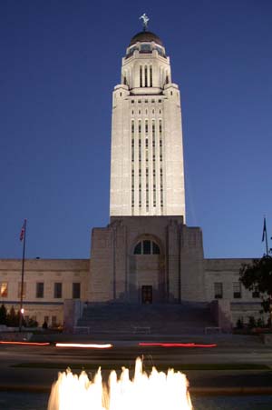
40°48′23″N 96°42′01″W / 40.806389°N 96.700278°WLincoln 50 Nebraska State Capitol 
October 16, 1970 1445 K St.
40°48′29″N 96°41′57″W / 40.808056°N 96.699167°WLincoln 51 Nebraska State Historical Society Building August 21, 2003 1500 R St.
40°49′02″N 96°41′57″W / 40.817222°N 96.699167°WLincoln 52 Nebraska Telephone Company Building November 16, 1978 128-130 S. 13th St.
40°48′46″N 96°42′08″W / 40.812778°N 96.702222°WLincoln 53 Nine-Mile Prairie 
July 30, 1986 Northwest of Huskerville
40°52′01″N 96°48′54″W / 40.866944°N 96.815°WLincoln 54 Old Main, Nebraska Wesleyan University 
May 21, 1975 50th and St. Paul Sts.
40°50′20″N 96°38′58″W / 40.838889°N 96.649444°WLincoln 55 Old University Library August 6, 1975 11th and R Sts.
40°49′02″N 96°42′21″W / 40.817222°N 96.705833°WLincoln 56 Olive Branch Bridge June 29, 1992 W. Stagecoach Rd. over Olive Brook, 1.7 miles southwest of Sprague
40°36′37″N 96°46′27″W / 40.610278°N 96.774167°WSprague 57 Palisade and Regent Apartments March 5, 1998 1035 S. 17th St. and 1626 D St.
40°48′09″N 96°41′49″W / 40.8025°N 96.696944°WLincoln 58 Park Hill September 3, 2010 1913 S. 41st St.
40°47′33″N 96°39′45″W / 40.7925°N 96.6625°WLincoln 59 Peter Peterson Farmstead February 11, 1980 Address Restricted Waverly 60 Phi Delta Theta Fraternity House May 28, 1986 1545 R St.
40°48′56″N 96°41′59″W / 40.815556°N 96.699722°WLincoln 61 Phi Kappa Tau Fraternity House November 25, 2005 5305 Huntington Ave.
40°50′16″N 96°38′44″W / 40.837778°N 96.645556°WLincoln 62 R.O. Phillips House November 29, 1979 1845 D St
40°48′08″N 96°41′38″W / 40.802222°N 96.693889°WLincoln 63 Pioneers Park June 17, 1993 Junction of W. Van Dorn and Coddington Sts.
40°46′39″N 96°45′57″W / 40.7775°N 96.765833°WLincoln 64 President and Ambassador Apartments December 10, 1993 1330 and 1340 Lincoln Mall
40°48′30″N 96°42′06″W / 40.808333°N 96.701667°WLincoln 65 Quinn Chapel African Methodist Episcopal Church and Parsonage June 25, 1999 1225 S. 9th St.
40°48′01″N 96°42′26″W / 40.800278°N 96.707222°WLincoln 66 Retzlaff Farmstead May 31, 1979 Address Restricted Lincoln 67 Rock Island Depot September 3, 1971 1944 O St.
40°48′49″N 96°41′34″W / 40.81359°N 96.69274°WLincoln 68 Nimrod Ross House June 25, 1999 445 S. 30th St.
40°48′28″N 96°40′37″W / 40.807778°N 96.676944°WLincoln 69 Royer-Williams House June 14, 1982 407 N. 26th St.
40°49′01″N 96°41′02″W / 40.816944°N 96.683889°WLincoln 70 Ryons-Alexander House July 8, 1982 1835 Ryons St.
40°47′27″N 96°41′39″W / 40.790833°N 96.694167°WLincoln 71 St. Charles Apartments September 12, 1985 4717 Baldwin Ave.
40°50′33″N 96°39′18″W / 40.8425°N 96.655°WLincoln 72 Schrader Archeological Site January 21, 1974 Address Restricted Roca 73 Scottish Rite Temple December 1, 1986 332 Centennial Mall, S.
40°48′35″N 96°42′05″W / 40.809722°N 96.701389°WLincoln 74 South Bottoms Historic District 
July 17, 1986 Roughly bounded by M and J and H and G Sts., 2nd and 9th Sts., and W. B Sts., and Salt Creek
40°48′16″N 96°43′02″W / 40.804444°N 96.717222°WLincoln 75 Frank M. Spalding House March 25, 1999 2221 Sheridan Boulevard
40°47′27″N 96°41′03″W / 40.790833°N 96.684167°WLincoln 76 R.O. Stake House April 27, 2005 145 S. 28th St.
40°48′49″N 96°40′43″W / 40.813611°N 96.678611°WLincoln 77 State Arsenal September 17, 1981 17th and Court Sts.
40°49′45″N 96°41′47″W / 40.829167°N 96.696389°WLincoln 78 Stuart Building December 23, 2003 13th and P Sts.
40°48′52″N 96°42′07″W / 40.814444°N 96.701944°WLincoln 79 Temple of Congregation B'nai Jeshurun June 25, 1982 20 and South Sts.
40°47′31″N 96°41′31″W / 40.791944°N 96.691944°WLincoln 80 Terminal Building December 29, 1986 947 O St.
40°48′45″N 96°42′33″W / 40.8125°N 96.709167°WLincoln 81 John M. Thayer House December 5, 2002 1901 Prospect St.
40°47′42″N 96°41′36″W / 40.795°N 96.693333°WLincoln 82 Tifereth Israel Synagogue May 9, 1985 344 S. 18th St.
40°48′37″N 96°41′41″W / 40.810278°N 96.694722°WLincoln 83 William H. Tyler House April 6, 1978 808 D St.
40°48′10″N 96°42′35″W / 40.802778°N 96.709722°WLincoln 84 University Place Historic Residential District February 7, 2003 Roughly Walker Ave., 51st-54th Sts., Leighton Ave., and 49th-53rd Sts.
40°50′09″N 96°39′06″W / 40.835833°N 96.651667°WLincoln 85 Veith Building September 18, 1980 816 P St.
40°48′54″N 96°42′32″W / 40.815°N 96.708889°WLincoln 86 Albert Watkins House April 3, 1989 920 D St.
40°48′07″N 96°42′38″W / 40.801944°N 96.710556°WLincoln 87 Whitehall October 29, 1982 5903 Walker
40°50′10″N 96°38′23″W / 40.836111°N 96.639722°WLincoln 88 Woods Brothers Building September 18, 1980 132 S. 13th St.
40°48′46″N 96°42′08″W / 40.812778°N 96.702222°WLincoln 89 Frank and Nelle Cochrane Woods House June 30, 1995 2501 Sheridan Boulevard
40°47′13″N 96°40′54″W / 40.786944°N 96.681667°WLincoln 90 Woodsshire Residential Historic District March 29, 2011 Bounded by High and Calvert Sts., South 17th to South 20th Sts.
40°46′45″N 96°41′41″W / 40.779167°N 96.694722°WLincoln 91 Wyuka Cemetery July 19, 1982 3600 O St.
40°49′01″N 96°39′54″W / 40.816944°N 96.665°WLincoln 92 John H. and Christina Yost House April 26, 2002 1900 S. 25th St.
40°47′32″N 96°41′00″W / 40.792222°N 96.683333°WLincoln 93 Arthur C. Ziemer House November 23, 1977 2030 Euclid Ave.
40°47′39″N 96°41′28″W / 40.794167°N 96.691111°WLincoln Former listings
Three buildings in Lincoln were removed from the Register on March 14, 2007:
- Baldwin Terrace
- Metropolitan Apartments
- Townsend Photography Studio
See also
- List of National Historic Landmarks in Nebraska
- National Register of Historic Places listings in Nebraska
References
- ^ The latitude and longitude information provided in this table was derived originally from the National Register Information System, which has been found to be fairly accurate for about 99% of listings. For about 1% of NRIS original coordinates, experience has shown that one or both coordinates are typos or otherwise extremely far off; some corrections may have been made. A more subtle problem causes many locations to be off by up to 150 yards, depending on location in the country: most NRIS coordinates were derived from tracing out latitude and longitudes off of USGS topographical quadrant maps created under North American Datum of 1927, which differs from the current, highly accurate GPS system used by Google maps. Chicago is about right, but NRIS longitudes in Washington are higher by about 4.5 seconds, and are lower by about 2.0 seconds in Maine. Latitudes differ by about 1.0 second in Florida. Some locations in this table may have been corrected to current GPS standards.
- ^ "National Register of Historic Places: Weekly List Actions". National Park Service, United States Department of the Interior. Retrieved on November 10, 2011.
- ^ Numbers represent an ordering by significant words. Various colorings, defined here, differentiate National Historic Landmark sites and National Register of Historic Places Districts from other NRHP buildings, structures, sites or objects.
U.S. National Register of Historic Places Topics Lists by states Alabama • Alaska • Arizona • Arkansas • California • Colorado • Connecticut • Delaware • Florida • Georgia • Hawaii • Idaho • Illinois • Indiana • Iowa • Kansas • Kentucky • Louisiana • Maine • Maryland • Massachusetts • Michigan • Minnesota • Mississippi • Missouri • Montana • Nebraska • Nevada • New Hampshire • New Jersey • New Mexico • New York • North Carolina • North Dakota • Ohio • Oklahoma • Oregon • Pennsylvania • Rhode Island • South Carolina • South Dakota • Tennessee • Texas • Utah • Vermont • Virginia • Washington • West Virginia • Wisconsin • WyomingLists by territories Lists by associated states Other  Category:National Register of Historic Places •
  Portal:National Register of Historic Places
Municipalities and communities of Lancaster County, Nebraska County seat: Lincoln Cities 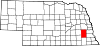
Villages Unincorporated
communitiesMartell | Prairie Home
Categories:- National Register of Historic Places in Nebraska by county
- Lancaster County, Nebraska
- Buildings and structures in Lancaster County, Nebraska
-


Wikimedia Foundation. 2010.