- Titus County, Texas
-
Titus County, Texas 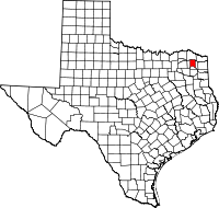
Location in the state of Texas
Texas's location in the U.S.Founded 1846 Seat Mount Pleasant Area
- Total
- Land
- Water
426 sq mi (1,103 km²)
411 sq mi (1,064 km²)
15 sq mi (39 km²), 3.56%Population
- (2000)
- Density
28,118
67/sq mi (26/km²)Website www.co.titus.tx.us Titus County is a county located in the U.S. state of Texas. In 2000, its population was 28,118. Its county seat is Mount Pleasant.[1] The county is named for Andrew Jackson Titus, an early settler.
Titus County is represented in the Texas House of Representatives by the Republican Erwin Cain of Sulphur Springs, Texas. It was formerly represented in the Texas State Senate by Bill Ratliff, another Republican, who served from 2001-2003 as Lieutenant Governor of Texas.
Contents
Geography
According to the U.S. Census Bureau, the county has a total area of 426 square miles (1,103 km²), of which 411 square miles (1,063 km²) is land and 15 square miles (40 km²) (3.56%) is water.
Major highways
 Interstate 30
 U.S. Highway 67
 U.S. Highway 271
 State Highway 49
Adjacent counties
- Red River County (north)
- Morris County (east)
- Camp County (south)
- Franklin County (west)
Demographics
Historical populations Census Pop. %± 1850 3,636 — 1860 9,648 165.3% 1870 11,339 17.5% 1880 5,959 −47.4% 1890 8,190 37.4% 1900 12,292 50.1% 1910 16,422 33.6% 1920 18,128 10.4% 1930 16,003 −11.7% 1940 19,228 20.2% 1950 17,302 −10.0% 1960 16,785 −3.0% 1970 16,702 −0.5% 1980 21,442 28.4% 1990 24,009 12.0% 2000 28,118 17.1% Est. 2009 30,206 7.4% U.S. Census Bureau[2] Texas Almanac[3] As of the census[4] of 2000, there were 28,118 people, 9,552 households, and 7,154 families residing in the county. The population density was 68 people per square mile (26/km²). There were 10,675 housing units at an average density of 26 per square mile (10/km²). The racial makeup of the county was 70.15% White, 10.70% Black or African American, 0.58% Native American, 0.43% Asian, 0.02% Pacific Islander, 16.42% from other races, and 1.71% from two or more races. 28.31% of the population were Hispanic or Latino of any race.
There were 9,552 households out of which 39.10% had children under the age of 18 living with them, 59.00% were married couples living together, 11.40% had a female householder with no husband present, and 25.10% were non-families. 22.10% of all households were made up of individuals and 11.10% had someone living alone who was 65 years of age or older. The average household size was 2.88 and the average family size was 3.36.
In the county, the population was spread out with 30.30% under the age of 18, 9.80% from 18 to 24, 28.00% from 25 to 44, 19.50% from 45 to 64, and 12.50% who were 65 years of age or older. The median age was 32 years. For every 100 females there were 97.80 males. For every 100 females age 18 and over, there were 94.00 males.
The median income for a household in the county was $32,452, and the median income for a family was $37,390. Males had a median income of $26,466 versus $18,238 for females. The per capita income for the county was $15,501. About 14.90% of families and 18.50% of the population were below the poverty line, including 25.10% of those under age 18 and 14.10% of those age 65 or over.
Cities and towns
Education
The following school districts serve Titus County:
- Chapel Hill ISD
- Daingerfield-Lone Star ISD (mostly in Morris County)
- Harts Bluff ISD
- Mount Pleasant ISD
- Pewitt CISD (mostly in Morris County, small portion in Cass County)
- Rivercrest ISD (partly in Red River County, small portion in Franklin County)
- Winfield ISD
In addition, Northeast Texas Community College serves Titus County as well as neighboring Morris and Camp counties.
See also
References
- ^ "Find a County". National Association of Counties. http://www.naco.org/Counties/Pages/FindACounty.aspx. Retrieved 2011-06-07.
- ^ http://www.factfinder.census.gov
- ^ http://www.texasalmanac.com/population/population-counties-history.pdf
- ^ "American FactFinder". United States Census Bureau. http://factfinder.census.gov. Retrieved 2008-01-31.
External links
- Titus County government's website
- Titus County from the Handbook of Texas Online

Red River County Franklin County 
Morris County  Titus County, Texas

Camp County Municipalities and communities of Titus County, Texas Cities 
Town Unincorporated
communitiesCategories:- Texas counties
- Titus County, Texas
- 1846 establishments in the United States


Wikimedia Foundation. 2010.