- Mirando City, Texas
-
Mirando City, Texas — CDP — Mirando City water tower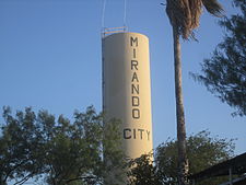 Location of Mirando City, Texas
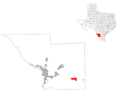
Coordinates: 27°26′26″N 98°59′57″W / 27.44056°N 98.99917°WCoordinates: 27°26′26″N 98°59′57″W / 27.44056°N 98.99917°W Country United States State Texas County Webb Established 1881 Area – Total 11.1 sq mi (28.7 km2) – Land 11.1 sq mi (28.7 km2) – Water 0.0 sq mi (0.0 km2) Elevation 786 ft (231 m) Population (2000) – Total 493 – Density 44.5/sq mi (17.2/km2) Time zone CST (UTC-6) – Summer (DST) CST (UTC-5) Zip Code 78369 Area code(s) +1 - 361 FIPS code 48-48756[1] GNIS feature ID 1341732[2] Nearest Airports: Laredo: Laredo International Airport KLRD LRD Nuevo Laredo: Quetzalcoatl International Airport MMNL NLD 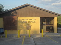 U.S. Post Office in Mirando City
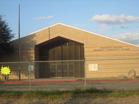 Ernesto J. Salinas Memorial Community Center
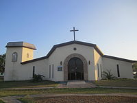 St. Agnes Roman Catholic Mission in Mirando City
Mirando City is a census-designated place (CDP) in Webb County, Texas, United States. The population was 493 at the 2000 census. The town gets its name from Nicolás Mirando, a Spanish land grantee. The population of Mirando City was highest in 1929, at an estimated 1500. The peyote cactus thrives in and around Mirando City and nearby Oilton, and is a clandestine source of income for residents. Peyoteros have harvested peyote in Mirando City for over a hundred years.
Mirando City was the center of the South Texas Oil Boom, launched in 1921 by the industrialist Oliver Winfield Killam of Laredo.
Contents
History
O. W. Killiam established the community in 1921.[3]
Geography
Mirando City is located at 27°26′26″N 98°59′57″W / 27.44056°N 98.99917°W (27.440631, -98.999170)[4].
According to the United States Census Bureau, the CDP has a total area of 11.1 square miles (28.7 km²), all of it land.
It is 30 miles (48 km) southeast of Laredo.[3]
Demographics
As of the census[1] of 2000, there were 493 people, 145 households, and 108 families residing in the CDP. The population density was 44.5 people per square mile (17.2/km²). There were 205 housing units at an average density of 18.5/sq mi (7.1/km²). The racial makeup of the CDP was 85.80% White, 0.20% Native American, 0.81% Asian, 10.95% from other races, and 2.23% from two or more races. Hispanic or Latino of any race were 91.89% of the population.
There were 145 households out of which 48.3% had children under the age of 18 living with them, 63.4% were married couples living together, 8.3% had a female householder with no husband present, and 25.5% were non-families. 22.8% of all households were made up of individuals and 8.3% had someone living alone who was 65 years of age or older. The average household size was 3.40 and the average family size was 4.16.
In the CDP the population was spread out with 39.6% under the age of 18, 7.1% from 18 to 24, 23.1% from 25 to 44, 19.7% from 45 to 64, and 10.5% who were 65 years of age or older. The median age was 28 years. For every 100 females there were 90.3 males. For every 100 females age 18 and over, there were 94.8 males.
The median income for a household in the CDP was $24,375, and the median income for a family was $30,221. Males had a median income of $25,250 versus $18,250 for females. The per capita income for the CDP was $9,553. About 22.2% of families and 26.0% of the population were below the poverty line, including 27.3% of those under age 18 and 35.6% of those age 65 or over.
Education
Mirando City is served by the Webb Consolidated Independent School District.
Mirando City residents attend:
- Bruni High School (9-12)
- Bruni Middle School (6-8)
- Oilton Elementary School (K-5)
Prior to 1994 Webb CISD served only Bruni and Oilton. Mirando City Independent School District served the community of Mirando City from 1923 to 2005. Prior to 1994 all Mirando City children attended Mirando City ISD schools. After spring 1994, Mirando High School closed.[5] Therefore, from Fall 1994 to July 1, 2005, WCISD served high schoolers from Mirando City while Mirando Elementary School in the Mirando City ISD served students from kindergarten through 8th grade. On May 9, 2005 the Texas Education Agency ordered the closure of Mirando City ISD. The district closed on July 1, 2005, and all students were rezoned to Webb CISD schools.[6] All of Mirando City's children now go to Webb CISD schools.
References
- ^ a b "American FactFinder". United States Census Bureau. http://factfinder.census.gov. Retrieved 2008-01-31.
- ^ "US Board on Geographic Names". United States Geological Survey. 2007-10-25. http://geonames.usgs.gov. Retrieved 2008-01-31.
- ^ a b "[http://www.window.state.tx.us/tspr/mirandopr/ Progress Report Mirando City Independent School District]." Texas Comptroller of Public Accounts. October 2003. Retrieved on October 2, 2011.
- ^ "US Gazetteer files: 2010, 2000, and 1990". United States Census Bureau. 2011-02-12. http://www.census.gov/geo/www/gazetteer/gazette.html. Retrieved 2011-04-23.
- ^ Mirando City, Texas from the Handbook of Texas Online
- ^ Bogan, Jesse. "A school district counts its final days." San Antonio Express-News. May 9, 2005. 01A. Retrieved on April 11, 2009.
External links
- Mirando City Website
- Mirando City, Texas from the Handbook of Texas Online
Municipalities and communities of Webb County, Texas Cities 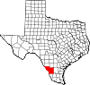
CDPs Botines | Bruni | La Presa | Laredo Ranchettes | Larga Vista | Mirando City | Oilton | Ranchitos Las Lomas | Ranchos Penitas West
Unincorporated
communitiesAguilares | Callaghan | Dolores | Las Tiendas | Webb
Ghost towns Darwin | Islitas | Los Ojuelos | Pescadito | Santo Tomás
Categories:- Census-designated places in Texas
- Populated places in Webb County, Texas
- Populated places in Texas with Hispanic majority populations
- 1921 establishments in the United States


Wikimedia Foundation. 2010.