- Washington, Arkansas
Infobox Settlement
official_name = Washington, Arkansas
settlement_type =City
imagesize =
image_caption =
image_
imagesize =
image_caption =
image_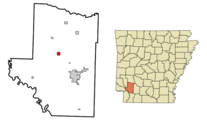
mapsize = 250px
map_caption = Location in Hempstead County and the state ofArkansas
mapsize1 =
map_caption1 =
subdivision_type = Country
subdivision_type1 = State
subdivision_type2 = County
subdivision_name =United States
subdivision_name1 =Arkansas
subdivision_name2 = Hempstead
government_type =
leader_title =
leader_name =
established_date =
area_magnitude =
area_total_km2 = 2.6
area_total_sq_mi = 1
area_land_km2 = 2.6
area_land_sq_mi = 1
area_water_km2 = 0
area_water_sq_mi = 0
elevation_ft = 446
elevation_m = 136
population_as_of = 2000
population_footnotes =
population_total = 148
population_metro =
population_density_km2 = 56.9
population_density_sq_mi = 148
timezone = Central (CST)
utc_offset = -6
latd = 33 |latm = 46 |lats = 29 |latNS = N
longd = 93 |longm = 40 |longs = 53 |longEW = W
timezone_DST = CDT
utc_offset_DST = -5
postal_code_type =ZIP code
postal_code = 71862
area_code = 870
blank_name = FIPS code
blank_info = 05-73370
blank1_name = GNIS feature ID
blank1_info = 0078702
footnotes =
website =Washington is a
settlement in Hempstead County,Arkansas ,United States . The population was 148 at the 2000 census. It is part of the Hope Micropolitan Statistical Area.The city is also home to
Old Washington Historic State Park .Augustus H. Garland , theAttorney General of the United States underU.S. President Grover Cleveland lived there in his early years.Geography
Washington is located at coor dms|33|46|29|N|93|40|53|W|city (33.774670, -93.681451)GR|1.
According to the
United States Census Bureau , the city has a total area of 1.0square mile s (2.6km² ), all of it land.History
From its establishment in
1824 , Washington was an important stop on the ruggedSouthwest Trail for pioneers traveling toTexas . That same year it was established as the "seat of justice" for that area, and in1825 the "Hempstead County Court of Common Pleas" was established, located in a building constructed next door to atavern owned by early resident Elijah Stuart. Between1832 and1839 thousands ofChoctaw American Indians passed through Washington on their way toIndian Territory . Frontiersmen and national heroesJames Bowie ,Sam Houston andDavy Crockett all traveled through Washington enroute to the Alamo. Houston is believed to have planned parts of the revolt strategy in a tavern in Washington during1834 . [http://asms.k12.ar.us/armem/deloney/mem4.htm]James Black , a local blacksmith, is credited with creating the legendaryBowie knife carried by Jim Bowie at his blacksmith shop in Washington. [cite web|url=http://asms.k12.ar.us/armem/deloney/mem4.htm|title=Role in developing history|publisher=The Arkansas School for Mathematics]During the
War with Mexico , beginning in1846 , Washington became a rally point for volunteer troops on their way to serve with theUS Army . Later, the town became a major service center for area planters, merchants and professionals. Following the capture of Little Rock by theUnion Army in1863 , the Confederate government moved the state government offices to Hot Springs for short time, then ultimately based the state government out of Washington, making it the Capital ofArkansas from 1863-1865 . [http://www.civilwarbuff.org/washington.html] [http://asms.k12.ar.us/armem/deloney/mem3.htm]Albert G. Simms (1882 -1964 ), aUnited States Representative fromNew Mexico , was born here. Following the construction of the "Cairo and Fulton"railroad eight miles to the south of Washington, which connected much of the state with Little Rock, the town began a slow decline. No longer on a main travel route,Hope, Arkansas took on Washington's formerly important role. [http://asms.k12.ar.us/armem/deloney/mem5.htm]Demographics
As of the
census GR|2 of 2000, there were 148 people, 78 households, and 40 families residing in the city. Thepopulation density was 147.6 people per square mile (57.1/km²). There were 93 housing units at an average density of 92.7/sq mi (35.9/km²). The racial makeup of the city was 38.51% White and 61.49% Black or African American.There were 78 households out of which 14.1% had children under the age of 18 living with them, 37.2% were married couples living together, 12.8% had a female householder with no husband present, and 48.7% were non-families. 44.9% of all households were made up of individuals and 21.8% had someone living alone who was 65 years of age or older. The average household size was 1.90 and the average family size was 2.58.
In the city the population was spread out with 14.9% under the age of 18, 6.1% from 18 to 24, 25.0% from 25 to 44, 28.4% from 45 to 64, and 25.7% who were 65 years of age or older. The median age was 49 years. For every 100 females there were 72.1 males. For every 100 females age 18 and over, there were 85.3 males.
The median income for a household in the city was $19,375, and the median income for a family was $21,042. Males had a median income of $41,875 versus $20,313 for females. The
per capita income for the city was $16,066. There were 10.8% of families and 18.6% of the population living below thepoverty line , including 25.0% of under eighteens and 21.7% of those over 64.References
External links
Wikimedia Foundation. 2010.