- National Register of Historic Places listings in Jefferson County, Oklahoma
-
 Location of Jefferson County in Oklahoma
This is a list of the National Register of Historic Places listings in Jefferson County, Oklahoma.
This is intended to be a complete list of the properties on the National Register of Historic Places in Jefferson County, Oklahoma, United States. The locations of National Register properties for which the latitude and longitude coordinates are included below, may be seen in a Google map.[1]
There are 7 properties listed on the National Register in the county.
-
- This National Park Service list is complete through NPS recent listings posted November 10, 2011.[2]
Current listings
[3] Landmark name [4] Image Date listed Location City or town Summary 1 Archeological Site 34JF109 December 13, 2010 Address Restricted Belleville vicinity 2 First Presbyterian Church March 13, 2002 124 West Broadway
34°09′54″N 98°00′07″W / 34.165°N 98.001944°WWaurika 3 Irving Baptist Church December 3, 2009 OK Rt. 1 Box 32 Ryan 4 Jefferson County Courthouse August 23, 1984 N. Main St.
34°09′56″N 98°00′04″W / 34.165556°N 98.001111°WWaurika 5 Rock Island Passenger Station March 13, 2002 105 S. Meridian
34°09′46″N 97°59′57″W / 34.162778°N 97.999167°WWaurika 6 San Bernardo March 10, 1982 Address Restricted Ringling 7 State Highway 79 Bridge at the Red River December 20, 1996 State Highway 79 across the Red River at the Oklahoma-Texas state line
34°07′58″N 98°05′26″W / 34.132778°N 98.090556°WByers Extends into Clay County, Texas See also
- List of National Historic Landmarks in Oklahoma
- National Register of Historic Places listings in Oklahoma
References
- ^ The latitude and longitude information provided in this table was derived originally from the National Register Information System, which has been found to be fairly accurate for about 99% of listings. For about 1% of NRIS original coordinates, experience has shown that one or both coordinates are typos or otherwise extremely far off; some corrections may have been made. A more subtle problem causes many locations to be off by up to 150 yards, depending on location in the country: most NRIS coordinates were derived from tracing out latitude and longitudes off of USGS topographical quadrant maps created under the North American Datum of 1927, which differs from the current, highly accurate WGS84 GPS system used by Google maps. Chicago is about right, but NRIS longitudes in Washington are higher by about 4.5 seconds, and are lower by about 2.0 seconds in Maine. Latitudes differ by about 1.0 second in Florida. Some locations in this table may have been corrected to current GPS standards.
- ^ "National Register of Historic Places: Weekly List Actions". National Park Service, United States Department of the Interior. Retrieved on November 10, 2011.
- ^ Numbers represent an ordering by significant words. Various colorings, defined here, differentiate National Historic Landmark sites and National Register of Historic Places Districts from other NRHP buildings, structures, sites or objects.
- ^ "National Register Information System". National Register of Historic Places. National Park Service. . http://nrhp.focus.nps.gov/natreg/docs/All_Data.html.
U.S. National Register of Historic Places Topics Lists by states Alabama • Alaska • Arizona • Arkansas • California • Colorado • Connecticut • Delaware • Florida • Georgia • Hawaii • Idaho • Illinois • Indiana • Iowa • Kansas • Kentucky • Louisiana • Maine • Maryland • Massachusetts • Michigan • Minnesota • Mississippi • Missouri • Montana • Nebraska • Nevada • New Hampshire • New Jersey • New Mexico • New York • North Carolina • North Dakota • Ohio • Oklahoma • Oregon • Pennsylvania • Rhode Island • South Carolina • South Dakota • Tennessee • Texas • Utah • Vermont • Virginia • Washington • West Virginia • Wisconsin • WyomingLists by territories Lists by associated states Other Municipalities and communities of Jefferson County, Oklahoma City 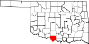
Towns Unincorporated
communitiesCategories:- Jefferson County, Oklahoma
- National Register of Historic Places in Oklahoma by county
- Buildings and structures in Jefferson County, Oklahoma
-

Wikimedia Foundation. 2010.