- Oklahoma State Highway 79
-
State Highway 79
Route information Maintained by ODOT Length: 4.43 mi[2] (7.13 km) Existed: ca. 1938[1] – present Major junctions South end:  SH 79 at the Texas state line
North end:  US-70 west of Waurika
Highway system Oklahoma State Highways
Oklahoma turnpike system←  SH-78
SH-78SH-80  →
→State Highway 79 (abbreviated SH-79 or OK-79) is a state highway in Jefferson County, Oklahoma. It runs for 4.43 miles (7.13 km) as a continuation of Texas State Highway 79 to U.S. Highway 70 on the outskirts of Waurika. It has no lettered spur routes.
SH-79 was first commissioned in 1938, and has had the same route since then.
Contents
Route description
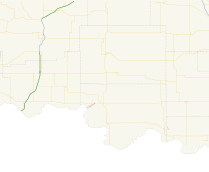
Oklahoma's State Highway 79 begins where Texas's State Highway 79 crosses over the Red River from Clay County, Texas into Jefferson County, Oklahoma. The bridge over the river is a multiple-span pony truss bridge.[3] Upon reaching the shore, the highway continues on a northeast trajectory, rising out of the Red River valley.[4] The highway then comes to an end at US-70 on the southwest outskirts of Waurika.[2]
History
State Highway 79 is first shown on the April 1939 state highway map. It has the same extent on that map as it does today, although it had a dirt surface.[1] By 1941, the whole route had been upgraded to asphalt.[5]
Junction list
County Location Mile[2] Destinations Notes Jefferson 0.00 TX 79Texas state line, southern terminus Waurika 4.43 US-70Northern terminus 1.000 mi = 1.609 km; 1.000 km = 0.621 mi References
- ^ a b Oklahoma Department of Highways. Map Showing Condition of Improvement of the State Highway System (Map) (April 1939 ed.). http://www.odot.org/hqdiv/p-r-div/maps/state-maps/pdfs/1939.pdf. Retrieved 2010-03-17.
- ^ a b c Oklahoma Department of Transportation. 2008 Control Section Maps (Map). p. Jefferson. http://www.odot.org/hqdiv/p-r-div/maps/control-maps/Jefferson.pdf. Retrieved 2010-03-16.
- ^ Stuve, Eric. "OK-79". OKHighways. http://www.okhighways.com/ok79.html. Retrieved 2007-07-04.
- ^ DeLorme (2006). Oklahoma Atlas and Gazetteer (Map). 1:200,000. p. 61.
- ^ Oklahoma Department of Highways. Map Showing Condition of Improvement of the State Highway System (Map) (April 1941 ed.). http://www.odot.org/hqdiv/p-r-div/maps/state-maps/pdfs/1941.pdf. Retrieved 2010-03-17.
External links
Categories:- State highways in Oklahoma
- Jefferson County, Oklahoma


Wikimedia Foundation. 2010.