- National Register of Historic Places listings in Sauk County, Wisconsin
-
Buildings, sites, structures, districts, and objects in Sauk County listed on the National Register of Historic Places
Two of these, the Aldo Leopold Shack and Farm and the Van Hise Rock, are further designated as National Historic Landmarks.
-
- This National Park Service list is complete through NPS recent listings posted November 10, 2011.[1]
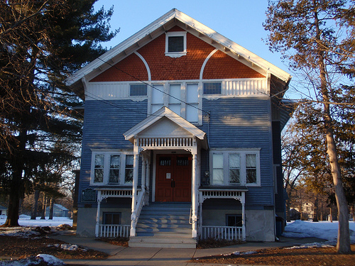
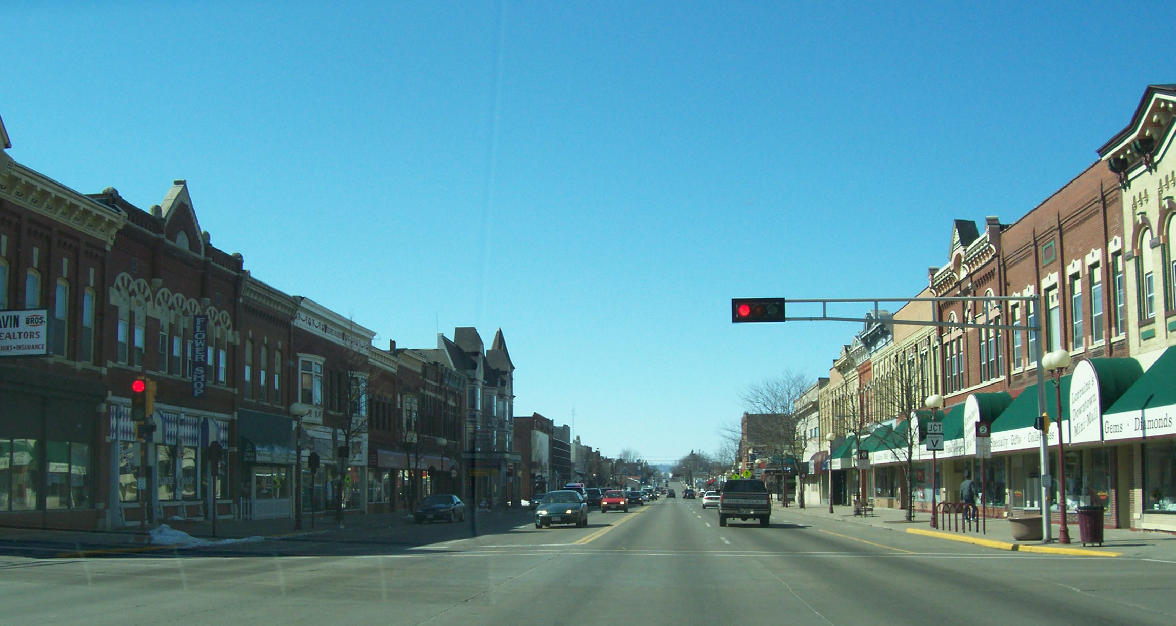
[2] Landmark name [3] Image Date listed Location City or town Summary 1 Baraboo Public Library September 14, 1981 230 4th Ave.
43°28′16″N 89°44′44″W / 43.471111°N 89.745556°WBaraboo 2 Chicago and North Western Depot December 26, 1984 Railroad St.
43°31′49″N 90°00′27″W / 43.530278°N 90.0075°WReedsburg 3 City Hotel December 26, 1984 125 Main St.
43°31′57″N 90°00′33″W / 43.5325°N 90.009167°WReedsburg 4 William Clark House April 8, 1980 320 Walnut St.
43°27′48″N 89°44′27″W / 43.463333°N 89.740833°WBaraboo 5 J. W. Corwith Livery April 20, 2004 121 S. Webb Ave.
43°31′54″N 90°00′34″W / 43.531667°N 90.009444°WReedsburg 6 August W. Derleth House April 30, 1991 S10431a Lueders Rd.
43°16′00″N 89°44′17″W / 43.266667°N 89.738056°WSauk City 7 Durst-Bloedau Site December 19, 1978 North of Leland Leland 8 Freethinkers' Hall 
March 31, 1988 309 Polk St.
43°16′34″N 89°43′28″W / 43.276111°N 89.724444°WSauk City 9 Gust Brothers' Store August 5, 2002 101 Fourth St.
43°28′16″N 89°44′32″W / 43.471111°N 89.742222°WBaraboo 10 Edward M. Hackett House December 26, 1984 612 E. Main St.
43°31′56″N 90°00′08″W / 43.532222°N 90.002222°WReedsburg 11 Abner L. Harris House December 26, 1984 226 N. Pine St.
43°31′58″N 90°00′13″W / 43.532778°N 90.003611°WReedsburg 12 Honey Creek Swiss Rural Historic District April 6, 1990 SE of Prairie du Sac
43°18′10″N 89°51′08″W / 43.302778°N 89.852222°WPrairie du Sac 13 Hulburt Creek Garden Beds 
August 8, 1991 Address Restricted Delton 14 Island Woolen Company Office Building August 18, 2011 900 2nd Ave.
43°28′10″N 89°45′24″W / 43.469444°N 89.756667°WBaraboo NRHP # 11000559 15 Lachmund Family House 
March 29, 2000 717 Water St.
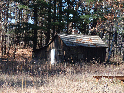
43°16′22″N 89°43′16″W / 43.272778°N 89.721111°WSauk City 16 Aldo Leopold Shack 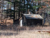
July 14, 1978 Central Wisconsin
43°33′46″N 89°39′33″W / 43.562778°N 89.659167°WColumbus Former chicken coop where conservationist Aldo Leopold wrote much of A Sand County Almanac 17 Main Street Commercial Historic District 
December 26, 1984 Roughly bounded by N. Park, S. Park, N. Walnut, and S. Walnut Sts. on Main
43°31′57″N 90°00′25″W / 43.5325°N 90.006944°WReedsburg 18 Man Mound November 30, 1978 East of Baraboo off WI 33
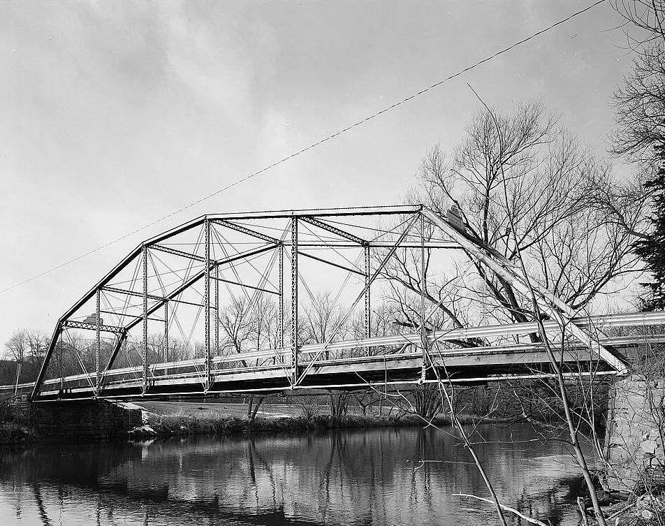
43°29′19″N 89°40′15″W / 43.488611°N 89.670833°WBaraboo Boundary increase (listed April 26, 2010): Man Mound Road 19 Manchester Street Bridge 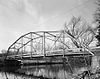
October 13, 1988 Ochsner Park
43°28′13″N 89°45′21″W / 43.470278°N 89.755833°WBaraboo 20 Marshall Memorial Hall April 1, 1993 30 Wisconsin Dells Parkway S.
43°35′20″N 89°47′37″W / 43.588889°N 89.793611°WLake Delton 21 Merrimac Ferry 
December 31, 1974 WI 113 at the Wisconsin River
43°22′05″N 89°37′26″W / 43.368056°N 89.623889°WMerrimac Ferry over the Sauk River 22 Our Lady of Loretto Roman Catholic Church and Cemetery March 9, 1990 Co. Hwy. C, 1 mi. W of Denzer
43°21′03″N 89°54′17″W / 43.350833°N 89.904722°WHoney Creek 23 Park Street Historic District December 26, 1984 On N. Park St. roughly bounded by 6th, Locust, N. Pine and Main Sts.
43°32′04″N 90°00′20″W / 43.534444°N 90.005556°WReedsburg 24 Seth Peterson Cottage November 9, 1981 Dell Ave.
43°33′47″N 89°49′30″W / 43.563056°N 89.825°WLake Delton Frank Lloyd Wright-designed lakeside cottage 25 Point of Rocks June 11, 2010 US-12 approximately .85 mi north of Ski Hi Rd. and .25 mi south of STH 159
43°26′09″N 89°46′22″W / 43.435833°N 89.772778°WBaraboo 26 Walworth D. Porter Duplex Residence September 27, 1996 221-225 7th St.
43°28′27″N 89°44′22″W / 43.474167°N 89.739444°WBaraboo 27 Raddatz Rockshelter December 18, 1978 Address Restricted Leland 28 Reedsburg Brewery December 26, 1984 401 N. Walnut St.
43°32′09″N 90°00′30″W / 43.535833°N 90.008333°WReedsburg 29 Reedsburg Post Office October 24, 2000 215 N. Walnut St.
43°32′01″N 90°00′30″W / 43.533611°N 90.008333°WReedsburg 30 Reedsburg Woolen Mill Office December 26, 1984 26 Main St.
43°31′56″N 90°00′40″W / 43.532222°N 90.011111°WReedsburg 31 Rest Haven Motel 
July 20, 2011 E5116 US 14
43°11′08″N 90°03′47″W / 43.185556°N 90.063056°WSpring Green Now the Usonian Inn[4] 32 William Riggert House December 26, 1984 547 S. Park St.
43°31′35″N 90°00′22″W / 43.526389°N 90.006111°WReedsburg 33 Ringling Brothers Circus Headquarters 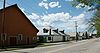
August 4, 1969 Bounded roughly by Water, Brian, Lynn, and East Sts.
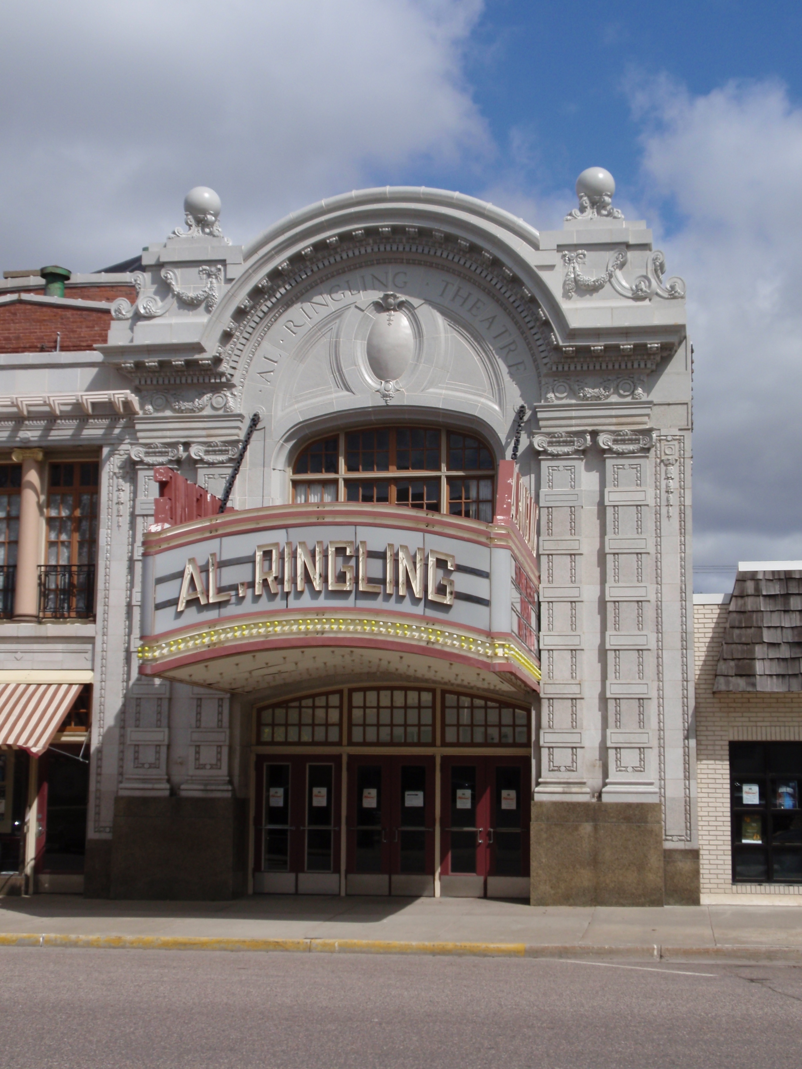
43°28′02″N 89°44′21″W / 43.467194°N 89.739053°WBaraboo Headquarters for Ringling Brothers Circus 34 Al. Ringling Theatre 
May 17, 1976 136 4th Ave.
43°28′16″N 89°44′37″W / 43.471111°N 89.743611°WBaraboo Associated with Ringling Brothers Circus ? 35 Albrecht C. Ringling House May 17, 1976 623 Broadway
43°28′25″N 89°44′41″W / 43.473611°N 89.744722°WBaraboo Associated with Ringling Brothers Circus ? 36 Charles Ringling House March 21, 1997 201 8th St.
43°28′30″N 89°44′24″W / 43.475°N 89.74°WBaraboo Associated with Ringling Brothers Circus ? 37 Salem Evangelical Church March 29, 1988 Jct. of CR PF and Church Rd.
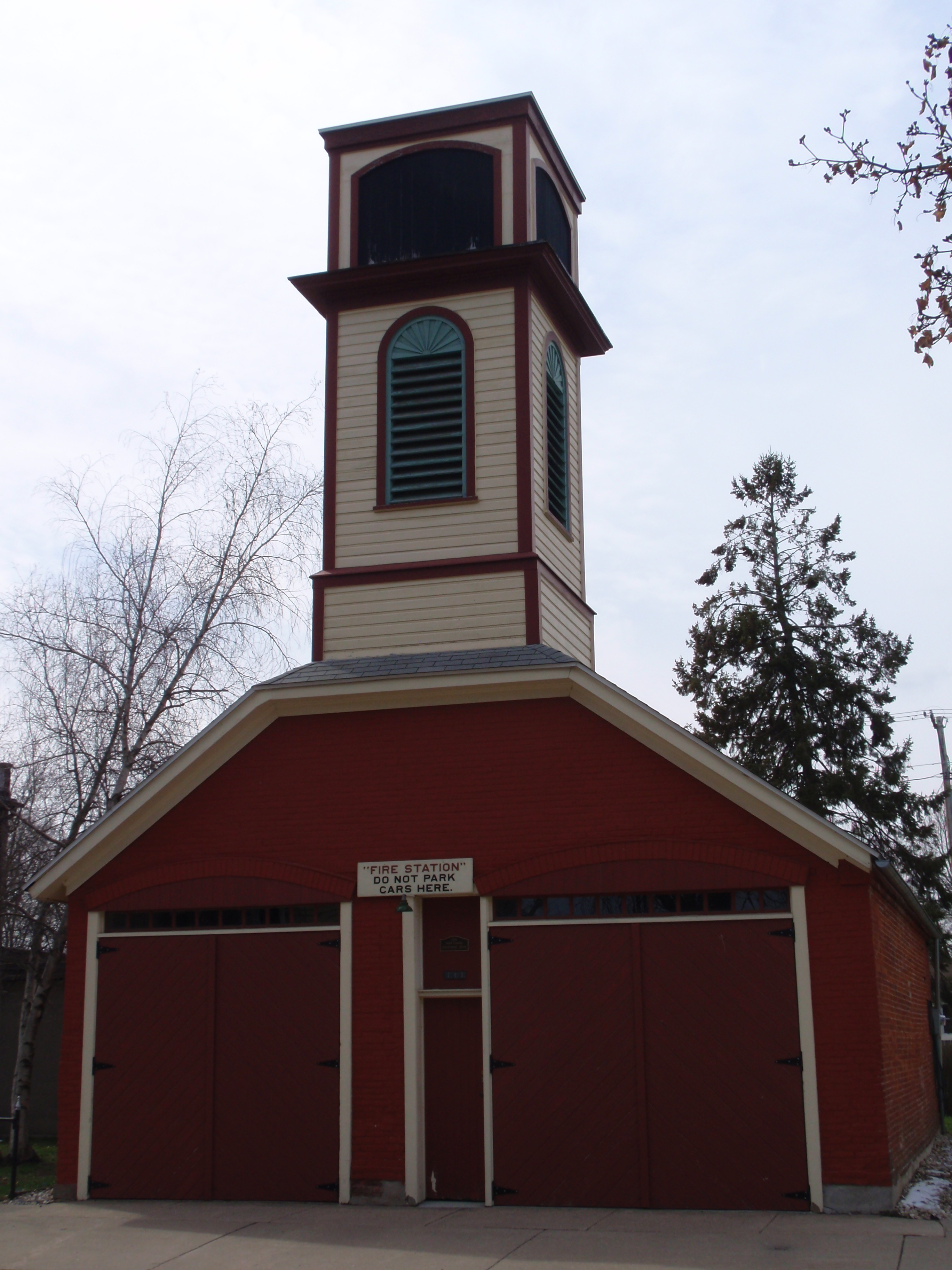
43°17′59″N 89°50′30″W / 43.299722°N 89.841667°WPlain 38 Sauk City Fire Station 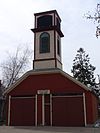
July 28, 1999 717 John Adams St.
43°16′14″N 89°43′23″W / 43.270556°N 89.723056°WSauk City 39 Sauk City High School 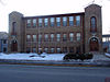
February 23, 1989 713 Madison St.
43°16′22″N 89°43′33″W / 43.272778°N 89.725833°WSauk City 40 Sauk County Courthouse March 9, 1982 515 Oak St.
43°28′13″N 89°44′35″W / 43.470278°N 89.743056°WBaraboo 41 Seven Gables 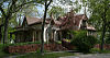
January 20, 1978 215 6th St.
43°28′23″N 89°44′23″W / 43.473056°N 89.739722°WBaraboo 42 State Bank of Spring Green 
July 16, 2010 134 W. Jefferson St.
43°10′36″N 90°04′08″W / 43.176667°N 90.068889°WSpring Green 43 Steam Locomotive #1385 May 18, 2000 E8948 Diamond Hill Rd.
43°27′31″N 89°52′29″W / 43.458611°N 89.874722°WNorth Freedom 44 William Stolte, Jr., House December 26, 1984 432 S. Walnut St.
43°31′44″N 90°00′30″W / 43.528889°N 90.008333°WReedsburg 45 William Stolte, Sr., House December 26, 1984 444 S. Walnut St.
43°31′43″N 90°00′30″W / 43.528611°N 90.008333°WReedsburg 46 Thompson House Hotel December 22, 1997 200 Ash St.
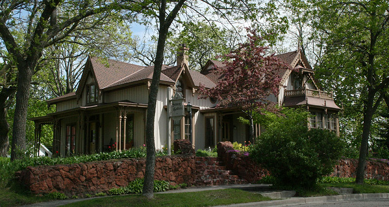
43°28′02″N 89°44′24″W / 43.467222°N 89.74°WBaraboo 47 Tripp Memorial Library and Hall September 14, 1981 565 Water St.
43°17′29″N 89°43′17″W / 43.291389°N 89.721389°WPrairie du Sac 48 A.G. Tuttle Estate November 6, 1980 N. Elizabeth St.
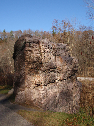
43°29′00″N 89°43′59″W / 43.483333°N 89.733056°WBaraboo 49 Van Hise Rock 
September 25, 1997 WI 136, 0.75 mi. N of WI 154
43°29′22″N 89°54′55″W / 43.489444°N 89.915278°WRock Springs Roadside rock outcropping significant for its association with geologist Charles Van Hise 50 Jacob Van Orden House September 6, 1996 531 4th Ave.
43°28′15″N 89°45′06″W / 43.470833°N 89.751667°WBaraboo See also
- List of National Historic Landmarks in Wisconsin
- National Register of Historic Places listings in Wisconsin
References
- ^ "National Register of Historic Places: Weekly List Actions". National Park Service, United States Department of the Interior. Retrieved on November 10, 2011.
- ^ Numbers represent an ordering by significant words. Various colorings, defined here, differentiate National Historic Landmark sites and National Register of Historic Places Districts from other NRHP buildings, structures, sites or objects.
- ^ "National Register Information System". National Register of Historic Places. National Park Service. . http://nrhp.focus.nps.gov/natreg/docs/All_Data.html.
- ^ "The Usonian Inn: History". http://www.usonianinn.com/history.html. Retrieved August 7, 2011.
U.S. National Register of Historic Places Topics Lists by states Alabama • Alaska • Arizona • Arkansas • California • Colorado • Connecticut • Delaware • Florida • Georgia • Hawaii • Idaho • Illinois • Indiana • Iowa • Kansas • Kentucky • Louisiana • Maine • Maryland • Massachusetts • Michigan • Minnesota • Mississippi • Missouri • Montana • Nebraska • Nevada • New Hampshire • New Jersey • New Mexico • New York • North Carolina • North Dakota • Ohio • Oklahoma • Oregon • Pennsylvania • Rhode Island • South Carolina • South Dakota • Tennessee • Texas • Utah • Vermont • Virginia • Washington • West Virginia • Wisconsin • WyomingLists by territories Lists by associated states Other Municipalities and communities of Sauk County, Wisconsin Cities 
Villages Cazenovia‡ | Ironton | La Valle | Lake Delton | Lime Ridge | Loganville | Merrimac | North Freedom | Plain | Prairie du Sac | Rock Springs | Sauk City | Spring Green | West Baraboo
Towns Baraboo | Bear Creek | Dellona | Delton | Excelsior | Fairfield | Franklin | Freedom | Greenfield | Honey Creek | Ironton | La Valle | Merrimac | Prairie du Sac | Reedsburg | Spring Green | Sumpter | Troy | Washington | Westfield | Winfield | Woodland
CDPs Bluffview | Lake Wisconsin‡
Unincorporated
communitiesCassell | Dellwood | Denzer | Hill Point | La Rue | Leland | Loddes Mill | Loreta | Moon Valley | Valton
Footnotes ‡This populated place also has portions in an adjacent county or counties
Categories:- Sauk County, Wisconsin
- Lists of historic places in Wisconsin
-


Wikimedia Foundation. 2010.