- National Register of Historic Places listings in Todd County, Minnesota
-
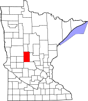
 Location of Todd County in Minnesota
This is a list of the National Register of Historic Places listings in Todd County, Minnesota. This is intended to be a complete list of the properties and districts on the National Register of Historic Places in Todd County, Minnesota, United States. The locations of National Register properties and districts for which the latitude and longitude coordinates are included below, may be seen in a Google map.[1]
There are 12 properties listed on the National Register in the county.
-
- This National Park Service list is complete through NPS recent listings posted November 10, 2011.[2]
Listings county-wide
[3] Landmark name [4] Image Date listed Location City or town Summary 1 Bank of Long Prairie September 5, 1985 262 Central Ave.
45°58′28″N 94°51′39″W / 45.974444°N 94.860833°WLong Prairie 2 Batcher Opera House Block August 11, 2004 5th St. and 2nd Ave.
46°21′27″N 94°47′38″W / 46.3575°N 94.793889°WStaples 3 Dr. George R. Christie House December 27, 2006 15 1st St. S
45°58′26″N 94°51′50″W / 45.973889°N 94.863889°WLong Prairie 4 Church of St. Joseph-Catholic September 5, 1985 Main St. between 7th and 8th Sts.
46°05′12″N 94°52′04″W / 46.086667°N 94.867778°WBrowerville 5 Germania Hall November 29, 1995 County Highway 11 north of Clarissa
46°12′59″N 94°58′04″W / 46.216389°N 94.967778°WGermania Township 6 Grey Eagle Village Hall September 5, 1985 Spruce and Woodman Sts.
45°49′27″N 94°44′53″W / 45.824167°N 94.748056°WGrey Eagle 7 Hewitt Public School December 27, 2006 514 N. Wisconsin St.
46°19′40″N 95°05′01″W / 46.327778°N 95.083611°WHewitt 8 Hotel Reichert September 5, 1985 20 3rd St., N.
45°58′28″N 94°51′36″W / 45.974444°N 94.86°WLong Prairie 9 Kahlert Mercantile Store September 5, 1985 Main St.
46°05′06″N 94°52′00″W / 46.085°N 94.866667°WBrowerville 10 Northern Pacific Railway Depot and Freighthouse June 4, 2008 1st Ave., N. and 4th St., NE.
46°21′16″N 94°47′43″W / 46.354444°N 94.795278°WStaples 11 Saint Cloud and Red River Valley Stage Road-Kandota Section August 30, 1991 Off County Highway 92 southeast of West Union
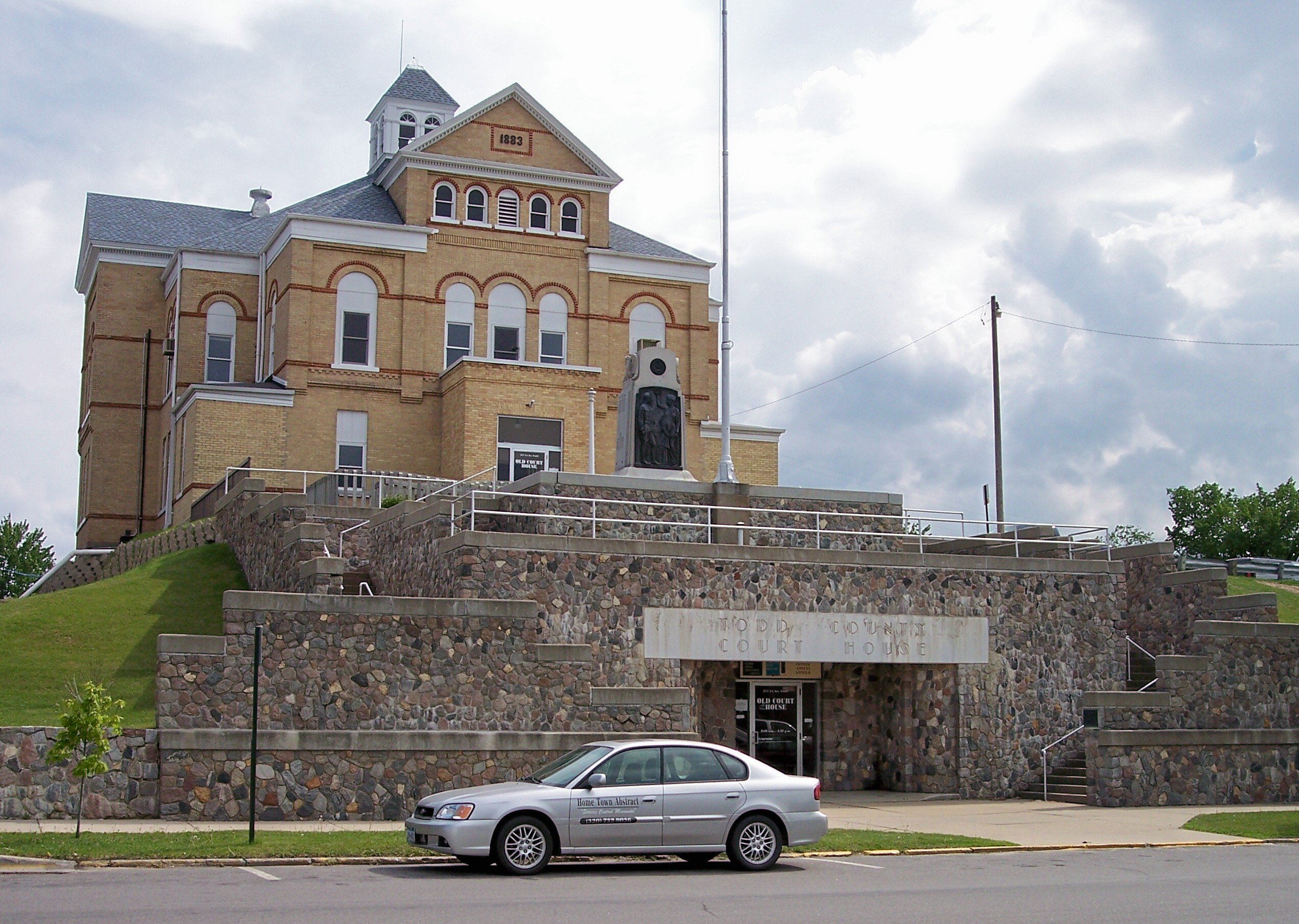
45°46′28″N 95°00′07″W / 45.774444°N 95.001944°WKandota Township 12 Todd County Courthouse, Sheriff's House, and Jail 
September 5, 1985 215 1st Ave., S.
45°58′22″N 94°51′39″W / 45.972778°N 94.860833°WLong Prairie See also
- List of National Historic Landmarks in Minnesota
- National Register of Historic Places listings in Minnesota
References
- ^ The latitude and longitude information provided in this table was derived originally from the National Register Information System, which has been found to be fairly accurate for about 99% of listings. For about 1% of NRIS original coordinates, experience has shown that one or both coordinates are typos or otherwise extremely far off; some corrections may have been made. A more subtle problem causes many locations to be off by up to 150 yards, depending on location in the country: most NRIS coordinates were derived from tracing out latitude and longitudes off of USGS topographical quadrant maps created under the North American Datum of 1927, which differs from the current, highly accurate WGS84 GPS system used by Google maps. Chicago is about right, but NRIS longitudes in Washington are higher by about 4.5 seconds, and are lower by about 2.0 seconds in Maine. Latitudes differ by about 1.0 second in Florida. Some locations in this table may have been corrected to current GPS standards.
- ^ "National Register of Historic Places: Weekly List Actions". National Park Service, United States Department of the Interior. Retrieved on November 10, 2011.
- ^ Numbers represent an ordering by significant words. Various colorings, defined here, differentiate National Historic Landmark sites and National Register of Historic Places Districts from other NRHP buildings, structures, sites or objects.
- ^ "National Register Information System". National Register of Historic Places. National Park Service. . http://nrhp.focus.nps.gov/natreg/docs/All_Data.html.
U.S. National Register of Historic Places Topics Lists by states Alabama • Alaska • Arizona • Arkansas • California • Colorado • Connecticut • Delaware • Florida • Georgia • Hawaii • Idaho • Illinois • Indiana • Iowa • Kansas • Kentucky • Louisiana • Maine • Maryland • Massachusetts • Michigan • Minnesota • Mississippi • Missouri • Montana • Nebraska • Nevada • New Hampshire • New Jersey • New Mexico • New York • North Carolina • North Dakota • Ohio • Oklahoma • Oregon • Pennsylvania • Rhode Island • South Carolina • South Dakota • Tennessee • Texas • Utah • Vermont • Virginia • Washington • West Virginia • Wisconsin • WyomingLists by territories Lists by associated states Other Municipalities and communities of Todd County, Minnesota Cities Bertha | Browerville | Burtrum | Clarissa | Eagle Bend | Grey Eagle | Hewitt | Long Prairie | Osakis‡ | Staples‡ | Swanville‡ | West Union
Townships Bartlett | Bertha | Birchdale | Bruce | Burleene | Burnhamville | Eagle Valley | Fawn Lake | Germania | Gordon | Grey Eagle | Hartford | Iona | Kandota | Leslie | Little Elk | Little Sauk | Long Prairie | Moran | Reynolds | Round Prairie | Staples | Stowe Prairie | Turtle Creek | Villard | Ward | West Union | Wykeham
Ghost town Footnotes ‡This populated place also has portions in an adjacent county or counties
Categories:- National Register of Historic Places in Minnesota by county
- Todd County, Minnesota
- Buildings and structures in Todd County, Minnesota
-

Wikimedia Foundation. 2010.