- Long Prairie, Minnesota
Infobox Settlement
official_name = City of Long Prairie
other_name =
native_name =
nickname =
settlement_type =City
motto =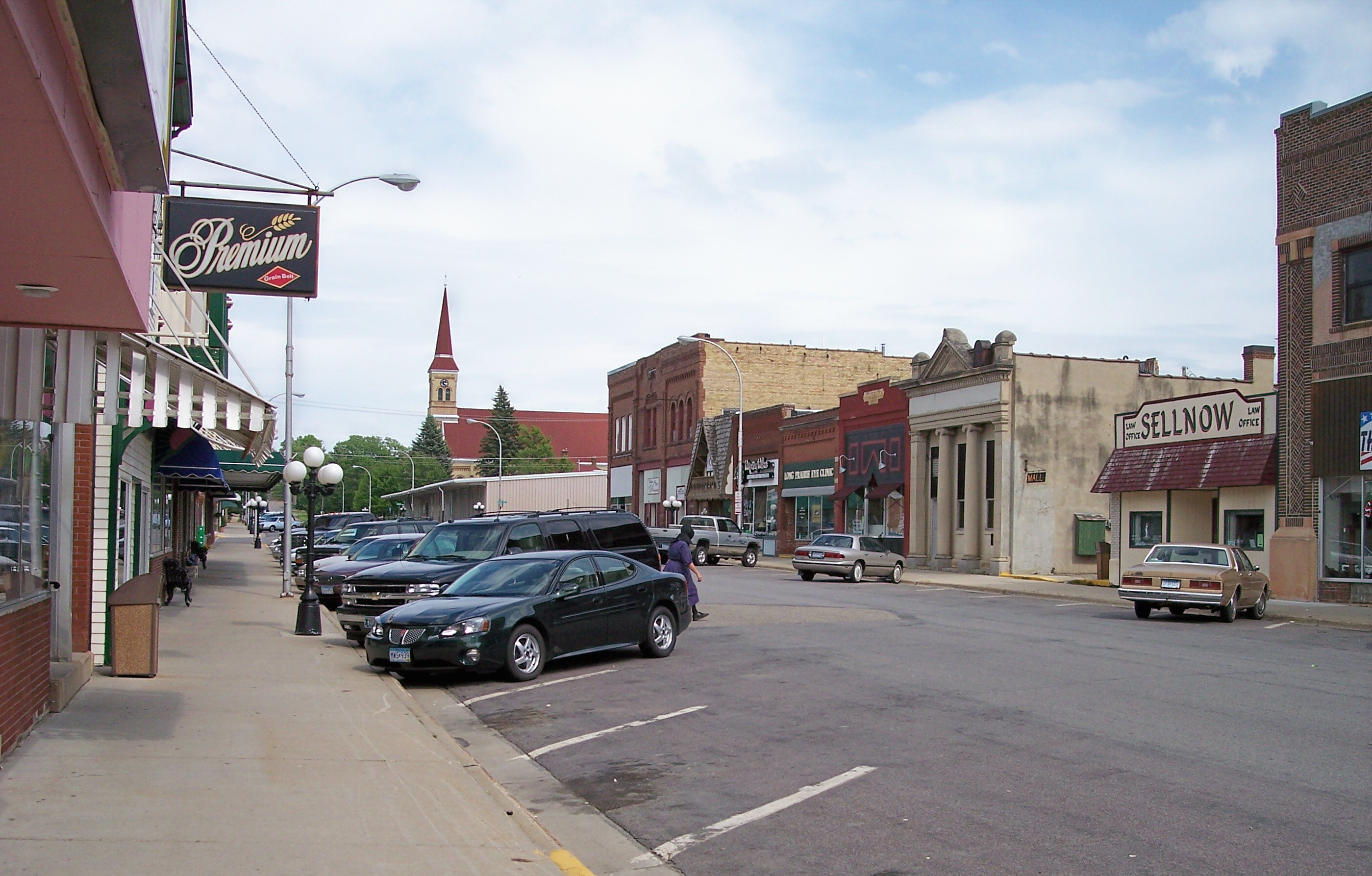
imagesize = 250px
image_caption = Central Avenue in downtown Long Prairie in 2007
flag_size =
image_
seal_size =
image_shield =
shield_size =
image_blank_emblem =
blank_emblem_size =
flag_size =
image_
seal_size =
image_shield =
shield_size =
image_blank_emblem =
blank_emblem_size =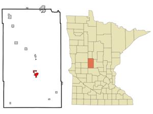
mapsize = 250px
map_caption = Location of Long Prairie in Minnesota
mapsize1 =
map_caption1 =
image_dot_
dot_mapsize =
dot_map_caption =
dot_x =
dot_y =
pushpin_
pushpin_label_position =
pushpin_map_caption =
pushpin_mapsize =
subdivision_type = Country
subdivision_name =United States
subdivision_type1 = State
subdivision_name1 =Minnesota
subdivision_type2 = County
subdivision_name2 = Todd
subdivision_type3 =
subdivision_name3 =
subdivision_type4 =
subdivision_name4 =
government_footnotes =
government_type =
leader_title = Mayor
leader_name =
leader_title1 =
leader_name1 =
leader_title2 =
leader_name2 =
leader_title3 =
leader_name3 =
leader_title4 =
leader_name4 =
established_title =
established_date =
established_title2 =
established_date2 =
established_title3 =
established_date3 =
area_magnitude =
unit_pref = Imperial
area_footnotes =
area_total_km2 = 6.3
area_land_km2 = 6.1
area_water_km2 = 0.2
area_total_sq_mi = 2.4
area_land_sq_mi = 2.4
area_water_sq_mi = 0.1
area_water_percent =
area_urban_km2 =
area_urban_sq_mi =
area_metro_km2 =
area_metro_sq_mi =
population_as_of = 2000
population_footnotes =
population_note =
population_total = 3,040
population_density_km2 = 495.3
population_density_sq_mi = 1285.2
population_metro =
population_density_metro_km2 =
population_density_metro_sq_mi =
population_urban =
population_density_urban_km2 =
population_density_urban_sq_mi =
population_blank1_title =
population_blank1 =
population_density_blank1_km2 =
population_density_blank1_sq_mi =
timezone = CST
utc_offset = -6
timezone_DST = CDT
utc_offset_DST = -5
latd = 45 |latm = 58 |lats = 29 |latNS = N
longd = 94 |longm = 51 |longs = 56 |longEW = W
elevation_footnotes =
elevation_m = 394
elevation_ft = 1293
postal_code_type =ZIP code
postal_code = 56347
area_code = 320
blank_name = FIPS code
blank_info = 27-38060GR|2
blank1_name = GNIS feature ID
blank1_info = 0647139GR|3
website = [http://www.longprairie.net/ www.longprairie.net]
footnotes = Long Prairie is a city in Todd County,Minnesota ,United States . The population was 3,040 at the 2000 census. It is thecounty seat of Todd CountyGR|6.Geography
According to the
United States Census Bureau , the city has a total area of 2.4square mile s (6.3km² ), of which, 2.4 square miles (6.1 km²) of it is land and 0.1 square miles (0.2 km²) of it (2.88%) is water. TheLong Prairie River flows through the city. [cite book| title= Minnesota Atlas & Gazetteer |year=1994 |publisher=DeLorme |location=Yarmouth, Me. |isbn= 0-89933-222-6 |pages= p. 45]U.S. Route 71 and Minnesota State Highways 27 and 287 are three of the main routes in the city.Demographics
As of the
census GR|2 of 2000, there were 3,040 people, 1,229 households, and 769 families residing in the city. Thepopulation density was 1,285.2 people per square mile (495.3/km²). There were 1,334 housing units at an average density of 564.0/sq mi (217.3/km²). The racial makeup of the city was 93.06% White, 0.07% African American, 1.74% Native American, 0.10% Asian, 0.03% Pacific Islander, 4.28% from other races, and 0.72% from two or more races. Hispanic or Latino of any race were 9.38% of the population.There were 1,229 households out of which 29.6% had children under the age of 18 living with them, 48.6% were married couples living together, 9.8% had a female householder with no husband present, and 37.4% were non-families. 33.2% of all households were made up of individuals and 19.1% had someone living alone who was 65 years of age or older. The average household size was about 2.36 and the average family size was 3.01.
In the city the population was spread out with 25.4% under the age of 18, 9.2% from 18 to 24, 24.5% from 25 to 44, 19.8% from 45 to 64, and 21.2% who were 65 years of age or older. The median age was 38 years. For every 100 females there were 88.0 males. For every 100 females age 18 and over, there were 85.1 males.
The median income for a household in the city was $28,237, and the median income for a family was $35,699. Males had a median income of $31,359 versus $20,152 for females. The
per capita income for the city was $14,386. About 13.8% of families and 16.4% of the population were below thepoverty line , including 23.1% of those under age 18 and 13.5% of those age 65 or over.References
External links
* [http://www.longprairie.net/ City website]
* [http://www.longprairie.org/ Long Prairie -- Visitor Information site]
* [http://www.lpge.k12.mn.us/ Long Prairie / Grey Eagle Schools site]
Wikimedia Foundation. 2010.