- Merritt Island, Florida
-
For the Yolo County, California island, see Merritt Island AVA.
Merritt Island, Florida — CDP — Location in Brevard County and the state of Florida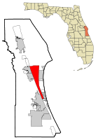
Coordinates: 28°21′28″N 80°41′5″W / 28.35778°N 80.68472°WCoordinates: 28°21′28″N 80°41′5″W / 28.35778°N 80.68472°W Country  United States
State  Florida
County Brevard Area – Total 47.1 sq mi (121.8 km2) – Land 17.7 sq mi (45.7 km2) – Water 29.4 sq mi (76.1 km2) Elevation 3 ft (1 m) Population (2000) – Total 36,090 – Density 766.2/sq mi (296.3/km2) Time zone Eastern (EST) (UTC-5) – Summer (DST) EDT (UTC-4) ZIP codes 32952-32954 Area code(s) 321 FIPS code 12-44275[1] GNIS feature ID 0294625[2] Merritt Island is a census-designated place in Brevard County, Florida, United States. It is located on the east coast of the state on the Atlantic Ocean. As of the 2000 census, the population was 36,090. It is part of the Palm Bay – Melbourne – Titusville, Florida Metropolitan Statistical Area. The name "Merritt Island" also refers to the extent of the former island, which is now a peninsula.
Merritt Island National Wildlife Refuge and NASA's John F. Kennedy Space Center are located on the northern part of Merritt Island. The southern area is heavily residential, with centralized light commercial and light industrial areas.
The island does not belong to any official city. The central part of Merritt Island, previously known as Merritt City,[3] is home to the majority of the population and includes the local high school, library, and shopping district.
Contents
History
Etymology
Merritt Island owes its name to the generosity of the king of Spain. The entire island was part of a land grant given by the king to a nobleman named Merritt.[4]
Post-Columbian
Merritt Island's recent history dates back into the mid-19th century and centers on the growth of citrus, stressing the cultivation of pineapples and oranges. The Indian River oranges and grapefruit come from this sandy area.
The island's population grew in the 1950s and 1960s as the Space Race began and nearby NASA expanded. Construction of a barge canal to the intracoastal waterway from the Atlantic Ocean (for power plant oil shipments) cut off the northern half of the island for many years. To this day, the northern portion of the island remains slightly less developed with a few areas remaining cattle pasture or citrus land. The small towns on the island vanished with the coming of the Space Age, and now only live on in the names of streets and historic churches.
Geography
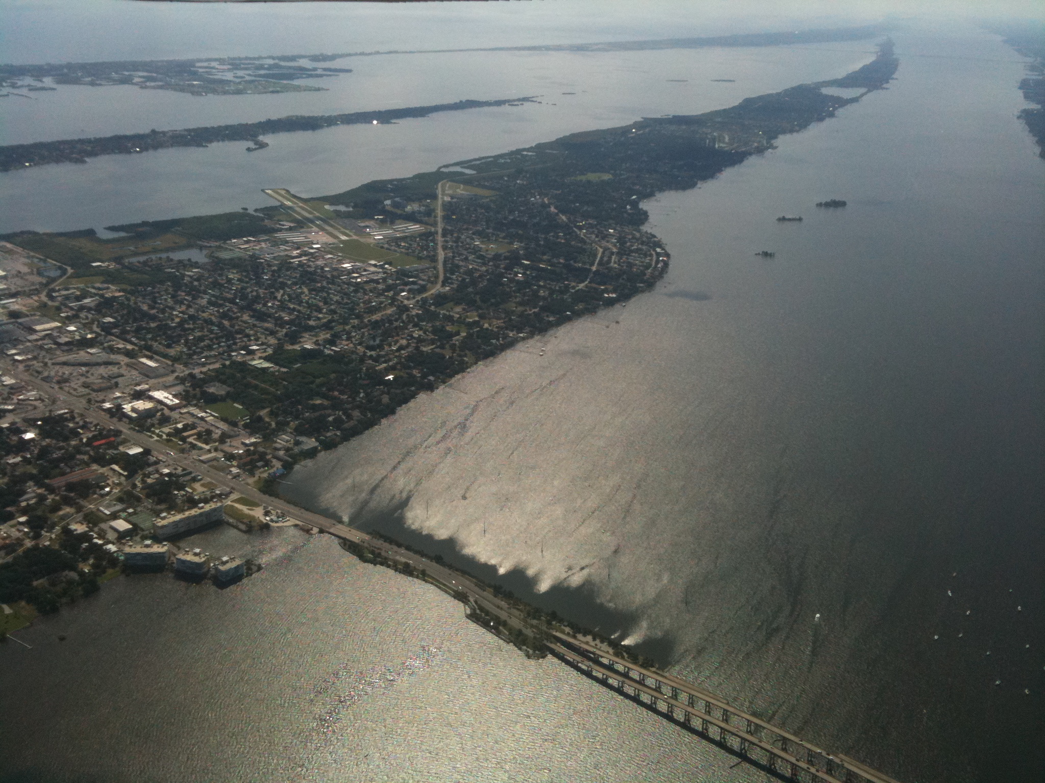
 South end of Merritt Island from about 4,000 feet looking southeast
According to the United States Census Bureau, the CDP has a total area of 47.0 square miles (122 km2), of which, 17.6 square miles (46 km2) of it is land and 29.4 square miles (76 km2) of it (62.49%) is water.
Merritt Island is an island. The construction of the Crawlerway in the north (for NASA space vehicles to move to the launch pad over the Banana Creek) connected Merritt Island to a mainland peninsula. To the west and south it is separated by the Indian River Lagoon and the Atlantic Intracoastal Waterway. The east side of Merritt Island splits and is divided by Sykes Creek and Newfound Harbor. They, in turn, are separated by the Banana River Lagoon from Cocoa Beach, Florida.
To the north, Merritt Island National Wildlife Refuge, along with a narrow barrier island that make up Canaveral National Seashore, offer an unpopulated protected buffer area for space shuttle launches at Kennedy Space Center. Migrating migratory birds join the more resident wildlife including, alligators, manatees, dolphins, sea turtles, Bald Eagles, ospreys, bobcats, and the elusive Florida panther. A number of Bald Eagle nests are monitored atop power line poles along SR 3 within Kennedy Space Center.
To the west, the island connects to mainland Brevard County near Titusville and Cocoa on its northern end, and in Melbourne, Florida on its southern end.
Places on Merritt Island
Merritt Island has several concentrations of population known as a place.
- Allenhurst
- Angel City
- Audubon
- Banyan
- Courtenay
- Fairyland
- Georgiana
- Indianola
- Lotus
- Merritt City
- Orsino
- Shiloh
- Tropic
- Wilson
Demographics
As of the census[1] of 2000, there were 36,090 people, 14,955 households, and 10,049 families residing in the CDP. The population density was 2,044.6 people per square mile (789.5/km²). There were 15,813 housing units at an average density of 895.9 per square mile (345.9/km²). The racial makeup of the CDP was 90.22% White, 5.31% African American, 0.41% Native American, 1.65% Asian, 0.06% Pacific Islander, 0.68% from other races, and 1.66% from two or more races. Hispanic or Latino of any race were 3.83% of the population.
Of the 14,955 households, 27.1% had children under the age of 18, 52.9% were married couples living together, 10.7% had a female householder with no husband, and 32.8% were non-families. 26.8% of households were solely individuals and 11.4% had a lone resident of 65 or older. The average household size was 2.36 and the average family size was 2.86.
In the CDP the population was spread out with 21.8% under the age of 18, 6.1% from 18 to 24, 26.1% from 25 to 44, 26.2% from 45 to 64, and 19.8% of 65 or older. The median age was 43 years. For every 100 females there were 95.3 males. For every 100 females age 18 and over, there were 92.3 males.
Government
With the lack of a municipal government Merritt Island is left to the administrative care of the local county government and the water and sewer (where available) are handled by neighboring Cocoa, Florida. As a result, there are no city taxes. The county maintains sheriff, fire, and EMS coverage.
Economy
Personal income
According to the 2000 Census:
- Median household income = $43,532
- Median family income = $52,388
- Median income for males = $41,393
- Median income for females = $25,787
- Per capita income = $23,961
- Below the poverty line:
- Families = 7.2%
- Population = 9.4%
- Those under age 18 = 13.8%
- Those over age 64 = 7.0%
Industry
There are also light industrial fabrication centers around the Merritt Island Airport, and NASA-related industrial activities to support the space shuttle, which was retired in summer of 2011, and other rocket launches on Cape Canaveral Air Force Station
Sea Ray operates a factory on Merritt Island.[5]
Redevelopment
Merritt Island has a redevelopment agency funded by the county.[6]
Infrastructure
Roads
The residential areas of Merritt Island, East and West Merritt Island, are only assessable by causeway or drawbridge at all points. The island is linked by causeways,
 SR 520 and SR 528, to the barrier island to its east and the mainland to the west.
 SR 3, a 4-lane highway, connects the Kennedy Space Center for workers from the more densely populated central and southern sections of the island.
Airports
Merritt Island Airport is a public general aviation airport located on South Merritt Island and run by the Titusville-Cocoa (TICO) Airport Authority.
Landmarks
- J. R. Field Homestead
- Georgiana Church and Cemetery, 19th Century
- Hacienda del Sol, large historic agricultural estate on South Merritt Island (home still exists, property is now housing development)
- Old Haulover Canal
- Dr. George E. Hill House
- NASA Kennedy Space Center
- Mather's Bridge Restaurant (now closed), previously Hacienda del Sol's workers mess hall, was joined by former field workers quarters (since destroyed) across South Tropical Trail at Mather's Bridge
- Merritt Island Airport
- Merritt Island Barge Canal
- Merritt Island Dragon (crumbled into the water because of negligence by owner and unwillingness of the county to subsidize rehabilitation)
- Merritt Island National Wildlife Refuge
- Merritt Island Rotary Park Nature Trail and Center
- Pine Island Conservation Area
- Old St. Luke's Episcopal Church and Cemetery
- Ulumay Wildlife Sanctuary
Notable residents
- Emory L. Bennett, medal of honor recipient; lived in Indianola briefly as a child
- Zora Neale Hurston, novelist, folklorist, anthropologist.[7][8]
- Roy C. Padrick, Navy journalist and actor was born on Merritt Island
- Patrick D. Smith, author; long-time resident of Merritt Island[citation needed]
- Cecil W. Stoughton, photographer for John F. Kennedy, lived on Merritt Island
- Guenter Wendt, engineer noted for his work in the U.S. manned spaceflight program
- Cullen Douglas, actor and screenwriter lived and was educated on Merritt Island[citation needed]
- Eric Robert Rudolph, Olympic Park Bomber
See also
References
- ^ a b "American FactFinder". United States Census Bureau. http://factfinder.census.gov. Retrieved 2008-01-31.
- ^ "US Board on Geographic Names". United States Geological Survey. 2007-10-25. http://geonames.usgs.gov. Retrieved 2008-01-31.
- ^ Parrish, Field, Harrell (2001). Images of America, Merritt Island and Cocoa Beach. Arcadia Publishing. pp. 123. ISBN 978-0-7385-0668-5.
- ^ Alpha Theta Chapter of Delta Kappa Gamma (1970?). The History of Brevard County, Florida. Merritt Island Public Library: Alpha Theta Chapter of Delta Kappa Gamma. pp. various pagings. ISBN none assigned. FL 975.927 His.
- ^ "Sea Ray Locations". http://www.searay.com/Page.aspx/pageId/9894/Locations.aspx. Retrieved 18 May 2011.
- ^ http://flatoday.com/apps/pbcs.dll/article?AID=/20070629/NEWS01/706290338/1006 retrieved June 29, 2007
- ^ Robert E. Hemenway (1980). Zora Neale Hurston: a literary biography. http://books.google.com/books?id=Gzta3iHgiQ8C&pg=PA346&lpg=PA346&dq=zora+neale+hurston+biography+%22merritt+island%22#v=onepage&q&f=false.
- ^ Scott, Megan K. (6 March 2011). "Hurston's real home". Florida Today (Melbourne, Florida): pp. 1D. http://www.floridatoday.com/article/20110309/LIFE/303090002/Zora-Neale-Hurston-s-real-home-Brevard-County.
Cape Canaveral and Merritt Island launch sites Atlantic Missile Range drop zone • Grand Turk Island drop zone • Mobile Launch Area • SLBM Launch Area • Patrick AFB • Shuttle Landing Facility • Cape Canaveral AFS Skid StripMunicipalities and communities of Brevard County, Florida Cities 
Towns CDPs Cocoa West | June Park | Merritt Island | Micco | Mims | Port St. John | Sharpes | South Patrick Shores
Unincorporated
communitiesCategories:- Census-designated places in Brevard County, Florida
- Merritt Island, Florida
- Landforms of Brevard County, Florida


Wikimedia Foundation. 2010.