- Micco, Florida
-
Micco, Florida — CDP — Location in Brevard County and the state of Florida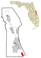
Coordinates: 27°52′39″N 80°30′52″W / 27.8775°N 80.51444°WCoordinates: 27°52′39″N 80°30′52″W / 27.8775°N 80.51444°W Country  United States
State  Florida
County Brevard Area – Total 9.7 sq mi (25.1 km2) – Land 9.4 sq mi (24.4 km2) – Water 0.3 sq mi (0.7 km2) Elevation 0 ft (0 m) Population (2000) – Total 9,498 – Density 979.2/sq mi (378.4/km2) Time zone Eastern (EST) (UTC-5) – Summer (DST) EDT (UTC-4) ZIP code 32976 Area code(s) 772 FIPS code 12-45275[1] GNIS feature ID 0286768[2] Micco is a census-designated place (CDP) in Brevard County, Florida, United States. The population was 9,498 at the 2000 census. It is part of the Palm Bay–Melbourne–Titusville Metropolitan Statistical Area.
Contents
Geography
Micco is located at 27°52′39″N 80°30′52″W / 27.8775°N 80.51444°W (27.877504, -80.514578)[3].
According to the United States Census Bureau, the CDP has a total area of 9.7 square miles (25 km2), of which, 9.4 square miles (24 km2) of it is land and 0.3 square miles (0.78 km2) of it (2.69%) is water.
Surrounding Areas
- Grant-Valkaria

- Deer Run

- Indian River Lagoon

- Indian River County

Demographics
As of the census[1] of 2000, there were 9,498 people, 5,212 households, and 3,163 families residing in the CDP. The population density was 1,009.9 people per square mile (389.7/km²). There were 6,400 housing units at an average density of 680.5 per square mile (262.6/km²). The racial makeup of the CDP was 98.82% White, 0.24% African American, 0.15% Native American, 0.09% Asian, 0.13% Pacific Islander, 0.18% from other races, and 0.39% from two or more races. Hispanic or Latino of any race were 1.32% of the population.
There were 5,212 households out of which 5.2% had children under the age of 18 living with them, 54.6% were married couples living together, 4.2% had a female householder with no husband present, and 39.3% were non-families. 34.4% of all households were made up of individuals and 26.1% had someone living alone who was 65 years of age or older. The average household size was 1.82 and the average family size was 2.23.
In the CDP the population was spread out with 5.9% under the age of 18, 2.0% from 18 to 24, 9.3% from 25 to 44, 24.2% from 45 to 64, and 58.6% who were 65 years of age or older. The median age was 69 years. For every 100 females there were 87.4 males. For every 100 females age 18 and over, there were 86.7 males.
The median income for a household in the CDP was $27,673, and the median income for a family was $34,645. Males had a median income of $25,638 versus $20,352 for females. The per capita income for the CDP was $20,649. About 5.1% of families and 10.1% of the population were below the poverty line, including 37.3% of those under age 18 and 6.1% of those age 65 or over.
References
- ^ a b "American FactFinder". United States Census Bureau. http://factfinder.census.gov. Retrieved 2008-01-31.
- ^ "US Board on Geographic Names". United States Geological Survey. 2007-10-25. http://geonames.usgs.gov. Retrieved 2008-01-31.
- ^ "US Gazetteer files: 2010, 2000, and 1990". United States Census Bureau. 2011-02-12. http://www.census.gov/geo/www/gazetteer/gazette.html. Retrieved 2011-04-23.
Municipalities and communities of Brevard County, Florida Cities 
Towns CDPs Cocoa West | June Park | Merritt Island | Micco | Mims | Port St. John | Sharpes | South Patrick Shores
Unincorporated
communitiesCategories:- Census-designated places in Brevard County, Florida
- Grant-Valkaria


Wikimedia Foundation. 2010.