- Town 'n' Country, Florida
Infobox Settlement
official_name = Town 'n' Country, Florida
other_name =
native_name =
nickname =
settlement_type = CDP
motto =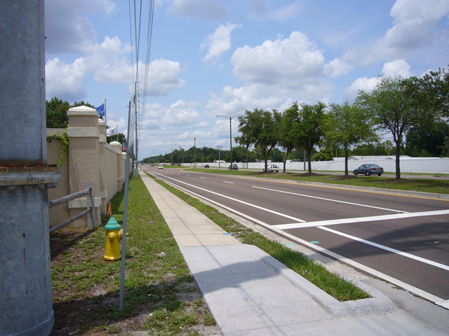
imagesize = 250x200px
image_caption = Town 'n' Country
flag_size =
image_
seal_size =
image_shield =
shield_size =
image_blank_emblem =
blank_emblem_type =
blank_emblem_size =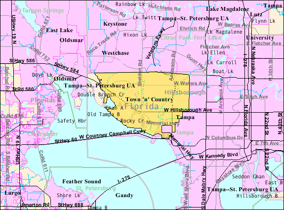
mapsize = 250x200px
map_caption =
mapsize1 = 250x200px
map_caption1 = Location in Hillsborough County and the state ofFlorida
image_dot_
dot_mapsize =
dot_map_caption =
dot_x =
dot_y =
pushpin_
pushpin_label_position =
pushpin_map_caption =
pushpin_mapsize =
subdivision_type = Country
subdivision_name = flag|United States
subdivision_type1 = State
subdivision_name1 = flag|Florida
subdivision_type2 = County
subdivision_name2 = noflag|Hillsborough
subdivision_type3 =
subdivision_name3 =
subdivision_type4 =
subdivision_name4 =
government_footnotes =
government_type =
leader_title =
leader_name =
leader_title1 =
leader_name1 =
leader_title2 =
leader_name2 =
leader_title3 =
leader_name3 =
leader_title4 =
leader_name4 =
established_title =
established_date =
established_title2 =
established_date2 =
established_title3 =
established_date3 =
area_magnitude =
unit_pref = Imperial
area_footnotes =
area_total_km2 = 63.2
area_land_km2 = 61.3
area_water_km2 = 1.9
area_total_sq_mi = 24.4
area_land_sq_mi = 23.7
area_water_sq_mi = 0.7
area_water_percent =
area_urban_km2 =
area_urban_sq_mi =
area_metro_km2 =
area_metro_sq_mi =
area_blank1_title =
area_blank1_km2 =
area_blank1_sq_mi =
population_as_of = 2000
population_footnotes =
population_note =
population_total = 72523
population_density_km2 = 1147.5
population_density_sq_mi = 2972.3
population_metro =
population_density_metro_km2 =
population_density_metro_sq_mi =
population_urban =
population_density_urban_km2 =
population_density_urban_sq_mi =
population_blank1_title =
population_blank1 =
population_density_blank1_km2 =
population_density_blank1_sq_mi =
timezone = Eastern (EST)
utc_offset = -5
timezone_DST = EDT
utc_offset_DST = -4
latd = 28 |latm = 0 |lats = 36 |latNS = N
longd = 82 |longm = 34 |longs = 22 |longEW = W
elevation_footnotes =
elevation_m = 1
elevation_ft = 3
postal_code_type =ZIP code
postal_code = 33615
area_code = 813
blank_name = FIPS code
blank_info = 12-72145GR|2
blank1_name = GNIS feature ID
blank1_info = 1867220GR|3
website =
footnotes =Town 'n' Country is an
unincorporated community and acensus-designated place inHillsborough County, Florida . As of the 2000 census, the area had a total population of 72,523. There is an ongiong debate on incorporating this community with the city ofTampa .Town 'n' Country census boundaries contain separate communities of "Bay Crest Park", "Countryway", "Rocky Creek", "Sweetwater Creek", and "Town 'n' Country".
ZIP Code
The
ZIP Code for the community of Town 'n' Country is 33615, however, other ZIP Codes for the census area are 33634 and 33635.Geography
Town 'n' Country is located at coor dms|28|0|36|N|82|34|22|W|city (28.010046, -82.572815)GR|1. or 5 miles NW of Tampa. The extreme northwest portion of
Tampa International Airport is located within the boundaries.According to the
United States Census Bureau , the census area has a total area of 24.4square mile s (63.2km² ), of which, 23.7 square miles (61.3 km²) of it is land and 0.7 square miles (1.9 km²) of it (3.03%) is water.Demographics
As of the
census GR|2 of 2000, there were 72,523 people, 28,870 households, and 18,707 families residing in the census area. Thepopulation density was 3,063.5 people per square mile (1,183.0/km²). There were 30,720 housing units at an average density of 1,297.7/sq mi (501.1/km²). The racial makeup of the community was 50.48% White, 7.89% African American, 0.36% Native American, 3.28% Asian, 0.08% Pacific Islander, 6.96% from other races, and 2.95% from two or more races. Hispanic or Latino of any race were 28.97% of the population.There were 28,870 households out of which 30.6% had children under the age of 18 living with them, 48.0% were married couples living together, 12.4% had a female householder with no husband present, and 35.2% were non-families. 26.4% of all households were made up of individuals and 6.5% had someone living alone who was 65 years of age or older. The average household size was 2.50 and the average family size was 3.06.
In the census area the population was spread out with 24.0% under the age of 18, 8.7% from 18 to 24, 34.7% from 25 to 44, 22.5% from 45 to 64, and 10.2% who were 65 years of age or older. The median age was 35 years. For every 100 females there were 95.0 males. For every 100 females age 18 and over, there were 91.9 males.
The median income for a household in the census area was $42,415, and the median income for a family was $49,054. Males had a median income of $32,489 versus $26,946 for females. The
per capita income for the community was $21,346. About 6.2% of families and 8.6% of the population were below thepoverty line , including 10.3% of those under age 18 and 7.7% of those age 65 or over.Town 'n' Country's History
Settled in
1956 as a dairy farm. It remained rural untilsuburb ization occurred during the 1960s and the 1970's.Town 'n' Country's Population History from the
U.S. Census Bureau *1970....19,453 (Z)
*1980....37,834
*1990....60,946
*2000....72,523(Z): Area reported as Sweetwater Creek during the 1970 census.
References
External links

Wikimedia Foundation. 2010.