- Social Circle, Georgia
Infobox Settlement
official_name = Social Circle, Georgia
other_name =
native_name =
nickname =
settlement_type =City
motto =
imagesize =
image_caption =
flag_size =
image_
seal_size =
image_shield =
shield_size =
image_blank_emblem =
blank_emblem_type =
blank_emblem_size =
imagesize =
image_caption =
flag_size =
image_
seal_size =
image_shield =
shield_size =
image_blank_emblem =
blank_emblem_type =
blank_emblem_size =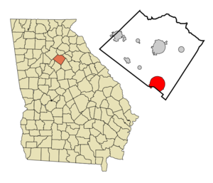
mapsize = 250px
map_caption = Location in Walton County and the state of Georgia
mapsize1 =
map_caption1 =
image_dot_
dot_mapsize =
dot_map_caption =
dot_x =
dot_y =
pushpin_
pushpin_label_position =
pushpin_map_caption =
pushpin_mapsize =
subdivision_type = Country
subdivision_name =United States
subdivision_type1 = State
subdivision_name1 = Georgia
subdivision_type2 = Counties
subdivision_name2 = Walton, Newton
subdivision_type3 =
subdivision_name3 =
subdivision_type4 =
subdivision_name4 =
government_footnotes =
government_type =
leader_title =
leader_name =
leader_title1 =
leader_name1 =
leader_title2 =
leader_name2 =
leader_title3 =
leader_name3 =
leader_title4 =
leader_name4 =
established_title =
established_date =
established_title2 =
established_date2 =
established_title3 = Incorporated
established_date3 = 1832
area_magnitude =
unit_pref = Imperial
area_footnotes =
area_total_km2 = 29.2
area_land_km2 = 29.1
area_water_km2 = 0.1
area_total_sq_mi = 11.2
area_land_sq_mi = 11.2
area_water_sq_mi = 0
area_water_percent =
area_urban_km2 =
area_urban_sq_mi =
area_metro_km2 =
area_metro_sq_mi =
area_blank1_title =
area_blank1_km2 =
area_blank1_sq_mi =
population_as_of = 2000
population_footnotes =
population_note =
population_total = 3379
population_density_km2 = 115.7
population_density_sq_mi = 301.7
population_metro =
population_density_metro_km2 =
population_density_metro_sq_mi =
population_urban =
population_density_urban_km2 =
population_density_urban_sq_mi =
population_blank1_title =
population_blank1 =
population_density_blank1_km2 =
population_density_blank1_sq_mi =
timezone = Eastern (EST)
utc_offset = -5
timezone_DST = EDT
utc_offset_DST = -4
latd = 33 |latm = 39 |lats = 24 |latNS = N
longd = 83 |longm = 43 |longs = 2 |longEW = W
elevation_footnotes =
elevation_m = 270
elevation_ft = 886
postal_code_type =ZIP code
postal_code = 30025
area_code = 470/678/770
blank_name = FIPS code
blank_info = 13-71660GR|2
blank1_name = GNIS feature ID
blank1_info = 0333086GR|3
website =
footnotes =Social Circle is a city in Walton and Newton counties in the
U.S. state of Georgia. The population was 3,379 at the 2000 census. The city was named in or around 1826, and incorporated in 1832; theetymology of the name is unknown. [http://www.socialcirclegeorgia.citymax.com/History.html]Geography
Social Circle is located at coor dms|33|39|24|N|83|43|2|W|city (33.656620, -83.717215)GR|1.
According to the
United States Census Bureau , the city has a total area of 11.3square mile s (29.2km² ), of which, 11.2 square miles (29.1 km²) of it is land and 0.04 square miles (0.1 km²) of it (0.27%) is water.It was founded in 1820.Demographics
As of the
census GR|2 of 2000, there were 3,379 people, 1,176 households, and 873 families residing in the city. Thepopulation density was 300.5 people per square mile (116.0/km²). There were 1,264 housing units at an average density of 112.4/sq mi (43.4/km²). The racial makeup of the city was 57.21% White, 41.31% African American, 0.06% Native American, 0.18% Asian, 0.03% Pacific Islander, 0.21% from other races, and 1.01% from two or more races. Hispanic or Latino of any race were 1.48% of the population.There were 1,176 households out of which 34.4% had children under the age of 18 living with them, 46.7% were married couples living together, 21.9% had a female householder with no husband present, and 25.7% were non-families. 21.1% of all households were made up of individuals and 7.7% had someone living alone who was 65 years of age or older. The average household size was 2.78 and the average family size was 3.21.
In the city the population was spread out with 28.3% under the age of 18, 8.6% from 18 to 24, 27.4% from 25 to 44, 21.2% from 45 to 64, and 14.6% who were 65 years of age or older. The median age was 35 years. For every 100 females there were 92.1 males. For every 100 females age 18 and over, there were 83.2 males.
The median income for a household in the city was $35,353, and the median income for a family was $37,183. Males had a median income of $31,250 versus $22,831 for females. The
per capita income for the city was $18,636. About 11.3% of families and 14.0% of the population were below thepoverty line , including 20.6% of those under age 18 and 7.8% of those age 65 or over.References
External links
* [http://www.bluewillowinn.com/social/index.htm Site about the town]
* [http://www.mapicurious.com/socialcircle Tour of historic houses]
Wikimedia Foundation. 2010.