- Walton County, Georgia
Infobox U.S. County
county = Walton County
state = Georgia
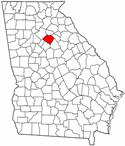
map size = 225
founded = 1818
seat = Monroe | largest city = Monroe
area_total_sq_mi =330
area_land_sq_mi =329
area_water_sq_mi =1
area percentage = 0.26%
census yr = 2006
pop = 79338
density_km2 =71
web = www.waltoncountyga.org
|Walton County is a
county located in theU.S. state of Georgia. As of 2000, the population was 60,687. The 2007 Census Estimate shows a population of 83,144 [http://www.census.gov/popest/counties/tables/CO-EST2007-01-13.xls] . Thecounty seat is Monroe, GeorgiaGR|6.This county is a part of the
Atlanta Metropolitan Area (Atlanta-Sandy Springs-Marietta, GeorgiaMetropolitan Statistical Area ).History
Walton County was created on
December 15 ,1818 . It is named forGeorge Walton , one of the three men from Georgia who signed theUnited States Declaration of Independence . The other two wereButton Gwinnett andLyman Hall .Walton County is located about 50 miles east of Fulton County. Monroe is the County Seat with other major towns being Loganville, Social Circle, Jersey, Between, Good Hope and Walnut Grove.
Walton County has been home to, birthplace of, or claimed 7 Georgia governors, to wit:James Boynton, Howell Cobb, Alfred Colquitt, Wilson Lumpkin, Henry McDaniel, Richard Russell, Jr., Clifford Walker.
The County has public and private schools.
Geography
According to the
U.S. Census Bureau , the county has a total area of 330square mile s (855km² ), of which, 329 square miles (853 km²) of it is land and 1 square miles (2 km²) of it (0.26%) is water.The land is mostly undeveloped farm land but that is quickly changing. As more people move into Walton County developers are buying up large tracts of land and increasing the number of subdivisions, forever altering the bucolic landscape.
Major highways
*
*
*
*
*
*
*Adjacent counties
*Barrow County, Georgia - north
*Oconee County, Georgia - east
*Morgan County, Georgia - southeast
*Newton County, Georgia - south
*Rockdale County, Georgia - west
*Gwinnett County, Georgia - northwestDemographics
As of the
census GR|2 of 2000, there were 60,687 people, 21,307 households, and 17,002 families residing in the county. Thepopulation density was 184 people per square mile (71/km²). There were 22,500 housing units at an average density of 68 per square mile (26/km²). The racial makeup of the county was 83.03% White, 14.42% Black or African American, 0.25% Native American, 0.70% Asian, 0.02% Pacific Islander, 0.64% from other races, and 0.95% from two or more races. 1.92% of the population were Hispanic or Latino of any race.There were 21,307 households out of which 39.20% had children under the age of 18 living with them, 62.70% were married couples living together, 12.80% had a female householder with no husband present, and 20.20% were non-families. 16.60% of all households were made up of individuals and 6.20% had someone living alone who was 65 years of age or older. The average household size was 2.82 and the average family size was 3.16.
In the county the population was spread out with 28.40% under the age of 18, 8.10% from 18 to 24, 32.20% from 25 to 44, 21.70% from 45 to 64, and 9.60% who were 65 years of age or older. The median age was 34 years. For every 100 females there were 94.90 males. For every 100 females age 18 and over, there were 93.00 males.
The median income for a household in the county was $46,479 and the median income for a family was $52,386. Males had a median income of $37,482 versus $25,840 for females. The
per capita income for the county was $19,470. About 8.00% of families and 9.70% of the population were below thepoverty line , including 12.30% of those under age 18 and 10.60% of those age 65 or over.Cities and towns
*Between
*Bold Springs (unincorporated)
*Campton (unincorporated)
*Good Hope
*Gratis (unincorporated)
*Jersey
*Loganville
*Monroe
*Mt. Vernon (unincorporated)
*Pannell (unincorporated)
*Social Circle
*Walnut Grove
*Youth (unincorporated)References
* Camp, Lynn Robinson, and Jennifer E. Cheek-Collins. "Walton County, Georgia" (Black America Series; Charleston, S.C., 2003) (ISBN 0-7385-1528-0).
* Sams, Anita B. "Wayfarers in Walton: A History of Walton County, Georgia, 1818-1967" (Monroe, Ga., 1967).
* Wexler, Laura. "Fire in a Canebrake: The Last Mass Lynching in America" (New York, 2003) (ISBN 0-684-86816-4).External links
* [http://waltoncounty.georgia.gov/03/home/0,2230,8917882,00.html Georgia.gov on Walton County]
* [http://www.negrdc.org/counties/walton/default.asp]
Wikimedia Foundation. 2010.