- National Register of Historic Places listings in Bibb County, Georgia
-
This is a list of properties and districts in Bibb County, Georgia that are listed on the National Register of Historic Places (NRHP).
-
- This National Park Service list is complete through NPS recent listings posted November 10, 2011.[1]
Current listings
[2] Landmark name Image Date listed Location City or town Summary 1 Capt. R. J. Anderson House May 27, 1971 1730 West End Ave.
32°49′54″N 83°39′08″W / 32.831667°N 83.652222°WMacon 2 Judge Clifford Anderson House July 14, 1971 642 Orange St.
32°50′10″N 83°38′18″W / 32.836111°N 83.638333°WMacon 3 Ambrose Baber House August 14, 1973 577-587 Walnut St.
32°50′20″N 83°37′35″W / 32.838889°N 83.626389°WMacon 4 Thomas C. Burke House June 21, 1971 1085 Georgia Ave.
32°50′27″N 83°38′12″W / 32.840833°N 83.636667°WMacon 5 Cannonball House May 27, 1971 856 Mulberry St.
32°50′22″N 83°37′54″W / 32.839444°N 83.631667°WMacon 6 Central City Park Bandstand March 16, 1972 Central City Park
32°49′59″N 83°36′55″W / 32.833056°N 83.615278°WMacon 7 Cherokee Brick and Tile Company April 11, 2002 3250 Waterville Rd.
32°46′01″N 83°37′24″W / 32.766944°N 83.623333°WMacon 8 Cherokee Heights District July 8, 1982 Pio Nono, Napier, Inverness, and Suwanee Aves.
32°50′17″N 83°39′58″W / 32.838056°N 83.666111°WMacon 9 Christ Episcopal Church July 14, 1971 538-566 Walnut St.
32°50′18″N 83°37′35″W / 32.838333°N 83.626389°WMacon 10 Collins-Odom-Strickland House January 22, 1979 1495 2nd St.
32°49′25″N 83°38′23″W / 32.823611°N 83.639722°WMacon 11 Cowles House June 21, 1971 988 Bond St.
32°50′32″N 83°38′04″W / 32.842222°N 83.634444°WMacon 12 Jerry Cowles Cottage June 21, 1971 4569 Rivoli Dr.
32°52′26″N 83°42′17″W / 32.873889°N 83.704722°WMacon 13 Dasher-Stevens House October 18, 1972 904 Orange Ter.
32°49′59″N 83°38′20″W / 32.833056°N 83.638889°WMacon 14 Davis-Guttenberger-Rankin House November 30, 1973 134 Buford Pl.
32°50′47″N 83°39′35″W / 32.846389°N 83.659722°WMacon 15 Domingos House June 21, 1971 1261 Jefferson Ter.
32°50′28″N 83°38′22″W / 32.841111°N 83.639444°WMacon 16 East Macon Historic District April 1, 1993 Roughly bounded by Emery Hwy., Coliseum Dr., and Clinton, Fletcher and Fairview Sts.
32°50′42″N 83°36′43″W / 32.845°N 83.611944°WMacon 17 Emerson-Holmes Building 
June 21, 1971 566 Mulberry St.
32°50′13″N 83°37′39″W / 32.836944°N 83.6275°WMacon 18 Robert Findlay House January 20, 1972 785 2nd St.
32°49′54″N 83°38′01″W / 32.831667°N 83.633611°WMacon 19 First Presbyterian Church September 14, 1972 690 Mulberry St.
32°50′17″N 83°37′47″W / 32.838056°N 83.629722°WMacon 20 Fort Hawkins Archeological Site 
November 23, 1977 Address Restricted Macon 21 Fort Hill Historic District April 16, 1993 Roughly bounded by Emery Hwy., Second St. Ext., Mitchell and Morrow Sts. and Schaeffer Pl.
32°51′06″N 83°36′51″W / 32.851667°N 83.614167°WMacon 22 Goodall House May 27, 1971 618 Orange St.
32°50′11″N 83°38′17″W / 32.836389°N 83.638056°WMacon 23 Grand Opera House June 22, 1970 651 Mulberry St.
32°50′25″N 83°37′45″W / 32.840278°N 83.629167°WMacon 24 Green-Poe House July 14, 1971 841-845 Poplar St.
32°50′15″N 83°38′01″W / 32.8375°N 83.633611°WMacon 25 Hatcher-Groover-Schwartz House June 21, 1971 1144-1146 Georgia Ave.
32°50′25″N 83°38′15″W / 32.840278°N 83.6375°WMacon 26 Walter R. Holt House February 24, 2005 3776 Vineville Ave.
32°51′13″N 83°41′15″W / 32.853611°N 83.6875°WMacon 27 Holt-Peeler-Snow House 
June 21, 1971 1129 Georgia Ave.
32°50′29″N 83°38′17″W / 32.841389°N 83.638056°WMacon 28 Johnston-Hay House 
May 27, 1971 934 Georgia Ave.
32°50′26″N 83°38′04″W / 32.840556°N 83.634444°WMacon 29 Sidney Lanier Cottage January 31, 1972 935 High St.
32°50′14″N 83°38′11″W / 32.837222°N 83.636389°WMacon (see Sidney Lanier ) 30 Lassiter House April 11, 1972 315 College St.
32°50′32″N 83°38′17″W / 32.842222°N 83.638056°WMacon 31 Ellamae Ellis League House February 15, 2005 1790 Waverland Dr.
32°52′14″N 83°37′56″W / 32.870556°N 83.632222°WMacon 32 Joseph and Mary Jane League House January 9, 2009 1849 Waverland Dr. Macon 33 W. G. Lee Alumni House July 14, 1971 1270 Ash (Coleman) St.
32°49′52″N 83°38′49″W / 32.831111°N 83.646944°WMacon 34 Lustron House at 3498 McKenzie Drive March 18, 1996 3498 McKenzie Dr.
32°50′52″N 83°40′57″W / 32.847778°N 83.6825°WMacon 35 Macon Historic District December 31, 1974 Roughly bounded by Riverside Dr., Broadway, Elm, and I-75
32°50′11″N 83°38′11″W / 32.836389°N 83.636389°WMacon 36 Macon Railroad Industrial District June 12, 1987 Roughly bounded by Fifth, Sixth, and Seventh Sts., Central of Georgia, Southern, and Seaboard RR tracks
32°49′31″N 83°37′33″W / 32.825278°N 83.625833°WMacon 37 Macon Railway and Light Company Substation November 9, 2006 1015 Riverside Dr.
32°50′41″N 83°37′53″W / 32.844722°N 83.631389°WMacon 38 DeWitt McCrary House March 22, 1974 320 Hydrolia St.
32°50′37″N 83°37′00″W / 32.843611°N 83.616667°WMacon 39 Mechanics Engine House No. 4 September 13, 1990 950 Third St.
32°49′43″N 83°37′58″W / 32.828611°N 83.632778°WMacon 40 Mercer University Administration Building Mercer University Administration BuildingAugust 26, 1971 Coleman Ave.
32°49′54″N 83°38′54″W / 32.831667°N 83.648333°WMacon 41 Militia Headquarters Building April 11, 1972 552-564 Mulberry St.
32°50′14″N 83°37′39″W / 32.837222°N 83.6275°WMacon 42 Monroe Street Apartments March 16, 1972 641-661 Monroe St.
32°50′18″N 83°38′37″W / 32.838333°N 83.643611°WMacon 43 Municipal Auditorium 
June 21, 1971 415-435 1st St.
32°50′14″N 83°37′53″W / 32.837222°N 83.631389°WMacon 44 Munroe-Dunlap-Snow House July 14, 1971 920 High St.
32°50′12″N 83°38′11″W / 32.836667°N 83.636389°WMacon 45 Munroe-Goolsby House January 20, 1972 159 Rogers Ave.
32°50′50″N 83°39′18″W / 32.847222°N 83.655°WMacon 46 Leroy Napier House May 27, 1971 2215 Napier Ave.
32°50′17″N 83°39′18″W / 32.838056°N 83.655°WMacon 47 North Highlands Historic District November 22, 1993 Roughly bounded by Nottingham Dr., Boulevard and Clinton Rd.
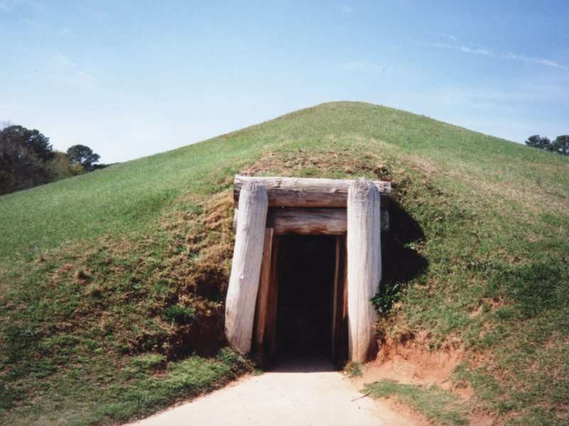
32°51′19″N 83°37′25″W / 32.855278°N 83.623611°WMacon 48 Ocmulgee National Monument 
October 15, 1966 1207 Emory Hwy., E of Macon
32°49′46″N 83°36′7″W / 32.82944°N 83.60194°WMacon 49 Old Macon Library November 26, 1973 652-662 Mulberry St.
32°50′16″N 83°37′44″W / 32.837778°N 83.628889°WMacon 50 Old U.S. Post Office and Federal Building January 20, 1972 475 Mulberry St.
32°50′13″N 83°37′32″W / 32.836944°N 83.625556°WMacon 51 Pleasant Hill Historic District May 22, 1986 Roughly bounded by Sheridan Ave. and Schofield St., Madison, Jefferson and Ferguson, and Galliard Sts.
32°50′48″N 83°38′45″W / 32.846667°N 83.645833°WMacon 52 Railroad Overpass at Ocmulgee December 18, 1979 Off GA 49
32°50′27″N 83°35′59″W / 32.840833°N 83.599722°WMacon 53 Raines-Carmichael House 
June 21, 1971 1183 Georgia Ave.
32°50′29″N 83°38′19″W / 32.841389°N 83.638611°WMacon 54 Randolph-Whittle House February 1, 1972 1231 Jefferson Ter.
32°50′27″N 83°38′18″W / 32.840833°N 83.638333°WMacon 55 Riverside Cemetery April 28, 1983 1301 Riverside Dr.
32°51′04″N 83°38′18″W / 32.851111°N 83.638333°WMacon 56 Rock Rogers House January 20, 1972 337 College St.
32°50′34″N 83°38′20″W / 32.842778°N 83.638889°WMacon 57 Rose Hill Cemetery October 9, 1973 Riverside Dr.
32°50′52″N 83°38′01″W / 32.847778°N 83.633611°WMacon 58 Shirley Hills Historic District August 17, 1989 Roughly Senate Pl., Parkview Dr., Curry Dr., Briarcliff Rd., Nottingham Dr., and the Ocmulgee River
32°51′33″N 83°37′50″W / 32.859167°N 83.630556°WMacon 59 Slate House January 21, 1974 931-945 Walnut St.
32°50′32″N 83°37′54″W / 32.842222°N 83.631667°WMacon 60 Small House May 27, 1971 156 Rogers Ave.
32°50′50″N 83°39′21″W / 32.847222°N 83.655833°WMacon 61 Solomon-Curd House May 27, 1971 770 Mulberry St.
32°50′19″N 83°37′49″W / 32.838611°N 83.630278°WMacon 62 Solomon-Smith-Martin House July 14, 1971 2619 Vineville Ave.
32°50′47″N 83°39′46″W / 32.846389°N 83.662778°WMacon 63 St. Joseph's Catholic Church July 14, 1971 812 Poplar St.
32°50′12″N 83°38′01″W / 32.836667°N 83.633611°WMacon 64 Tindall Heights Historic District July 1, 1993 Roughly bounded by Broadway, Eisenhower Pkwy., Felton and Nussbaum Aves., Central of Georgia RR tracks and Oglethorpe St
32°49′24″N 83°38′36″W / 32.823333°N 83.643333°WMacon 65 Villa Albicini May 16, 1974 150 Tucker Rd.
32°52′25″N 83°42′41″W / 32.873611°N 83.711389°WMacon 66 Vineville Historic District November 21, 1980 GA 247 and U.S. 41
32°50′46″N 83°39′33″W / 32.846111°N 83.659167°WMacon 67 Wesleyan College Historic District April 2, 2004 4760 Forsyth Rd.
32°52′20″N 83°43′08″W / 32.872222°N 83.718889°WMacon a historic district at Wesleyan College 68 Luther Williams Field 
June 24, 2004 225 Willie Smokey Glover Blvd., Central City Park
32°49′44″N 83°36′51″W / 32.828889°N 83.614167°WMacon 69 Willingham-Hill-O'Neal Cottage July 14, 1971 535 College St.
32°50′19″N 83°38′22″W / 32.838611°N 83.639444°WMacon References
- ^ "National Register of Historic Places: Weekly List Actions". National Park Service, United States Department of the Interior. Retrieved on November 10, 2011.
- ^ Numbers represent an ordering by significant words. Various colorings, defined here, differentiate National Historic Landmark sites and National Register of Historic Places Districts from other NRHP buildings, structures, sites or objects.
Categories:- National Register of Historic Places in Georgia (U.S. state)
- Buildings and structures in Bibb County, Georgia
-


Wikimedia Foundation. 2010.