- Alpharetta, Georgia
-
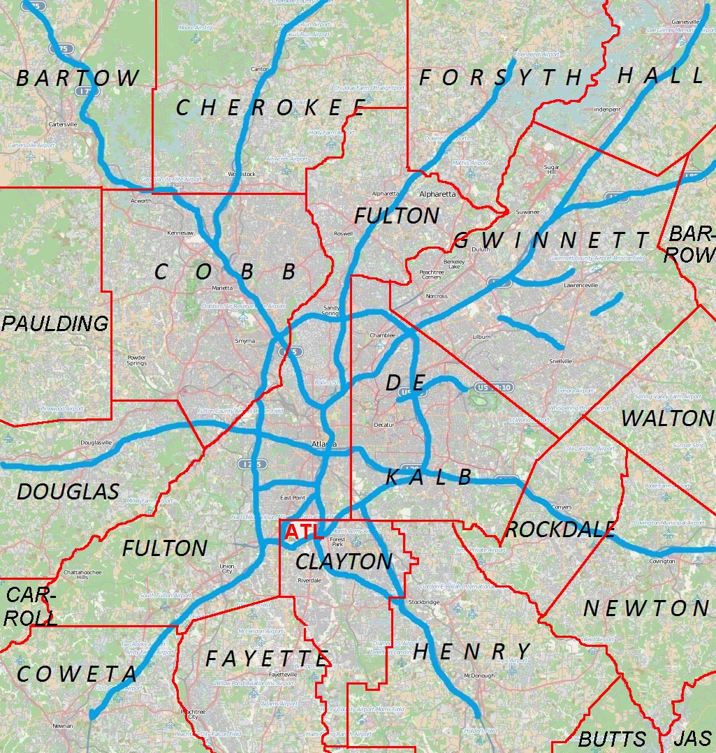
Alpharetta, Georgia — City — Location in Fulton County and the state of Georgia Location of Alpharetta in Metro Atlanta
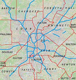
 Alpharetta
Coordinates: 34°04′24″N 84°16′52″W / 34.07333°N 84.28111°WCoordinates: 34°04′24″N 84°16′52″W / 34.07333°N 84.28111°W Country United States State Georgia County Fulton Incorporated December 11, 1858 Government – Mayor Arthur Letchas Area – Total 21.4 sq mi (55.4 km2) – Land 21.4 sq mi (55.3 km2) – Water 0.0 sq mi (0.1 km2) Elevation 1,135 ft (346 m) Population (2010) – Total 57,551 – Density 1,631.6/sq mi (630.0/km2) Time zone EST (UTC-5) – Summer (DST) EDT (UTC-4) ZIP codes 30004, 30005, 30009, 30022 Area code(s) 770, 404, 678 FIPS code 13-01696[1] GNIS feature ID 0310497[2] Website Alpharetta, Georgia Alpharetta is a city in north Fulton County, Georgia, United States and a northern suburb of Atlanta, Georgia. It is one of the most affluent communities in the state. According to the 2010 Census, Alpharetta's population is 57,551[3]. However, during the workday, the city swells to more than 120,000 residents, workers, and visitors, due to the more than 3,600 businesses that are located in the city.[4]
In 2009, Forbes ranked Alpharetta as the number 1 "reloville".
Contents
History
From the North Georgia Mountains to the Chattahoochee River along a Cherokee Indian trail, a tiny village named New Prospect Camp Ground was formed. This village, made up of tents, a log school, and arbor became a trading post where Indians and white settlers exchanged their goods. The surrounding countryside provided excellent farming land, especially for cotton. On December 11, 1858, the town was chartered and became the county seat of Milton County. The town was renamed Alpharetta, a misspelling of Alfarata, a character in a popular period song (The Blue Juniata). Note that this conflicts with the city's version of how the name came about. Alpharetta's city website states the name is a combination of the Greek words for "first" and "town", however "town" in Greek is "Poli" or "Polis" and "Retta" is not even a Greek Word. Officially chartered on December 11 of that year, Alpharetta served as the county seat of Milton County until the end of 1931 when Milton was merged with Fulton County to avoid bankruptcy during the Great Depression.[5]
Despite Alpharetta's poor start, today, Alpharetta is one of the fastest growing communities in the South.
Government
Alpharetta is governed by a city council composed of six members and a mayor. The mayor and council members serve staggered four-year terms.
Mayors:
- Arthur Letchas 2001–Present
- Chuck Martin 1995 - 2002
- Jimmy Phillips 1979 - 1994
- George Wills
- Randall Moore
- Sindey Dees[6]
Geography
Alpharetta is located at 34°4′24″N 84°16′52″W / 34.07333°N 84.28111°W (34.073318, -84.281086).[7]
According to the United States Census Bureau, the city has a total area of 55.4 km² (21.4 sq mi). 21.4 square miles (55 km2) of it is land and 0.05% is water.
Major highways
 State Route 9
 State Route 120
 State Route 400
Climate
Alpharetta has a humid subtropical climate (Köppen climate classification Cfa).
Climate data for Alpharetta Month Jan Feb Mar Apr May Jun Jul Aug Sep Oct Nov Dec Year Average high °F (°C) 50
(10)55
(13)63
(17)71
(22)78
(26)84
(29)88
(31)86
(30)81
(27)72
(22)62
(17)53
(12)70 Average low °F (°C) 29
(−2)32
(0)38
(3)45
(7)54
(12)62
(17)67
(19)66
(19)60
(16)47
(8)39
(4)32
(0)48 Precipitation inches (mm) 5.34
(135.6)4.78
(121.4)5.52
(140.2)4.04
(102.6)4.63
(117.6)3.66
(93)4.17
(105.9)4.32
(109.7)3.87
(98.3)3.58
(90.9)3.73
(94.7)4.18
(106.2)51.82
(1,316.2)Source: [8] Demographics
Historical populations Census Pop. %± 1960 1,349 — 1970 2,455 82.0% 1980 3,128 27.4% 1990 13,002 315.7% 2000 34,854 168.1% 2010 57,551 65.1% As of the census[1] of 2000, there were 34,854 people, 13,911 households, and 8,916 families residing in the city. The population density was 1,631.6 people per square mile (630.0/km²). There were 14,670 housing units at an average density of 686.7 per square mile (265.2/km²). The population has been gradually increasing over the last decade.
According to the 2010 census, the racial composition of the City of Alpharetta was as follows:
- White or European American: 72.0%
- Asian: 13.7%
- Black or African American: 11.2%
- Native American: 0.2%
- Native Hawaiian and Other Pacific Islander: 0.1%
- Some other race: 2.9%
- Two or more races: 2.8%
- Hispanic or Latino (of any race): 8.7%
Source:[9]
There were 13,911 households out of which 36.2% had children under the age of 18 living with them, 54.1% were married couples living together, 7.3% had a female householder with no husband present, and 35.9% were non-families. 27.7% of all households were made up of individuals and 4.2% had someone living alone who was 65 or older. The average household size was 2.50 and the average family size was 3.13.
In the city, 27.0% of the population was under the age of 18, 7.2% from 18 to 24, 40.5% from 25 to 44, 19.4% from 45 to 64, and 5.8% who were 65 years of age or older. The median age was 33. For every 100 females there were 98.3 males. For every 100 females age 18 and over, there were 94.9 males.
Alpharetta is one of the most affluent communities in the state of Georgia. The median income for a household in the city was $95,888, and the median income for a family was $111,918. The per capita income for the city was $42,431Source:[10]. Males had a median income of $79,275 versus $59,935 for females. About 2.9% of families and 1.2% of the population were below the poverty line, including .3% of those under age 18 and .6% of those age 65 or over.
Economy
Alpharetta features several mid-rise buildings, which are home to many high-tech companies
Major companies
- ADP
- Alltel
- AT&T
- ChristmasLightsEtc.com
- Ciena
- E-Trade
- Equifax
- General Electric
- Hanjin Shipping
- Hansgrohe
- Hewlett-Packard
- IBM
- IHG
- Landis+Gyr
- LexisNexis
- Liaison Technologies
- Locum Leaders
- Lucent
- McKesson Corporation
- MedAssets
- MetLife
- Neenah Paper
- Nokia
- Nortel
- Philips
- Publix
- Radiant Systems
- Scientific Games
- Siemens
- Sun Microsystems
- UPS Supply Chain Solutions
- Verizon
Source:[11]
When NetBank existed, its headquarters were in Alpharetta.[12]
Top employers
According to the City's 2010 Comprehensive Annual Financial Report,[13] the top private sector employers in the city are:
# Employer # of Employees 1 ADP 2,000 2 McKesson 1,905 3 LexisNexis 1,076 4 Hewlett-Packard 953 5 Verizon Wireless 817 6 AT&T Mobility 751 7 Comcast 729 8 Cox Communications 676 9 Equifax 675 10 E-Trade 587 Attractions
The Downtown Alpharetta Welcome Center is located at 178 South Main Street and has more than 200 complimentary brochures providing information on the surrounding area. The Center is open Monday — Friday from 9 a.m. - 5 p.m. and Saturday 10 a.m. - 4 p.m.[14]
The Alpharetta Arboretum at Wills Park was established in September 2008 and includes 26 trees. A brochure about the arboretum guides readers through a walking tour of the trees and is available at the Downtown Alpharetta Welcome Center.[15] Additionally, the Alpharetta Arboretum at Cogburn Road Park was established in December 2008 and showcases seven trees. A complimentary brochure for the arboretum is available at the Downtown Alpharetta Welcome Center and provides a starting point for a self-guided walking tour.[16]
The Alpharetta Farmers Market is a weekly farmers market in the downtown area that opens every Saturday from 8 AM to 12:30 PM from April to October, and features farmers and gardeners from the surrounding area selling fresh vegetables, flowers, and edible goods such as jam. Named "Best Saturday Morning Excursion" in 2007 by Atlanta Magazine.[17]
The Downtown Alpharetta Historic District is located in the center of Alpharetta at the convergence of North Main Street, South Main Street, Milton Avenue, and Academy Street. Around this area are several historic buildings dating from the late 19th century and older. The downtown area has been restored, replacing more modern buildings with period structures, and includes dining, shopping, and widened brick sidewalks.
The Mansell House and Gardens is a 1912 Queen Anne-style home that serves as a special event facility in Alpharetta. It also serves as home to the Alpharetta Historical Society.[18]
The Milton Log Cabin was built by Future Farmers of America students during the 1934-35 school year and resembles life during the late 19th century. The Cabin is available for tours by appointment. Contact the Alpharetta Historical Society for additional information.[19]
Verizon Wireless Amphitheatre at Encore Park is a 12,000-capacity outdoor venue that serves as the summer home to the Grammy Award-winning Atlanta Symphony Orchestra and plays host to acts like Dave Matthews Band, Rod Stewart and the Eagles.[20]
The Walk of Memories is located at American Legion Post 201 and pays tribute to veterans of the U.S. Armed Forces, community and friends, through a brick walk inscribed with the names of all Georgia residents killed in service including and following WWII. A separate section is reserved for those who served in the military and survived. A tank and helicopter are on display.[21]
The Alpharetta Big Creek Greenway is a 6.1-mile-long (9.8 km), 12-foot-wide (3.7 m) concrete path that meanders through the woods along Big Creek, offering a place to walk, jog, inline skate and bike. The path includes additional mountain bike trails.[22]
Newtown Park is a park located on Old Alabama Road with various areas to play recreational sports. The park includes baseball fields, a lacross field, a playground, a basketball court, and a lake with a gazebo. The entire park is enclosed within a concrete running path approximately a mile long.
Education
Primary and secondary schools
The city is served by Fulton County Schools.[23]
Elementary Schools (Grades K-5)[24]
- Alpharetta Elementary School
- Cogburn Woods Elementary School in Milton
- Crabapple Crossing Elementary School in Milton
- Creek View Elementary School
- Hembree Springs Elementary School in Roswell
- Lake Windward Elementary School
- Manning Oaks Elementary School
- Mimosa Elementary School in Roswell
- New Prospect Elementary School
- Ocee Elementary School in Johns Creek
- Summit Hill Elementary School in Milton
Middle Schools (Grades 6-8)[25]
- Autrey Mill Middle School in Johns Creek
- Elkins Pointe Middle School in Roswell
- Haynes Bridge Middle School
- Holcomb Bridge Middle School
- Hopewell Middle School in Milton
- Northwestern Middle School in Milton
- Webb Bridge Middle School
- Amana Academy,[26] a public charter school in Alpharetta for students in Kindergarten to 8th grade[27]
- Fulton Science Academy[28] (FSA), a public charter school in Roswell for students in 6th to 8th grade[29]
High Schools (Grades 9-12)[30]
- Alpharetta High School serves most of Alpharetta
- Centennial High School in Roswell
- Chattahoochee High School in Johns Creek
- Johns Creek High School in Johns Creek
- Milton High School in Milton
- Roswell High School in Roswell
- South Forsyth High School in Cumming
- Independence High School, an alternative school located on the old Milton High School campus.
Higher education
Both Georgia State University and Reinhardt University have satellite campuses located in Alpharetta. Also Georgia Perimeter College has a satellite campus off of Old Milton Parkway.
Public libraries
Atlanta-Fulton Public Library System operates the Alpharetta Branch.[31]
Notable residents
- Leila Denmark, pediatrician and centenarian
- Usher Raymond, R&B singer
- Whitney Houston, R&B singer
- Toni Braxton, R&B singer
- Monique, Actress
- Kordell Stewart, Former Pittsburgh Steeler
- Keith Sweat, R&B singer
- Jermaine Dupri, R&B singer
- Keyshia Cole, R&B singer
- Liam Connolly, writer
- Jeff Foxworthy, Comedian
- Andy Stanley, Pastor, Author
- Louie Giglio, Pastor, Author
- Parvati Shallow, Survivor: Micronesia winner, Survivor: Heroes vs Villains Runner Up, Survivor Cook Islands contestant
- DeShawn Snow, Cast member of "Real Housewives of Atlanta"
- Raven Symone, Actress
- Alton Brown, T.V. personality
- Brian A. Wright, Inspirational Speaker
- Alec Paul Seebohm, ARPD employee
- Tyler Joseph Vining, ARPD employee
- Bryce William Metsaxophone, Jefe
- Gary Robert Rossington, Guitarist founding member of Lynyrd Skynyrd
See also
References
- ^ a b "American FactFinder". United States Census Bureau. http://factfinder.census.gov. Retrieved 2008-01-31.
- ^ "US Board on Geographic Names". United States Geological Survey. 2007-10-25. http://geonames.usgs.gov. Retrieved 2008-01-31.
- ^ http://quickfacts.census.gov/qfd/states/13/1301696.html
- ^ Alpharetta.ga.us
- ^ Alpharetta.ga.us
- ^ Alpharetta City Council Minutes from April 17, 2006
- ^ "US Gazetteer files: 2010, 2000, and 1990". United States Census Bureau. 2011-02-12. http://www.census.gov/geo/www/gazetteer/gazette.html. Retrieved 2011-04-23.
- ^ "Average weather for Alpharetta". Weather.com. http://www.weather.com/outlook/travel/businesstraveler/wxclimatology/monthly/graph/USGA0013?from=36hr_bottomnav_business. Retrieved 14 August 2009.
- ^ http://factfinder2.census.gov/faces/tableservices/jsf/pages/productview.xhtml?pid=DEC_10_PL_GCTPL1.ST13&prodType=table
- ^ http://factfinder.census.gov/servlet/ACSSAFFFacts?_event=Search&geo_id=&_geoContext=&_street=&_county=alpharetta&_cityTown=alpharetta&_state=04000US13&_zip=&_lang=en&_sse=on&pctxt=fph&pgsl=010
- ^ "http://www.alpharetta.ga.us/index.php?id=60&m=files"
- ^ "Contact Us." NetBank. January 11, 2001. Retrieved on February 25, 2011. "NetBank Royal Centre Three, Suite 100 11475 Great Oaks Way Alpharetta, GA 30022."
- ^ City of Alpharetta CAFR
- ^ Wegoplaces.com, We Go Places. Accessed May 4, 2009.
- ^ Northfulton.com, Appen Newspapers: Alpharetta Arboretum Inc. Receiving State Award. Accessed March 26, 2009.
- ^ Travelersjournal.com, The Traveler's Journal: Alpharetta Arboretum at Cogburn Road Park Opens to Public. Accessed March 26, 2009.
- ^ Alpharettafarmersmarket.com, Alpharetta Farmers Market. Accessed September 30, 2009.
- ^ Ahsga.org, The Alpharetta Historical Society. Accessed May 4, 2009.
- ^ Ahsga.org, Alpharetta Historical Society. Accessed May 4, 2009.
- ^ Vzwamp.com, Verizon Wireless Amphitheatre at Encore Park. Accessed May 4, 2009.
- ^ Stage.aboutuonline.com, AboutU Community Magazine:Spring into the Outdoors. Accessed May 4, 2009.
- ^ Alpharetta.ga.us, City of Alpharetta: Big Creek Greenway. Accessed May 4, 2009.
- ^ Zoning Map, City of Alpharetta. Accessed October 26, 2008.
- ^ North Fulton Elementary Schools, Fulton County School System. Accessed April 17, 2010.
- ^ North Fulton Middle Schools, Fulton County School System. Accessed April 17, 2010.
- ^ Amanaacademy.org
- ^ Amanaacademy.org. Accessed October 26, 2008.
- ^ Fultonscience.org
- ^ Fultonscience.org Fulton Science Academy. Accessed October 26, 2008.
- ^ Fultonschools.org, Fulton County School System. Accessed April 17, 2010.
- ^ Alpharetta Branch Atlanta-Fulton Public Library System. Retrieved on February 24, 2010.
External links
Municipalities and communities of Fulton County, Georgia Cities Alpharetta | Atlanta‡ | Chattahoochee Hills | College Park‡ | East Point | Fairburn | Hapeville | Johns Creek | Milton | Mountain Park‡ | Palmetto‡ | Roswell | Sandy Springs | Union City

Unincorporated
communitiesCampbellton | Hopewell | Red Oak | Sandtown
Footnotes ‡This populated place also has portions in an adjacent county or counties
Metro Atlanta Counties 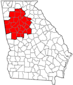
Major city Municipalities & communities 100k-250k 25k-100k Alpharetta • Brookhaven • Candler-McAfee • Duluth • Dunwoody • East Point • Gainesville • Johns Creek • Lawrenceville • Mableton • Marietta • Milton • Newnan • Peachtree City • Peachtree Corners • Redan • Smyrna • Tucker10k-25k Acworth • Belvedere Park • Buford • Carrollton • Cartersville • Chamblee • College Park • Conyers • Covington • Decatur • Doraville • Druid Hills • Douglasville • Fayetteville • Forest Park • Griffin • Kennesaw • Suwanee • Lilburn • Monroe • Mountain Park • North Decatur • North Druid Hills • Panthersville • Powder Springs • Riverdale • Snellville • Stockbridge • Sugar Hill • Union City • Vinings • Winder • WoodstockTopics Architecture • Culture • History • Media • Neighborhoods • People • Tourism • Transportation Categories:- Atlanta metropolitan area
- Cities in Georgia (U.S. state)
- Populated places in Fulton County, Georgia
- Milton County, Georgia
- Populated places established in 1858


Wikimedia Foundation. 2010.