- Lilburn, Georgia
Infobox Settlement
official_name = Lilburn, Georgia
other_name =
native_name =
nickname =
settlement_type =City
motto =
imagesize =
image_caption =
flag_size =
image_
seal_size =
image_shield =
shield_size =
image_blank_emblem =
blank_emblem_type =
blank_emblem_size =
imagesize =
image_caption =
flag_size =
image_
seal_size =
image_shield =
shield_size =
image_blank_emblem =
blank_emblem_type =
blank_emblem_size =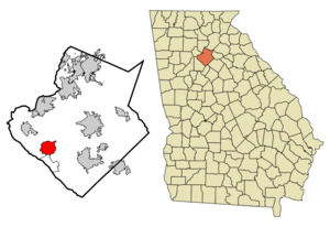
mapsize = 250x200px
map_caption = Location in Gwinnett County and the state of Georgia
mapsize1 =
map_caption1 =
image_dot_
dot_mapsize =
dot_map_caption =
dot_x =
dot_y =
pushpin_
pushpin_label_position =
pushpin_map_caption =
pushpin_mapsize =
subdivision_type = Country
subdivision_name =United States
subdivision_type1 = State
subdivision_name1 = Georgia
subdivision_type2 = County
subdivision_name2 = Gwinnett
subdivision_type3 =
subdivision_name3 =
subdivision_type4 =
subdivision_name4 =
government_footnotes =
government_type =
leader_title =
leader_name =
leader_title1 =
leader_name1 =
leader_title2 =
leader_name2 =
leader_title3 =
leader_name3 =
leader_title4 =
leader_name4 =
established_title =
established_date =
established_title2 =
established_date2 =
established_title3 =
established_date3 =
area_magnitude =
unit_pref = Imperial
area_footnotes =
area_total_km2 = 16
area_land_km2 = 15.9
area_water_km2 = 0.1
area_total_sq_mi = 6.2
area_land_sq_mi = 6.2
area_water_sq_mi = 0
area_water_percent =
area_urban_km2 =
area_urban_sq_mi =
area_metro_km2 =
area_metro_sq_mi =
area_blank1_title =
area_blank1_km2 =
area_blank1_sq_mi =
population_as_of = 2000
population_footnotes =
population_note =
population_total = 11307
population_density_km2 = 706.7
population_density_sq_mi = 1823.7
population_metro =
population_density_metro_km2 =
population_density_metro_sq_mi =
population_urban =
population_density_urban_km2 =
population_density_urban_sq_mi =
population_blank1_title =
population_blank1 =
population_density_blank1_km2 =
population_density_blank1_sq_mi =
timezone = Eastern (EST)
utc_offset = -5
timezone_DST = EDT
utc_offset_DST = -4
latd = 33 |latm = 53 |lats = 20 |latNS = N
longd = 84 |longm = 8 |longs = 27 |longEW = W
elevation_footnotes =
elevation_m = 290
elevation_ft = 951
postal_code_type =ZIP code s
postal_code = 30047-30048
area_code = 470/678/770
blank_name = FIPS code
blank_info = 13-46356GR|2
blank1_name = GNIS feature ID
blank1_info = 0332213GR|3
website =
footnotes = .Geography
Lilburn is located at coor dms|33|53|20|N|84|8|27|W|city (33.888853, -84.140897)GR|1.
According to the
United States Census Bureau , the city has a total area of 6.2square mile s (16.1km² ), of which, 6.2 square miles (15.9 km²) of it is land and 0.1 square miles (0.1 km²) of it (0.81%) is water.Historical Background
The city of Lilburn was founded in 1890 by the Seaboard Airline Railway. The area previously known as McDaniel, Georgia was renamed Lilburn, after the General Superintendent of the railroad, Lilburn Trigg Myers. The town prospered and was incorporated as Lilburn, Georgia on July 27, 1910.
A devastating fire and hard economic times in the 1920's ended the prosperity and the City of Lilburn ceased to exist. A revitalization of the original historic area has emerged with shopping and restaurants in the Old Town district which has been described as a "Slice of History."
Demographics
As of the
census GR|2 of 2000, there were 11,307 people, 3,943 households, and 2,835 families residing in the city. Thepopulation density was 1,837.6 people per square mile (709.9/km²). There were 4,049 housing units at an average density of 658.0/sq mi (254.2/km²). The racial makeup of the city was 69.09% White, 11.93% African American, 0.34% Native American, 11.69% Asian, 0.03% Pacific Islander, 4.81% from other races, and 2.11% from two or more races. Hispanic or Latino of any race were 13.22% of the population.There were 3,943 households out of which 38.1% had children under the age of 18 living with them, 57.1% were married couples living together, 11.1% had a female householder with no husband present, and 28.1% were non-families. 22.4% of all households were made up of individuals and 6.3% had someone living alone who was 65 years of age or older. The average household size was 2.80 and the average family size was 3.28.
In the city the population was spread out with 25.7% under the age of 18, 9.1% from 18 to 24, 33.7% from 25 to 44, 23.3% from 45 to 64, and 8.3% who were 65 years of age or older. The median age was 35 years. For every 100 females there were 97.1 males. For every 100 females age 18 and over, there were 92.5 males.
The median income for a household in the city was $53,707, and the median income for a family was $62,563. Males had a median income of $38,289 versus $28,996 for females. The
per capita income for the city was $22,503. About 4.7% of families and 6.1% of the population were below thepoverty line , including 7.1% of those under age 18 and 10.7% of those age 65 or over.Reflecting the shifting demographics of Lilburn and Metropolitan Atlanta, the largest traditional, stone, and marble
Hindu temple outside ofIndia was completed and dedicated onAugust 26 ,2007 . [ [http://lpe.ajc.com/gallery/view/metro/gwinnett/0823temple/ Gallery | Lilburn welcomes new Hindu temple | ajc.com ] ]Schools with Lilburn mailing address
Elementary Schools
* Arcado Elementary (Parkview)
* Camp Creek Elementary (Parkview)
* R.D. Head Elementary (Brookwood)
* G.H. Hopkins Elementary (Meadowcreek)
* Knight Elementary (Parkview)
* Lilburn Elementary (Meadowcreek)
* Rebecca Minor Elementary (Berkmar)
* Mountain Park Elementary (Parkview)Middle Schools
* Berkmar Middle (Berkmar)
* Lilburn Middle (Meadowcreek)
* Trickum Middle (Parkview)High Schools
*Berkmar High School (Berkmar)
* Parkview High School (Parkview)Private Schools
* Killian Hill Christian School
* Providence Christian Academy
* Gwinnett CollegeEvents
Lilburn Daze, an Arts and Crafts Festival, promoted by the Lilburn Woman's Club, is celebrated on the second Saturday in October and features over 400 vendors. The Annual Christmas Parade, held on the first Saturday in December, is always an anticipated event for the community with over 100 entries marching down Main Street ending at City Park.
Notable Residents of Lilburn
* Lilburn is the hometown of
Atlanta Braves right-fielderJeff Francoeur .
* It is also where NBA Hall of FamerDominique Wilkins lives with his family.
* Lilburn was the hometown ofKate Michael ,Miss District of Columbia 2006. Michael now resides in Washington D.C.References
External links
* [http://www.scangwinnett.com/ Listen to the Lilburn Police Department]
* [http://www.cityoflilburn.com/ City of Lilburn, GA Municipal Government]
Wikimedia Foundation. 2010.