- Brantley County, Georgia
Infobox U.S. County
county = Brantley County
state = Georgia
seallink =
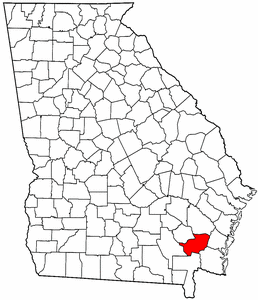
map size = 225
founded = 1920
seat = Nahunta
largest city = Nahunta
area_total_sq_mi = 447
area_total_km2 = 1159
area_land_sq_mi = 441
area_land_km2 = 1151
area_water_sq_mi = 3
area_water_km2 = 8
area percentage = 0.67%
census estimate yr = 2006
pop = 15753
density_sq_mi = 30
density_km2 = 12
time zone = Eastern
UTC offset = -5
DST offset = -4
web = www.brantleycounty.orgBrantley County is a
county located in theU.S. state of Georgia. It is part of the 'Brunswick, Georgia Metropolitan Statistical Area' which encompasses all of Brantley, Glynn, and McIntosh counties. As of 2000, the population is 14,629. The 2007 Census Estimate shows a population of 15,440 [http://www.census.gov/popest/counties/tables/CO-EST2007-01-13.xls] . Thecounty seat is NahuntaGR|6.History
Georgia voters passed a state constitutional amendment on
November 2 ,1920 to form Brantley County from pieces of Charlton, Pierce, and Wayne counties. The state historical marker on the grounds of the Brantley County courthouse and several other sources Who|date=July 2007 state that Brantley County was named forBenjamin D. Brantley , a member of a prominent local family. Other sources claim the name honored Benjamin Brantley's son,William Goodman Brantley of Brunswick, Georgia. The younger Brantley served as a state representative, state senator, and eight-term United States representative.Since the
Okefenokee Swamp is to the south and west of the county, passage throughBrantley County was essential to the railroads running from the coast through the southern part of the state.Fort McIntosh was built in the early years of the
American Revolutionary War to protect the extensive herds of cattle. It was placed under siege from Tories in 1777 and eventually surrendered.Fort Mudge was built in the county at about the same time. This fort was immortalized byWalt Kelly in the "Pogo" comic strip.Geography
According to the
U.S. Census Bureau , the county has a total area of 447square mile s (1,159km² ), of which, 444 square miles (1,151 km²) of it is land and 3 square miles (8 km²) of it (0.67%) is water. TheSatilla River runs through Brantley County.Major highways
*
*
*
*
*
*
*
*Adjacent counties
*Wayne County, Georgia - northeast
*Glynn County, Georgia - east
*Camden County, Georgia - southeast
*Charlton County, Georgia - southwest
*Ware County, Georgia - west
*Pierce County, Georgia - northwestDemographics
As of the
census GR|2 of 2000, there were 14,629 people, 5,436 households, and 4,153 families residing in the county. Thepopulation density was 33 people per square mile (13/km²). There were 6,490 housing units at an average density of 15 per square mile (6/km²). The racial makeup of the county was 94.36% White, 3.98% Black or African American, 0.14% Native American, 0.09% Asian, 0.01% Pacific Islander, 0.35% from other races, and 1.08% from two or more races. 1.04% of the population were Hispanic or Latino of any race.There were 5,436 households out of which 38.20% had children under the age of 18 living with them, 60.90% were married couples living together, 10.60% had a female householder with no husband present, and 23.60% were non-families. 20.40% of all households were made up of individuals and 7.70% had someone living alone who was 65 years of age or older. The average household size was 2.68 and the average family size was 3.06.
In the county the population was spread out with 28.30% under the age of 18, 8.50% from 18 to 24, 29.90% from 25 to 44, 23.20% from 45 to 64, and 10.10% who were 65 years of age or older. The median age was 35 years. For every 100 females there were 100.80 males. For every 100 females age 18 and over, there were 98.10 males.
The median income for a household in the county was $30,361, and the median income for a family was $35,534. Males had a median income of $29,269 versus $20,709 for females. The
per capita income for the county was $13,713. About 12.10% of families and 15.60% of the population were below thepoverty line , including 19.70% of those under age 18 and 16.90% of those age 65 or over.Cities and communities
*Hoboken
*Nahunta
*Waynesville
*Hortense
*TrudieReferences
* [http://www.cviog.uga.edu/Projects/gainfo/courthouses/brantleyCH.htm GeorgiaInfo Brantley County Courthouse History]
* [http://www.cviog.uga.edu/Projects/gainfo/courthouses/brantleyCHmarker.htm GeorgiaInfo record of the Brantley County State Historical Marker]Notes
Wikimedia Foundation. 2010.