- Charlton County, Georgia
-
Charlton County, Georgia 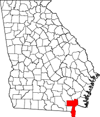
Location in the state of Georgia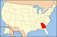
Georgia's location in the U.S.Founded 1854 Seat Folkston Largest city Folkston Area
- Total
- Land
- Water
782.97 sq mi (2,028 km²)
780.77 sq mi (2,022 km²)
2.20 sq mi (6 km²), .28%PopulationEst.
- (2006)
- Density
10,882
13/sq mi (5/km²)Congressional district 1st Time zone Eastern: UTC-5/-4 Charlton County is a county located in the U.S. state of Georgia. As of 2000, the population was 10,282. The 2007 Census Estimate shows a population of 10,609.[1] The county seat is Folkston.[2]
Contents
History
Charlton County was created from a portion of Camden County, Georgia by an act of the Georgia General Assembly on February 18, 1854. Additional lands from Ware County, Georgia, were added to Charlton's borders by an 1855 act of the General Assembly. In 1856, an additional legistlative act redefined the Charlton/Camden borders again with each county ceding land to the other.[3]
The County is named for Robert Milledge Charlton, an U. S. Senator from Georgia.[4]
Geography
According to the 2000 census, the county has a total area of 782.97 square miles (2,027.9 km2), of which 780.77 square miles (2,022.2 km2) (or 99.72%) is land and 2.20 square miles (5.7 km2) (or 0.28%) is water.[5] It is the southernmost county in Georgia. A large portion of the county lies within the Okefenokee Swamp and its federally protected areas.
Major highways
 U.S. Route 1
 U.S. Route 23
 U.S. Route 301
 State Route 4
 State Route 15
 State Route 23
 State Route 40
 State Route 94
 State Route 121
 State Route 185
Adjacent counties
- Brantley County, Georgia - northeast
- Nassau County, Florida - east
- Camden County, Georgia - east
- Baker County, Florida - south
- Ware County, Georgia - west and northwest
National protected area
Demographics
Of the census[6] of 2000, there were 10,282 people, 3,342 households, and 2,499 families residing in the county. The population density was 13 people per square mile (5/km²). There were 3,859 housing units at an average density of 5 per square mile (2/km²). The racial makeup of the county was 68.59% White, 29.26% Black or African American, 0.42% Native American, 0.34% Asian, 0.06% Pacific Islander, 0.14% from other races, and 1.21% from two or more races. 0.79% of the population were Hispanic or Latino of any race.
There were 3,342 households out of which 37.60% had children under the age of 18 living with them, 55.40% were married couples living together, 15.00% had a female householder with no husband present, and 25.20% were non-families. 21.80% of all households were made up of individuals and 8.50% had someone living alone who was 65 years of age or older. The average household size was 2.74 and the average family size was 3.20.
In the county the population was spread out with 27.50% under the age of 18, 10.60% from 18 to 24, 31.70% from 25 to 44, 20.60% from 45 to 64, and 9.70% who were 65 years of age or older. The median age was 33 years. For every 100 females there were 112.40 males. For every 100 females age 18 and over, there were 115.60 males.
The median income for a household in the county was $27,869, and the median income for a family was $33,364. Males had a median income of $26,631 versus $17,978 for females. The per capita income for the county was $12,920. About 17.80% of families and 20.90% of the population were below the poverty line, including 29.10% of those under age 18 and 20.40% of those age 65 or over.
Education
Cities and towns
- Racepond
- Saint George
- Silver Hill
- Stanley Landing
- Stokesville
- Toledo
- Traders Hill
- Uptonville
- Winokur
See also
External links
- Okefenokee National Wildlife Refuge U.S. Fish and Wildlife Service
Notes
- ^ [1]
- ^ "Find a County". National Association of Counties. http://www.naco.org/Counties/Pages/FindACounty.aspx. Retrieved 2011-06-07.
- ^ New Georgia Encyclopedia: Charlton County
- ^ georgia.gov - Charlton County
- ^ "Census 2000 U.S. Gazetteer Files: Counties". United States Census. http://www.census.gov/tiger/tms/gazetteer/county2k.txt. Retrieved 2011-02-13.
- ^ "American FactFinder". United States Census Bureau. http://factfinder.census.gov. Retrieved 2008-01-31.

Ware County Brantley County Ware County 
Camden County and Nassau County, Florida  Charlton County, Georgia

Baker County, Florida Municipalities and communities of Charlton County, Georgia Cities 
Unincorporated
communitiesCategories:- Georgia (U.S. state) counties
- Charlton County, Georgia
- 1854 establishments in the United States


Wikimedia Foundation. 2010.