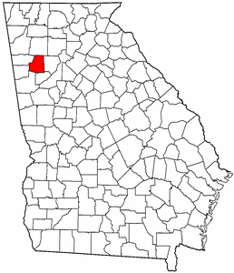
- Paulding County, Georgia
Infobox U.S. County
county = Paulding County
state = Georgia
map size = 225
founded = 1832
seat = Dallas | largest city = Dallas
area_total_sq_mi =315
area_land_sq_mi =313
area_water_sq_mi =2
area percentage = 0.52%
census yr = 2006
pop = 121530
density_km2 =101
web = www.paulding.gov
|Paulding County is a
county located in theU.S. state of Georgia. As of the2000 census , thepopulation is 81,678. The 2007 Census Estimate shows a population of 127,906. [http://www.census.gov/popest/counties/tables/CO-EST2007-01-13.xls] Thecounty seat is Dallas, Georgia.GR|6The county is a part of the
Atlanta metropolitan area (Atlanta-Sandy Springs-Marietta, GeorgiaMetropolitan Statistical Area ).History
Paulding County was created from Cherokee County by an act of the
Georgia General Assembly onDecember 3 ,1832 . In 1851, a portion of Paulding County was used to help create Polk County. Other portions of Paulding County were annexed to neighboring counties (Campbell, Carroll, Cobb, Douglas, Haralson, and Polk) between 1832 and 1874. Between 1850 and 1874, Paulding County was expanded through annexation of parts of Carroll, Cobb, Douglas, and Polk countiesThe County is named after
John Paulding (October 16 ,1758 –February 18 ,1818 ), who was famous for the capture of the British spy Major John André in 1780 during theAmerican Revolution . André was on a mission carrying secret papers fromBenedict Arnold when he was captured.Geography
According to the
U.S. Census Bureau , the county has a total area of 315square mile s (816km² ), of which, 313 square miles (812 km²) of it is land and 2 square miles (4 km²) of it (0.52%) is water.Geographic features
The
Tallapoosa River originates in Paulding County.Major highways
*
*
*
*
*
*econdary highways
*Dallas-Acworth Highway, S.R. 381
*Ridge Road, S.R. 61 Connector, South Paulding connector that runs between Georgia State Route 92 and Georgia State Route 61
*East Paulding Drive, S.R. 120 Connector, formerly known as Dragstrip Road
*Goldmine Road, U.S. 278/S.R. 6
*Bill Carruth Parkway, formerly known as West Hiram Parkway, originally known as Egg Farm Road
*Bobo Road, S.R. 92
*Macland Road, S.R. 360, western leg of Macland Road
*Mulberry Rock Road
*Braswell Mountain Road
*Cedarcrest Road
*Hickory Grove Church Road
*Dabbs Bridge Road
*Vinson Mountain Road
*Brushy Mountain RoadAdjacent counties
*Bartow County, Georgia - north
*Cobb County, Georgia - east
*Douglas County, Georgia - southeast
*Carroll County, Georgia - south
*Haralson County, Georgia - southwest
*Polk County, Georgia - westDemographics
As of the
census GR|2 of 2000, there were 81,678 people, 28,089 households, and 22,892 families residing in the county. Thepopulation density was 261 people per square mile (101/km²). There were 29,274 housing units at an average density of 93 per square mile (36/km²). The racial makeup of the county was 90.59% White, 6.96% Black or African American, 0.30% Native American, 0.40% Asian, 0.03% Pacific Islander, 0.57% from other races, and 1.16% from two or more races. 1.71% of the population were Hispanic or Latino of any race.There were 28,089 households out of which 46.20% had children under the age of 18 living with them, 68.30% were married couples living together, 9.00% had a female householder with no husband present, and 18.50% were non-families. 14.60% of all households were made up of individuals and 3.80% had someone living alone who was 65 years of age or older. The average household size was 2.89 and the average family size was 3.20.
In the county the population was spread out with 30.70% under the age of 18, 7.60% from 18 to 24, 38.40% from 25 to 44, 17.40% from 45 to 64, and 5.90% who were 65 years of age or older. The median age was 31 years. For every 100 females there were 100.20 males. For every 100 females age 18 and over, there were 96.80 males.
The median income for a household in the county was $52,161, and the median income for a family was $56,039. Males had a median income of $38,637 versus $27,341 for females. The
per capita income for the county was $19,974. About 4.00% of families and 5.50% of the population were below thepoverty line , including 5.60% of those under age 18 and 9.50% of those age 65 or over.Recreation
*Silver Comet Trail [ [http://www.silvercometga.com/silver-comet-paulding-county/paulding-county.shtml Silver Comet Trail, Paulding County Information - Georgia ] ]
Notable residents
*
Jayne County , formerly known as Wayne County: legendarypunk rock star who became an influentialtranssexual musician after leaving Paulding County forNew York City in 1968
*Patty Loveless ,country music star; and her husband,record producer Emory Gordy, Jr.
*Spencer Scott ,Playboy Playmate of the Month for October, 2007
*Ray Traylor , former WWF superstar
*Travis Tritt ,country music starCities and towns
References
* [http://www.cviog.uga.edu/Projects/gainfo/courthouses/pauldingCH.htm GeorgiaInfo Paulding County Courthouse History]
External links
* [http://www.paulding.gov/ Paulding County Government]
Wikimedia Foundation. 2010.