- Braswell, Georgia
Infobox Settlement
official_name = Braswell, Georgia
other_name =
native_name =
nickname =
settlement_type =City
motto =
imagesize =
image_caption =
flag_size =
image_
seal_size =
image_shield =
shield_size =
image_blank_emblem =
blank_emblem_type =
blank_emblem_size =
imagesize =
image_caption =
flag_size =
image_
seal_size =
image_shield =
shield_size =
image_blank_emblem =
blank_emblem_type =
blank_emblem_size =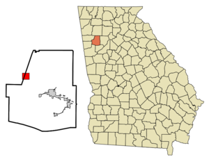
mapsize = 250px
map_caption = Location in Paulding County and the state of Georgia
mapsize1 =
map_caption1 =
image_dot_
dot_mapsize =
dot_map_caption =
dot_x =
dot_y =
pushpin_
pushpin_label_position =
pushpin_map_caption =
pushpin_mapsize =
subdivision_type = Country
subdivision_name =United States
subdivision_type1 = State
subdivision_name1 = Georgia
subdivision_type2 = Counties
subdivision_name2 = Polk, Paulding
subdivision_type3 =
subdivision_name3 =
subdivision_type4 =
subdivision_name4 =
government_footnotes =
government_type =
leader_title =
leader_name =
leader_title1 =
leader_name1 =
leader_title2 =
leader_name2 =
leader_title3 =
leader_name3 =
leader_title4 =
leader_name4 =
established_title =
established_date =
established_title2 =
established_date2 =
established_title3 =
established_date3 =
area_magnitude =
unit_pref = Imperial
area_footnotes =
area_total_km2 = 7.9
area_land_km2 = 7.9
area_water_km2 = 0
area_total_sq_mi = 3.1
area_land_sq_mi = 3.1
area_water_sq_mi = 0
area_water_percent =
area_urban_km2 =
area_urban_sq_mi =
area_metro_km2 =
area_metro_sq_mi =
area_blank1_title =
area_blank1_km2 =
area_blank1_sq_mi =
population_as_of = 2000
population_footnotes =
population_note =
population_total = 80
population_density_km2 = 10.1
population_density_sq_mi = 25.8
population_metro =
population_density_metro_km2 =
population_density_metro_sq_mi =
population_urban =
population_density_urban_km2 =
population_density_urban_sq_mi =
population_blank1_title =
population_blank1 =
population_density_blank1_km2 =
population_density_blank1_sq_mi =
timezone = Eastern (EST)
utc_offset = -5
timezone_DST = EDT
utc_offset_DST = -4
latd = 33 |latm = 59 |lats = 2 |latNS = N
longd = 84 |longm = 57 |longs = 34 |longEW = W
elevation_footnotes =
elevation_m = 354
elevation_ft = 1161
postal_code_type =
postal_code =
area_code =
blank_name = FIPS code
blank_info = 13-10104GR|2
blank1_name = GNIS feature ID
blank1_info = 0331229GR|3
website =
footnotes =Braswell is a city in Polk and Paulding Counties in the
U.S. state ofGeorgia (U.S. state) . The population was 80 at the 2000 census.Geography
Braswell is located at coor dms|33|59|2|N|84|57|34|W|city (33.983787, -84.959479)GR|1.
According to the
United States Census Bureau , the city has a total area of 3.1square mile s (8.0km² ), of which, 3.1 square miles (7.9 km²) of it is land and 0.33% is water.History
Braswell had a population of 25 in 1950. (Source=Columbia-Lippincott Gazeteer)
Demographics
As of the
census GR|2 of 2000, there were 80 people, 25 households, and 20 families residing in the city. Thepopulation density was 26.2 people per square mile (10.1/km²). There were 27 housing units at an average density of 8.8/sq mi (3.4/km²). The racial makeup of the city was 100.00% White and 00.00% African American.There were 25 households out of which 56.0% had children under the age of 18 living with them, 72.0% were married couples living together, 4.0% had a female householder with no husband present, and 20.0% were non-families. 12.0% of all households were made up of individuals and 8.0% had someone living alone who was 65 years of age or older. The average household size was 3.20 and the average family size was 3.65.
In the city the population was spread out with 33.8% under the age of 18, 11.3% from 18 to 24, 30.0% from 25 to 44, 20.0% from 45 to 64, and 5.0% who were 65 years of age or older. The median age was 30 years. For every 100 females there were 90.5 males. For every 100 females age 18 and over, there were 89.3 males.
The median income for a household in the city was $38,250, and the median income for a family was $38,750. Males had a median income of $28,000 versus $19,375 for females. The
per capita income for the city was $14,275. There were 13.0% of families and 13.0% of the population living below thepoverty line , including no under eighteens and none of those over 64.Braswell was also the location of the only tunnel on the Southern Railway (now Norfolk Southern) Chattanooga to Atlanta main line. The tunnel was bypassed in 1979 by cutting through Braswell mountain slightly to the east. The tunnel is still there, but is overgrown with vegetation and is a safety hazard due to snake infestation. Another nearby tunnel, at Divide, is currently used by bicyclists and joggers on the "Silver Comet Rail Trail".
References
External links
* [http://pchsm.org Paulding County Historical Society & Museum]
Wikimedia Foundation. 2010.