- Maxeys, Georgia
-
Maxeys, Georgia — Town — Location in Oglethorpe County and the state of Georgia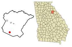
Coordinates: 33°45′26″N 83°10′26″W / 33.75722°N 83.17389°WCoordinates: 33°45′26″N 83°10′26″W / 33.75722°N 83.17389°W Country United States State Georgia County Oglethorpe Area – Total 2.4 sq mi (6.2 km2) – Land 2.4 sq mi (6.2 km2) – Water 0 sq mi (0 km2) Elevation 751 ft (229 m) Population (2000) – Total 210 – Density 87.5/sq mi (33.9/km2) Time zone Eastern (EST) (UTC-5) – Summer (DST) EDT (UTC-4) ZIP code 30671 Area code(s) 706 FIPS code 13-50260[1] GNIS feature ID 0328731[2] Maxeys is a town in Oglethorpe County, Georgia, United States. The population was 210 at the 2000 census.
Contents
Geography
Maxeys is located at 33°45′26″N 83°10′26″W / 33.75722°N 83.17389°W (33.757304, -83.173873)[3].
According to the United States Census Bureau, the town has a total area of 2.4 square miles (6.2 km2), of which, 2.4 square miles (6.2 km2) of it is land and 0.42% is water.
Demographics
As of the census[1] of 2000, there were 210 people, 77 households, and 62 families residing in the town. The population density was 87.8 people per square mile (33.9/km²). There were 86 housing units at an average density of 36.0 per square mile (13.9/km²). The racial makeup of the town was 92.38% White, 2.86% African American, 0.48% Native American, 2.86% from other races, and 1.43% from two or more races. Hispanic or Latino of any race were 2.86% of the population.
There were 77 households out of which 27.3% had children under the age of 18 living with them, 74.0% were married couples living together, 6.5% had a female householder with no husband present, and 18.2% were non-families. 13.0% of all households were made up of individuals and 9.1% had someone living alone who was 65 years of age or older. The average household size was 2.73 and the average family size was 3.02.
In the town the population was spread out with 23.8% under the age of 18, 8.6% from 18 to 24, 23.3% from 25 to 44, 22.9% from 45 to 64, and 21.4% who were 65 years of age or older. The median age was 42 years. For every 100 females there were 92.7 males. For every 100 females age 18 and over, there were 86.0 males.
The median income for a household in the town was $53,125, and the median income for a family was $58,750. Males had a median income of $31,406 versus $22,750 for females. The per capita income for the town was $16,227. About 12.9% of families and 13.1% of the population were below the poverty line, including 14.5% of those under the age of eighteen and 6.3% of those sixty five or over.
AT Brightwell Scholarship
The AT Brightwell Scholarship is a college scholarship available only to residents of Maxeys, and will continue to pay college expenses through and including graduate school.[4] It is available to all unmarried or divorced (proof of divorce necessary) students under 25 years of age who have lived within the strictly defined city limits of Maxeys for at least one year prior to the effective day of scholarship. The parents of the student must live and remain in Maxeys are for the duration of the scholarship. Because this scholarship is potentially so lucrative, many real estate companies in the area advertise homes as "AT Brightwell eligible".[5]
References
- ^ a b "American FactFinder". United States Census Bureau. http://factfinder.census.gov. Retrieved 2008-01-31.
- ^ "US Board on Geographic Names". United States Geological Survey. 2007-10-25. http://geonames.usgs.gov. Retrieved 2008-01-31.
- ^ "US Gazetteer files: 2010, 2000, and 1990". United States Census Bureau. 2011-02-12. http://www.census.gov/geo/www/gazetteer/gazette.html. Retrieved 2011-04-23.
- ^ Online Athens http://www.onlineathens.com/stories/071601/new_0716010015.shtml
- ^ Educational Grant Programs http://www.unclesamsmoney.com/access/priv_edu.html
Municipalities and communities of Oglethorpe County, Georgia Cities 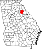
Town Maxeys
Unincorporated
communitiesPhilomath | Smithonia
Categories:- Populated places in Oglethorpe County, Georgia
- Towns in Georgia (U.S. state)
- Athens – Clarke County metropolitan area


Wikimedia Foundation. 2010.