- Oglethorpe County, Georgia
-
Oglethorpe County, Georgia 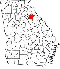
Location in the state of Georgia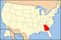
Georgia's location in the U.S.Founded December 19, 1795 Named for James Oglethorpe Seat Lexington Area
- Total
- Land
- Water
,PopulationEst.
- (2007)
- Density
13,963
28/sq mi (11/km²)Congressional district Georgia's 10th congressional district Oglethorpe County is a county located in the U.S. state of Georgia. It is the largest county in Northeast Georgia. As of 2000, the population was 12,635. The 2007 Census Estimate showed a population of 13,963.[1] The county seat is Lexington.[2]
Oglethorpe County is included in the Athens-Clarke County, Georgia, Metropolitan Statistical Area.
Contents
History
Oglethorpe County was originally part of a large tract of land surrendered by Creek and Cherokee Native Americans to the Colony of Georgia in the treaty of 1773. The county itself was founded on December 19, 1795, and is named for Georgia's founder, General James Oglethorpe.
Education
Recreation
- White Water Rafting on the Broad and South Fork Broad Rivers
- ATV and Motor Bike Park
- Sportsman Hunting: Seasonal Whitetail Deer, Turkey and Rabbit
Historic Districts and Heritage Research, Antique Stores in Historic Lexington, Agriculture and Agritourism as well as Oglethorpe Fresh Produce
State Parks
Geography
According to the 2000 census, the county has a total area of 442.17 square miles (1,145.2 km2), of which 441.11 square miles (1,142.5 km2) (or 99.76%) is land and 1.06 square miles (2.7 km2) (or 0.24%) is water.[3]
Major highways
 U.S. Highway 78
 Georgia State Route 22
 Georgia State Route 77
Major Rivers
- Broad River (north and northeast)
Adjacent counties
- Elbert (northeast)
- Wilkes (east)
- Taliaferro (southeast)
- Greene (south)
- Oconee (west-southwest)
- Clarke (west)
- Madison (north)
National protected area
- Oconee National Forest (part)
- Watson Mill Bridge State Park (part)
Demographics
As of the census[4] of 2000, there were 12,635 people, 4,849 households, and 3,539 families residing in the county. The population density was 11/km² (29/mi²). There were 5,368 housing units at an average density of 5/km² (12/mi²). The racial makeup of the county was 78.29% White, 19.75% Black or African American, 0.20% Native American, 0.25% Asian, 0.04% Pacific Islander, 0.63% from other races, and 0.85% from two or more races. 1.38% of the population were Hispanic or Latino of any race.
There were 4,849 households out of which 33.60% had children under the age of 18 living with them, 57.30% were married couples living together, 11.50% had a female householder with no husband present, and 27.00% were non-families. 23.00% of all households were made up of individuals and 9.00% had someone living alone who was 65 years of age or older. The average household size was 2.58 and the average family size was 3.05.
In the county the population was spread out with 25.80% under the age of 18, 7.80% from 18 to 24, 30.00% from 25 to 44, 24.00% from 45 to 64, and 12.40% who were 65 years of age or older. The median age was 37 years. For every 100 females there were 94.40 males. For every 100 females age 18 and over, there were 92.30 males.
The median income for a household in the county was $35,578, and the median income for a family was $41,443. Males had a median income of $30,733 versus $22,289 for females. The per capita income for the county was $17,089. About 10.00% of families and 13.20% of the population were below the poverty line, including 15.90% of those under age 18 and 18.40% of those age 65 or over.
Cities and towns
- Arnoldsville
- Crawford
- Lexington (County Seat)
- Maxeys
Notable Residents
William H. Crawford (1772–1834) - U.S. Minister to France, U.S. Secretary of War, U.S. Secretary of the Treasury, nearly successful candidate for President of the United States
George Mathews (1739–1812) - Revolutionary hero and twice Governor
Meriwether Lewis (1774–1809) was a teenage resident and later the leader of the Lewis and Clark Expedition
Wilson Lumpkin (1783–1870) - Governor
George R. Gilmer (1790–1859) - Twice Governor
Joseph H. Lumpkin (1799–1867) First Chief Justice of the Georgia Supreme Court, framed the state's penal code, cofounder of the Lumpkin Law School at UGA
James Monroe Smith (1839–1915) renowned agriculturist and plantation owner of historic Smithonia.
Country music performer Kenny Rogers resided in Oglethorpe County for a time. This can be verified through County Property records. He owned an Estate known as Beaverdam Farms there. The home was featured on Lifestyles of the Rich and Famous; the Estate contained a horse farm with several barns, a private indoor basketball court, and an in-home movie theater, among other things. The bathrooms were even noted as having 24kt gold faucets. The original asking price on Beaverdam Farms when Rogers sold the property was $24 million dollars.
See also
Andy Paul- Born in Oglethorpe County. He is the most successful red head to live in the county. He spent his life devoting it to his pigs, with which he was successful, reaching the seemingly unreachable height of being the best in the state for his grade. (2011) He also loves Disney, Music, and Jesus. Hit him up.
References
- ^ [1]
- ^ "Find a County". National Association of Counties. http://www.naco.org/Counties/Pages/FindACounty.aspx. Retrieved 2011-06-07.
- ^ "Census 2000 U.S. Gazetteer Files: Counties". United States Census. http://www.census.gov/tiger/tms/gazetteer/county2k.txt. Retrieved 2011-02-13.
- ^ "American FactFinder". United States Census Bureau. http://factfinder.census.gov. Retrieved 2008-01-31.
External links
- Oglethorpe County official website

Madison County Elbert County Clarke County 
Wilkes County  Oglethorpe County, Georgia

Oconee County Greene County Taliaferro County Municipalities and communities of Oglethorpe County, Georgia Cities 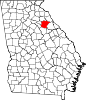
Town Unincorporated
communitiesPhilomath | Smithonia
Categories:- Georgia (U.S. state) counties
- Oglethorpe County, Georgia
- 1793 establishments
- Athens – Clarke County metropolitan area


Wikimedia Foundation. 2010.