- Decatur County, Georgia
-
Decatur County, Georgia 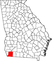
Location in the state of Georgia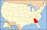
Georgia's location in the U.S.Founded 1823 Seat Bainbridge Largest city Bainbridge Area
- Total
- Land
- Water
623.16 sq mi (1,614 km²)
596.80 sq mi (1,546 km²)
26.36 sq mi (68 km²), 4.23%PopulationEst.
- (2005)
- Density
28,618
47/sq mi (18/km²)Time zone Eastern: UTC-5/-4 Decatur County is a county located in the U.S. state of Georgia. As of 2000, the population was 28,240. The 2007 Census Estimate shows a population of 28,544.[1] The county seat is Bainbridge.[2]
Contents
History
The County was created by an act of the Georgia General Assembly on December 8, 1823, from a portion of Early County. Three other counties were created from land that was originally part of Decatur County.
In 1825, a portion of Decatur was used in the creation of Thomas County. In 1905, another portion of Decatur was used in the creation of part of Grady County. In 1920, the western portion of Decatur County was used to form Seminole County in its entirety.
Decatur County is named for United States Navy Commodore Stephen Decatur, a hero of the War of 1812.
Geography
According to the 2000 census, the county has a total area of 623.16 square miles (1,614.0 km2), of which 596.80 square miles (1,545.7 km2) (or 95.77%) is land and 26.36 square miles (68.3 km2) (or 4.23%) is water.[3] Decatur County should not be confused with the City of Decatur, which is in DeKalb County.
Major highways
 U.S. Route 27
 U.S. Route 84
 State Route 1
 State Route 38
 State Route 97
 State Route 241
 State Route 262
 State Route 309
 State Route 310
 State Route 311
Adjacent counties
- Miller County, Georgia - north
- Mitchell County, Georgia - northeast
- Baker County, Georgia - northeast
- Grady County, Georgia - east
- Gadsden County, Florida - south
- Seminole County, Georgia - west
Demographics
As of the census[4] of 2000, there were 28,240 people, 10,380 households, and 7,546 families residing in the county. The population density was 47 people per square mile (18/km²). There were 11,968 housing units at an average density of 20 per square mile (8/km²). The racial makeup of the county was 57.10% White, 39.91% Black or African American, 0.24% Native American, 0.33% Asian, 0.04% Pacific Islander, 1.64% from other races, and 0.74% from two or more races. 3.20% of the population were Hispanic or Latino of any race.
There were 10,380 households out of which 35.40% had children under the age of 18 living with them, 49.00% were married couples living together, 19.50% had a female householder with no husband present, and 27.30% were non-families. 24.30% of all households were made up of individuals and 10.40% had someone living alone who was 65 years of age or older. The average household size was 2.65 and the average family size was 3.14.
In the county the population was spread out with 28.50% under the age of 18, 9.10% from 18 to 24, 28.00% from 25 to 44, 21.10% from 45 to 64, and 13.30% who were 65 years of age or older. The median age was 34 years. For every 100 females there were 91.00 males. For every 100 females age 18 and over, there were 85.90 males.
The median income for a household in the county was $28,820, and the median income for a family was $32,635. Males had a median income of $27,180 versus $20,745 for females. The per capita income for the county was $15,063. About 19.20% of families and 22.70% of the population were below the poverty line, including 33.00% of those under age 18 and 19.20% of those age 65 or over.
Education
Main article: Bainbridge, Georgia#EducationCities and towns
Unincorporated communities
- Amsterdam
- Ausmac
- Bethany
- Black Jack
- Cyrene
- Eldorendo
- Faceville
- Fowlstown
- Hannatown
- Hanover
- Jinks
- Laingkat
- Lynn
- Mount Pleasant
- Otisco
- Parker Courthouse
- Recovery
- Smith's Landing
- Vada
Ghost Towns
- Miriam
See also
References
- ^ http://www.census.gov/popest/counties/tables/CO-EST2007-01-13.xls
- ^ "Find a County". National Association of Counties. http://www.naco.org/Counties/Pages/FindACounty.aspx. Retrieved 2011-06-07.
- ^ "Census 2000 U.S. Gazetteer Files: Counties". United States Census. http://www.census.gov/tiger/tms/gazetteer/county2k.txt. Retrieved 2011-02-13.
- ^ "American FactFinder". United States Census Bureau. http://factfinder.census.gov. Retrieved 2008-01-31.

Miller County Mitchell County and Baker County Seminole County 
Grady County  Decatur County, Georgia

Gadsden County, Florida Municipalities and communities of Decatur County, Georgia Cities 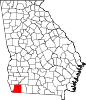
Town Unincorporated
communityCategories:- Georgia (U.S. state) counties
- Decatur County, Georgia
- 1823 establishments in the United States
- Populated places established in 1823


Wikimedia Foundation. 2010.