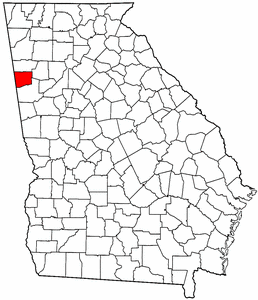
- Haralson County, Georgia
Infobox U.S. County
county = Haralson County
state = Georgia
seallink =
map size = 225
founded =January 26 ,1856
seat = Buchanan
largest city = Bremen
area_total_sq_mi = 283
area_total_km2 = 733
area_land_sq_mi = 282
area_land_km2 = 731
area_water_sq_mi = 1
area_water_km2 = 3
area percentage = 0.37%
census estimate yr = 2006
pop = 28616
density_sq_mi = 91
density_km2 = 35
time zone = Eastern
UTC offset = -5
DST offset = -4
web =Haralson County is a
county located in theU.S. state of Georgia. It was created on January 26, 1856. As of 2000, the population was 25,690. The 2007 Census Estimate shows a population of 28,718 [http://www.census.gov/popest/counties/tables/CO-EST2007-01-13.xls] . Thecounty seat is Buchanan, GeorgiaGR|6.It is part of the
Atlanta metropolitan area (Atlanta-Sandy Springs-Marietta, GeorgiaMetropolitan Statistical Area ).History
The history of the county is told through various [http://hchistory.com/newhome/exhibits.htm online exhibits] of the [http://hchistory.com/ Haralson County Historical Society] .
Law/Government
The county was originally governed by a sole Commissioner of Roads and Revenues. The last occupant of this office was Charles Sanders (D). The county is now governed by a five-member Board of Commissioners, which replaced the single-commissioner form beginning with the term starting in January 2005. The Chairman of the Board is elected county-wide. The current occupant of this office is Allen Poole (R), who had previously come close to winning election in the single-commissioner era. There are four other commissioners, one elected from each of four [http://hchistory.com/BHPL/HCcommsh.jpggeographical districts] . The current occupants of these offices are District 1's Eric Robinson (R), District 2's Bob Birky (R), District 3's Vance Posey (D) and District 4's Sammy Lewis Robinson (D). The current sheriff of Haralson County is Eddie Mixon. Judge J. Edward "Eddie" Hulsey, Jr. is the current probate judge.
Geography
According to the
U.S. Census Bureau , the county has a total area of 283square mile s (733km² ), of which, 282 square miles (731 km²) of it is land and 1 square miles (3 km²) of it (0.37%) is water.Major highways
*
*
*
*
*
*
*
*
*Adjacent counties
*Polk County, Georgia - north
*Paulding County, Georgia - northeast
*Carroll County, Georgia - south
*Cleburne County,Alabama - westEconomy
The [http://haralson.org/ Haralson County Chamber of Commerce] represents many businesses operating in the county. The [http://www.haralsoncounty.org/ Haralson County Development Authority] is concerned with economic development. A quantitative economic history of the county between 1969 and 2003 appears [http://hchistory.com/stories/Economics69-03.htm here] .
Demographics
As of the
census GR|2 of 2000, there were 25,690 people, 9,826 households, and 7,192 families residing in the county. Thepopulation density was 91 people per square mile (35/km²). There were 10,719 housing units at an average density of 38 per square mile (15/km²). The racial makeup of the county was 92.97% White, 5.40% Black or African American, 0.25% Native American, 0.34% Asian, 0.20% from other races, and 0.83% from two or more races. 0.56% of the population were Hispanic or Latino of any race.There were 9,826 households out of which 33.50% had children under the age of 18 living with them, 57.70% were married couples living together, 11.30% had a female householder with no husband present, and 26.80% were non-families. 23.00% of all households were made up of individuals and 10.20% had someone living alone who was 65 years of age or older. The average household size was 2.58 and the average family size was 3.03.
In the county the population was spread out with 26.10% under the age of 18, 8.10% from 18 to 24, 29.20% from 25 to 44, 23.60% from 45 to 64, and 13.00% who were 65 years of age or older. The median age was 36 years. For every 100 females there were 95.20 males. For every 100 females age 18 and over, there were 91.20 males.
The median income for a household in the county was $31,656, and the median income for a family was $38,373. Males had a median income of $31,816 versus $20,821 for females. The
per capita income for the county was $15,823. About 11.40% of families and 15.50% of the population were below thepoverty line , including 18.10% of those under age 18 and 16.10% of those age 65 or over.Education
The Haralson County Board of Education oversees public education in the county, including Buchanan Primary, Buchanan Elementary, Tallapoosa Primary, West Haralson Elementary, Haralson County Middle and Haralson County High School. The high school offers both academic and vocational classes.
West Central Technical College operates a Career Resource Center and the Thomas B. Murphy campus in Waco; some students from the county's high school attend
dual enrollment classes at the WCTC Murphy campus.Cities and towns
Wikimedia Foundation. 2010.