- Cleburne County, Alabama
-
Cleburne County, Alabama 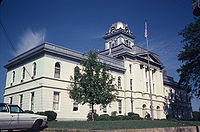 Cleburne County Courthouse in Heflin, Alabama
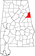
Location in the state of Alabama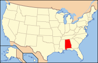
Alabama's location in the U.S.Founded December 6, 1866 Seat Heflin Largest city Heflin Area
- Total
- Land
- Water
561.02 sq mi (1,453 km²)
560.21 sq mi (1,451 km²)
0.81 sq mi (2 km²), (0.14%)Population
- (2010)
- Density
14,972
27/sq mi (10.3/km²)Cleburne County is a county of the U.S. state of Alabama. Its name is in honor of Major General Patrick Cleburne, of Arkansas. As of 2010 the population was 14,972. Its county seat is Heflin.
Contents
History
Cleburne County was established on December 6, 1866, by an act of the state legislature. The county was made from territory in Benton (now Calhoun), Randolph, and Talladega counties. In 1867, Edwardsville was made the county seat.[1] An election was held in 1905 to move the county seat to Heflin. The result of that election, which agreed to move the seat, was appealed to the Supreme Court, who decided on July 1, 1906, to uphold the election results. Heflin is still the county seat.[2]
Geography
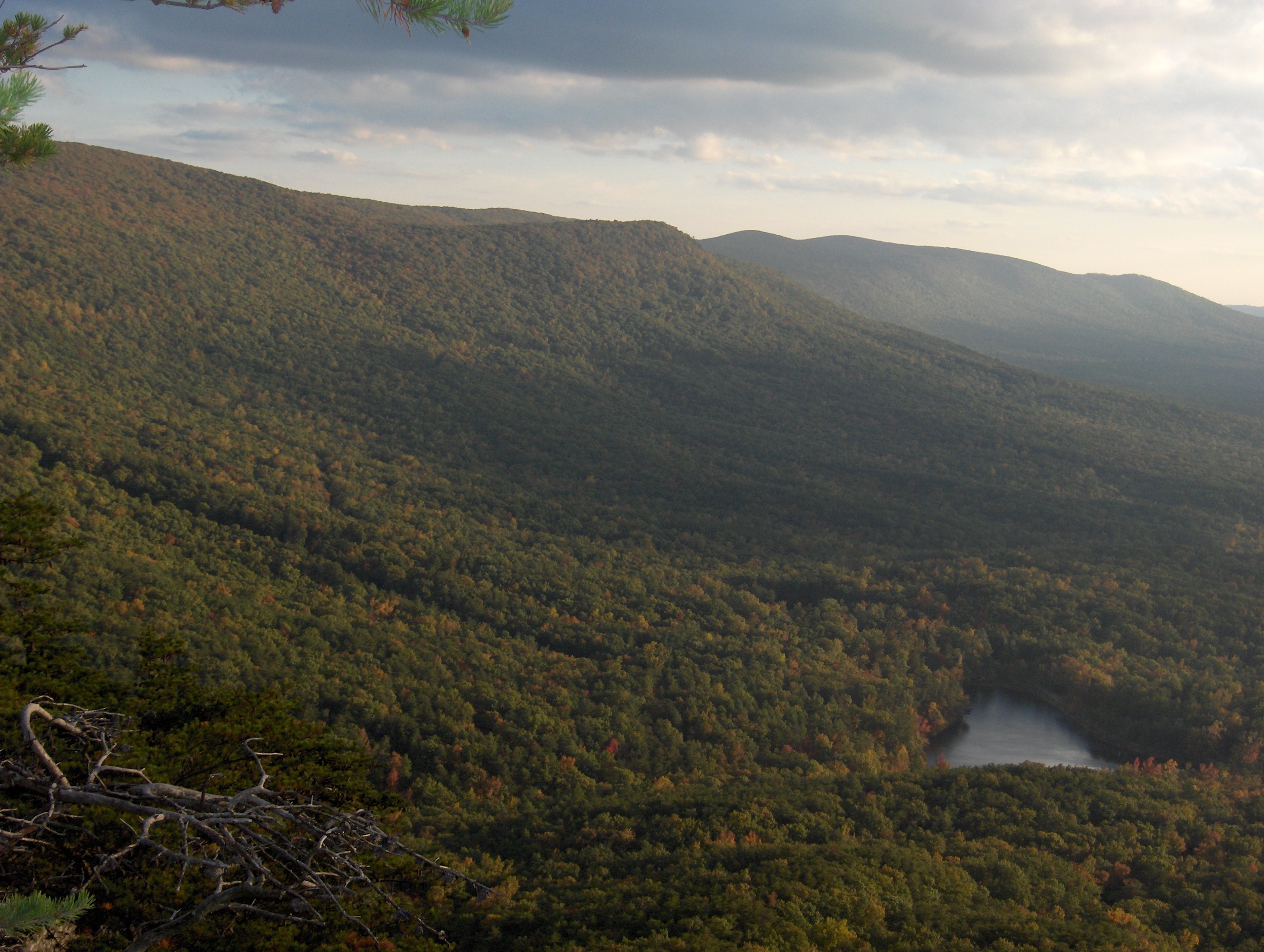
According to the 2000 census, the county has a total area of 561.02 square miles (1,453.0 km2), of which 560.21 square miles (1,450.9 km2) (or 99.86%) is land and 0.81 square miles (2.1 km2) (or 0.14%) is water.[3] Cleburne County is home to Alabama's highest natural point on Cheaha Mountain which is part of the southernmost mountain range in the Blue Ridge Mountains.
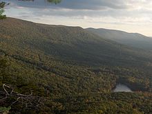 Cheaha Mountain, Cleburne County
Major highways
 Interstate 20
 U.S. Highway 78
 U.S. Highway 431
 State Route 9
 State Route 46
Rail
Adjacent counties
- Cherokee County, Alabama - north
- Polk County, Georgia - northeast
- Haralson County, Georgia - east
- Carroll County, Georgia - southeast
- Randolph County, Alabama - south
- Clay County, Alabama - southwest
- Talladega County, Alabama - southwest
- Calhoun County, Alabama - west
See also: List of counties bordering eight or more countiesNational protected area
- Talladega National Forest (part)
Demographics
Cleburne County, Alabama Year Pop. ±% 1870 8,017 — 1880 10,976 +36.9% 1890 13,218 +20.4% 1900 13,206 −0.1% 1910 13,385 +1.4% 1920 13,360 −0.2% 1930 12,877 −3.6% 1940 13,629 +5.8% 1950 11,904 −12.7% 1960 10,911 −8.3% 1970 10,996 +0.8% 1980 12,595 +14.5% 1990 12,730 +1.1% 2000 14,254 +12.0% 2010 14,972 +5.0% Sources: "American FactFinder". United States Census Bureau. http://factfinder2.census.gov/faces/nav/jsf/pages/index.xhtml. through 1960 As of the census[4] of 2000, there were 14,123 people, 5,590 households, and 4,125 families residing in the county. The population density was 25 people per square mile (10/km2). There were 6,189 housing units at an average density of 11 per square mile (4/km2). The racial makeup of the county was 94.74% White, 3.70% Black or African American, 0.30% Native American, 0.14% Asian, 0.01% Pacific Islander, 0.34% from other races, and 0.77% from two or more races. 1.40% of the population were Hispanic or Latino of any race.
There were 5,590 households out of which 32.80% had children under the age of 18 living with them, 61.40% were married couples living together, 8.70% had a female householder with no husband present, and 26.20% were non-families. 23.00% of all households were made up of individuals and 10.30% had someone living alone who was 65 years of age or older. The average household size was 2.51 and the average family size was 2.95.
In the county the population was spread out with 24.30% under the age of 18, 8.20% from 18 to 24, 28.50% from 25 to 44, 25.30% from 45 to 64, and 13.70% who were 65 years of age or older. The median age was 38 years. For every 100 females there were 99.30 males. For every 100 females age 18 and over, there were 96.40 males.
The median income for a household in the county was $30,820, and the median income for a family was $35,579. Males had a median income of $29,752 versus $18,840 for females. The per capita income for the county was $14,762. About 10.90% of families and 13.90% of the population were below the poverty line, including 16.10% of those under age 18 and 20.10% of those age 65 or over.
Cities and towns
- Edwardsville
- Fruithurst
- Heflin
- Hollis Crossroads
- Micaville
- Ranburne
See also
- National Register of Historic Places listings in Cleburne County, Alabama
- Properties on the Alabama Register of Landmarks and Heritage in Cleburne County, Alabama
- Chamber of Commerce web site
References
- ^ http://www.archives.state.al.us/counties/cleburne.html
- ^ http://www.cityofheflin.org/
- ^ "Census 2000 U.S. Gazetteer Files: Counties". United States Census. http://www.census.gov/tiger/tms/gazetteer/county2k.txt. Retrieved 2011-02-13.
- ^ "American FactFinder". United States Census Bureau. http://factfinder.census.gov. Retrieved 2008-01-31.
Coordinates: 33°40′38″N 85°30′09″W / 33.67722°N 85.5025°W

Cherokee County Polk County, Georgia Calhoun County 
Haralson County, Georgia  Cleburne County, Alabama

Clay County and Talladega County Randolph County Carroll County, Georgia Municipalities and communities of Cleburne County, Alabama Cities 
Towns Unincorporated
communityHopewell
 State of Alabama
Topics - Index
- History
- Geography
- People
- Delegations
- Government
- Governors
- Lieutenant Governors
- Metropolitan Areas
- Visitor Attractions
- National Historic Landmarks
Regions Metros - Greater Birmingham
- Montgomery Metro Area
- Mobile Metro Area
- Huntsville Metro Area
Larger cities Counties - Autauga
- Baldwin
- Barbour
- Bibb
- Blount
- Bullock
- Butler
- Calhoun
- Chambers
- Cherokee
- Chilton
- Choctaw
- Clarke
- Clay
- Cleburne
- Coffee
- Colbert
- Conecuh
- Coosa
- Covington
- Crenshaw
- Cullman
- Dale
- Dallas
- DeKalb
- Elmore
- Escambia
- Etowah
- Fayette
- Franklin
- Geneva
- Greene
- Hale
- Henry
- Houston
- Jackson
- Jefferson
- Lamar
- Lauderdale
- Lawrence
- Lee
- Limestone
- Lowndes
- Macon
- Madison
- Marengo
- Marion
- Marshall
- Mobile
- Monroe
- Montgomery
- Morgan
- Perry
- Pickens
- Pike
- Randolph
- Russell
- Shelby
- St. Clair
- Sumter
- Talladega
- Tallapoosa
- Tuscaloosa
- Walker
- Washington
- Wilcox
- Winston
Categories:- Alabama counties
- Cleburne County, Alabama
- 1866 establishments


Wikimedia Foundation. 2010.