- Cullman County, Alabama
-
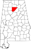
Cullman County, Alabama 
Location in the state of Alabama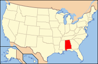
Alabama's location in the U.S.Founded January 24, 1877 Seat Cullman Largest city Cullman Area
- Total
- Land
- Water
754.82 sq mi (1,955 km²)
738.43 sq mi (1,913 km²)
16.39 sq mi (42 km²), 2.17%Population
- (2010)
- Density
80,406
109/sq mi (42/km²)Website www.co.cullman.al.us Cullman County is a county of the U.S. state of Alabama. Its name is in honor of Colonel John G. Cullmann. As of 2010, the population was 80,406. Its county seat is the town of the same name, Cullman, Alabama. It is a "moist" county in terms of availablity of alcoholic beverages, which means that the city of Cullman is wet and the rest of the county is dry. Cullman is served by TV stations and FM radio stations from both Huntsville and Birmingham. Cullman County is a part of the designated market area, or "DMA," of Birmingham. Electricity in Cullman County is provided by the Tennessee Valley Authority and by the Alabama Power Company. For a long time, telephone service in this county was provided by the Southern Bell Company.
There is no commercial air transportation service in Cullman County, and this county is no longer served by intercity commercial buses.
The entirety of Cullman County forms the Cullman micropolitan area, and apart of the Birmingham–Hoover–Cullman Combined Statistical Area.
Contents
History
This area was inhabited for thousands of years by varying cultures of indigenous peoples. The historic Cherokee and Choctaw lived here at the time of European encounter. The Cherokee who remained in the county after Indian Removal in the 1830s have worked at reviving their culture in the last thirty years. The Echota Cherokee are a recognized tribe.
Cullman County was established by German American immigrants from Cincinnati, Ohio, in 1877. They founded an agricultural community and sought to create an agricultural revolution in what had been a frontier area, in the best traditions of innovation in the New South. However, hard geographical and social realties clashed with the often impractical vision of colonizer John G. Cullmann. His Germans, with their traditional work ethic and willingness to experiment with such new products as wine and strawberries, did try to make practical changes in southern farming. The Germans were however outnumbered by more traditional families from neighboring, who replicated the traditional southern cotton culture.
Geography
According to the 2000 census, the county has a total area of 754.82 square miles (1,955.0 km2), of which 738.43 square miles (1,912.5 km2) (or 97.83%) is land and 16.39 square miles (42.4 km2) (or 2.17%) is water.[1]
Major highways
 Interstate 65
 U.S. Highway 31
 U.S. Highway 278
 U.S. Highway 231
 State Route 67
 State Route 69
 State Route 91
 State Route 157
Rail
Adjacent counties
- Morgan County (north)
- Marshall County (northeast)
- Blount County (east)
- Walker County (southwest)
- Winston County (west)
- Lawrence County (northwest)
Demographics
Cullman County, Alabama Year Pop. ±% 1880 6,355 — 1890 13,439 +111.5% 1900 17,849 +32.8% 1910 28,321 +58.7% 1920 33,034 +16.6% 1930 41,051 +24.3% 1940 47,343 +15.3% 1950 49,046 +3.6% 1960 45,572 −7.1% 1970 52,445 +15.1% 1980 61,642 +17.5% 1990 67,613 +9.7% 2000 77,483 +14.6% 2010 80,406 +3.8% Sources: "American FactFinder". United States Census Bureau. http://factfinder2.census.gov/faces/nav/jsf/pages/index.xhtml. through 1960 As of the census[2] of 2000, there were 77,483 people, 30,706 households, and 22,476 families residing in the county. The population density was 105 people per square mile (41/km2). There were 35,233 housing units at an average density of 48 per square mile (18/km2). The racial makeup of the county was 96.81% White, 0.96% Black or African American, 0.37% Native American, 0.18% Asian, 0.03% Pacific Islander, 0.62% from other races, and 1.03% from two or more races. 2.18% of the population were Hispanic or Latino of any race.
There were 30,706 households out of which 32.10% had children under the age of 18 living with them, 60.80% were married couples living together, 8.70% had a female householder with no husband present, and 26.80% were non-families. 24.00% of all households were made up of individuals and 10.40% had someone living alone who was 65 years of age or older. The average household size was 2.49 and the average family size was 2.94.
In the county the population was spread out with 24.30% under the age of 18, 8.80% from 18 to 24, 28.30% from 25 to 44, 24.00% from 45 to 64, and 14.60% who were 65 years of age or older. The median age was 38 years. For every 100 females there were 97.30 males. For every 100 females age 18 and over, there were 94.20 males.
The median income for a household in the county was $32,256, and the median income for a family was $39,341. Males had a median income of $30,444 versus $20,436 for females. The per capita income for the county was $16,922. About 9.50% of families and 13.00% of the population were below the poverty line, including 14.50% of those under age 18 and 16.80% of those age 65 or over.
Cities and towns
- Arab (part - most of Arab is in Marshall County)
- Ardell
- Arkadelphia
- Baileyton
- Battleground
- Berlin
- Bethel
- Bremen
- Birdsong
- Bolte
- Brooklyn
- Brushy Pond
- Bug Tussle
- Central
- Clifty
- Colony
- Corinth
- Crane Hill
- Cullman
- Dodge City
- East Point
- Etha
- Fairview
- Garden City (part - part of Garden City is in Blount County)
- Goldridge
- Good Hope
- Goodwin
- Hanceville
- Harmony
- Holly Pond
- Jones Chapel
- Joppa
- Logan
- Panama
- Providence
- Riverside
- Simcoe
- South Vinemont
- Thrasher Crossroads
- Trade
- Trimble
- Walter
- Welti
- West Point
- Wheat
- Wilburn
Education
Public education in Cullman County is provided by two systems: the Cullman City School Board and the Cullman County School Board, which governs all municipalities except the City of Cullman.
- Cullman High School - under the governance of the Cullman City School Board
Private educational institutions in the county include:
- Christ Covenant School - located in Cullman (Grades K-2)
- Cullman Christian School - located in Cullman (Grades K-12)
- Sacred Heart of Jesus Catholic Elementary School - located in Cullman (Grades PreK-6)
- St. Bernard Preparatory School - located in Cullman (Grades 7-12)
- St. Paul's Lutheran School - located in Cullman (Grades K-6)
- Vinemont Christian Academy - located in South Vinemont (Grades PreK-12)
Cullman is also the home of the state-owned and operated Wallace State Community College in Hanceville. It was named for the former Governor of Alabama, George C. Wallace. His father and his wife, Governor Lurleen B. Wallace, also had junior colleges named for them.
See also: Cullman City Board of EducationSee also
- National Register of Historic Places listings in Cullman County, Alabama
- Properties on the Alabama Register of Landmarks and Heritage in Cullman County, Alabama
References
- ^ "Census 2000 U.S. Gazetteer Files: Counties". United States Census. http://www.census.gov/tiger/tms/gazetteer/county2k.txt. Retrieved 2011-02-13.
- ^ "American FactFinder". United States Census Bureau. http://factfinder.census.gov. Retrieved 2008-01-31.
External links
Further reading
- Davis, Robert S., “The Old World in the New South: Entrepreneurial Ventures and the Agricultural History of Cullman County, Alabama,” Agricultural History, 79 (Fall 2005), 439–61.

Lawrence County Morgan County Marshall County Winston County 
Blount County  Cullman County, Alabama

Walker County Municipalities and communities of Cullman County, Alabama Cities Arab‡ | Cullman | Hanceville
Towns Baileyton | Colony | Dodge City | Fairview | Garden City‡ | Good Hope | Holly Pond | South Vinemont | West Point
Unincorporated
communitiesArkadelphia | Battleground | Berlin | Bremen | Bug Tussle | Crane Hill | Joppa | Wilburn
Footnotes ‡This populated place also has portions in an adjacent county or counties
 State of Alabama
Topics - Index
- History
- Geography
- People
- Delegations
- Government
- Governors
- Lieutenant Governors
- Metropolitan Areas
- Visitor Attractions
- National Historic Landmarks
Regions Metros - Greater Birmingham
- Montgomery Metro Area
- Mobile Metro Area
- Huntsville Metro Area
Larger cities Counties - Autauga
- Baldwin
- Barbour
- Bibb
- Blount
- Bullock
- Butler
- Calhoun
- Chambers
- Cherokee
- Chilton
- Choctaw
- Clarke
- Clay
- Cleburne
- Coffee
- Colbert
- Conecuh
- Coosa
- Covington
- Crenshaw
- Cullman
- Dale
- Dallas
- DeKalb
- Elmore
- Escambia
- Etowah
- Fayette
- Franklin
- Geneva
- Greene
- Hale
- Henry
- Houston
- Jackson
- Jefferson
- Lamar
- Lauderdale
- Lawrence
- Lee
- Limestone
- Lowndes
- Macon
- Madison
- Marengo
- Marion
- Marshall
- Mobile
- Monroe
- Montgomery
- Morgan
- Perry
- Pickens
- Pike
- Randolph
- Russell
- Shelby
- St. Clair
- Sumter
- Talladega
- Tallapoosa
- Tuscaloosa
- Walker
- Washington
- Wilcox
- Winston
Coordinates: 34°07′31″N 86°52′18″W / 34.12528°N 86.87167°W
Categories:- Alabama counties
- Cullman County, Alabama
- 1877 establishments


Wikimedia Foundation. 2010.