- Chambers County, Alabama
-
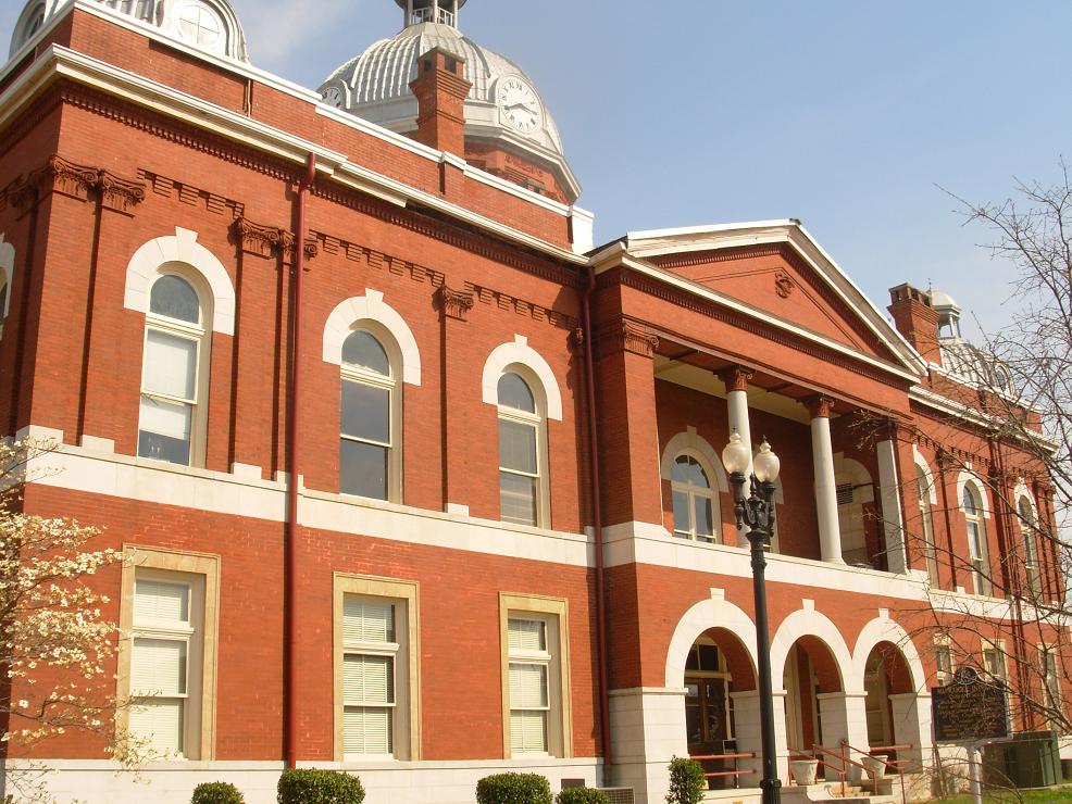
Chambers County, Alabama 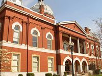 Chambers County courthouse in Lafayette, Alabama
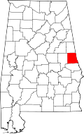
Location in the state of Alabama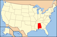
Alabama's location in the U.S.Founded December 18, 1832 Seat Lafayette Largest city Valley Area
- Total
- Land
- Water
603.11 sq mi (1,562 km²)
597.17 sq mi (1,547 km²)
5.94 sq mi (15 km²), (0.98%)Population
- (2010)
- Density
34,215
57/sq mi (22/km²)Chambers County is a county of the U.S. state of Alabama. Its name is in honor of Henry H. Chambers, who served as a Senator from Alabama. As of 2010 the population was 34,215. Its county seat is Lafayette. Chambers County is included in the Valley, Alabama, Micropolitan Statistical Area.
Contents
History
Chambers County was established on December 18, 1832.
Pat Garrett, the lawman famed for killing outlaw Billy the Kid, was born near the town of Cusseta in 1850.
Joe Louis "The Brown Bomber", renowned heavyweight boxing champion, was born near LaFayette, on Buckaloo Mountain, May 13, 1914.
Chambers County joined the four mill cities to make The Valley (which is now the largest city). Valley is rapidly increasing in size and located between Montgomery, Alabama and Atlanta, Georgia.
Geography
According to the 2000 census, the county has a total area of 603.11 square miles (1,562.0 km2), of which 597.17 square miles (1,546.7 km2) (or 99.02%) is land and 5.94 square miles (15.4 km2) (or 0.98%) is water.[1]
Major highways
 Interstate 85
 U.S. Highway 29
 U.S. Highway 280
 U.S. Highway 431
 State Route 50
 State Route 77
Adjacent counties
- Randolph County (north)
- Troup County, Georgia (east)
- Harris County, Georgia (southeast)
- Lee County (south)
- Tallapoosa County (west)
Demographics
Chambers County, Alabama Year Pop. ±% 1820 — 1830 — 1840 17,333 — 1850 23,960 +38.2% 1860 23,214 −3.1% 1870 17,562 −24.3% 1880 23,440 +33.5% 1890 26,319 +12.3% 1900 32,554 +23.7% 1910 36,056 +10.8% 1920 41,201 +14.3% 1930 39,313 −4.6% 1940 42,146 +7.2% 1950 39,528 −6.2% 1960 37,828 −4.3% 1970 36,356 −3.9% 1980 39,191 +7.8% 1990 36,876 −5.9% 2000 36,583 −0.8% 2010 34,215 −6.5% Sources: "American FactFinder". United States Census Bureau. http://factfinder2.census.gov/faces/nav/jsf/pages/index.xhtml. through 1960 As of the census[2] of 2000, there were 36,583 people, 14,522 households, and 10,194 families residing in the county. The population density was 61 people per square mile (24/km2). There were 16,256 housing units at an average density of 27 per square mile (11/km2). The racial makeup of the county was 60.88% White, 38.11% Black or African American, 0.13% Native American, 0.19% Asian, 0.12% from other races, and 0.57% from two or more races. 0.77% of the population were Hispanic or Latino of any race.
There were 14,522 households out of which 29.30% had children under the age of 18 living with them, 48.50% were married couples living together, 17.40% had a female householder with no husband present, and 29.80% were non-families. 27.00% of all households were made up of individuals and 12.40% had someone living alone who was 65 years of age or older. The average household size was 2.48 and the average family size was 3.01.
In the county the population was spread out with 24.60% under the age of 18, 8.60% from 18 to 24, 27.00% from 25 to 44, 23.50% from 45 to 64, and 16.20% who were 65 years of age or older. The median age was 38 years. For every 100 females there were 89.60 males. For every 100 females age 18 and over, there were 85.30 males.
The median income for a household in the county was $29,667, and the median income for a family was $36,598. Males had a median income of $28,771 versus $21,159 for females. The per capita income for the county was $15,147. About 14.30% of families and 17.00% of the population were below the poverty line, including 22.50% of those under age 18 and 18.20% of those age 65 or over.
Cities and towns
- Cusseta
- Five Points
- Huguley
- La Fayette
- Lanett
- Oak Bowery
- Valley
- Waverly (Part of Waverly is in Lee County)
See also
- National Register of Historic Places listings in Chambers County, Alabama
- Properties on the Alabama Register of Landmarks and Heritage in Chambers County, Alabama
References
- ^ "Census 2000 U.S. Gazetteer Files: Counties". United States Census. http://www.census.gov/tiger/tms/gazetteer/county2k.txt. Retrieved 2011-02-13.
- ^ "American FactFinder". United States Census Bureau. http://factfinder.census.gov. Retrieved 2008-01-31.
External links

Randolph County Tallapoosa County 
Troup County, Georgia  Chambers County, Alabama

Lee County Harris County, Georgia Municipalities and communities of Chambers County, Alabama Cities Cusseta | La Fayette | Lanett | Valley
Towns CDPs Abanda | Huguley
Unincorporated
communitiesFredonia | Oak Bowery | Oakland
Footnotes ‡This populated place also has portions in an adjacent county or counties
 State of Alabama
Topics - Index
- History
- Geography
- People
- Delegations
- Government
- Governors
- Lieutenant Governors
- Metropolitan Areas
- Visitor Attractions
- National Historic Landmarks
Regions Metros - Greater Birmingham
- Montgomery Metro Area
- Mobile Metro Area
- Huntsville Metro Area
Larger cities Counties - Autauga
- Baldwin
- Barbour
- Bibb
- Blount
- Bullock
- Butler
- Calhoun
- Chambers
- Cherokee
- Chilton
- Choctaw
- Clarke
- Clay
- Cleburne
- Coffee
- Colbert
- Conecuh
- Coosa
- Covington
- Crenshaw
- Cullman
- Dale
- Dallas
- DeKalb
- Elmore
- Escambia
- Etowah
- Fayette
- Franklin
- Geneva
- Greene
- Hale
- Henry
- Houston
- Jackson
- Jefferson
- Lamar
- Lauderdale
- Lawrence
- Lee
- Limestone
- Lowndes
- Macon
- Madison
- Marengo
- Marion
- Marshall
- Mobile
- Monroe
- Montgomery
- Morgan
- Perry
- Pickens
- Pike
- Randolph
- Russell
- Shelby
- St. Clair
- Sumter
- Talladega
- Tallapoosa
- Tuscaloosa
- Walker
- Washington
- Wilcox
- Winston
Coordinates: 32°54′40″N 85°23′38″W / 32.91111°N 85.39389°W
Categories:- Alabama counties
- Chambers County, Alabama
- 1832 establishments in the United States
- Populated places established in 1832


Wikimedia Foundation. 2010.