- Waverly, Alabama
Infobox Settlement
official_name = Waverly, Alabama
Slogan = "Little Town with a Big Heart"
website = http://www.waverlyalabama.com
settlement_type =Town 
imagesize =
image_caption =
image_
image_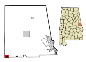
mapsize = 250px
map_caption = Location inAlabama
mapsize1 =
map_caption1 =
subdivision_type = Country
subdivision_type1 = State
subdivision_type2 = Counties
subdivision_name =United States
subdivision_name1 =Alabama
subdivision_name2 = Chambers, Lee
population_as_of = 2004
population_total = 180
timezone = CST
utc_offset = -6
timezone_DST = CDT
utc_offset_DST = -5
elevation_ft = 761
latd = 32 |latm = 44 |lats = 8 |latNS = N
longd = 85 |longm = 34 |longs = 27 |longEW = W
government_type =
leader_title =
leader_name =
established_date =
area_magnitude =
area_total_km2 = 7.1
area_land_km2 = 7.1
area_water_km2 = 0
area_total_sq_mi = 2.7
area_land_sq_mi = 2.7
area_water_sq_mi = 0
elevation_m = 232
postal_code_type =ZIP code
postal_code = 36879
area_code = 334
blank_name = FIPS code
blank_info = 01-80256
blank1_name = GNIS feature ID
blank1_info = 0153904
footnotes =Waverly is a town in Chambers and Lee Counties in the
U.S. state ofAlabama . It is located on the foothills of the Appalachian mountains and is part of theAuburn Metropolitan Area . As of 2004, the town population was 180.Currently, Waverly has an up and running post office. Three churches are also located in Waverly, and town functions are usually sponsored by them.
History
Waverly was settled in the 1830s as "Pea Ridge", but saw little growth until the 1870s. In 1871, the Central of Georgia railroad was extended from Opelika to Dadeville. As planned, the railroad was to take a route roughly one mile (1.6 km) north of the town. However, topographical problems forced the railroad engineer to "waver" the route to the south, passing through Pea Ridge. The townspeople, appreciative of this "waver" which gave their community a rail connection, renamed the town "Waverly". Some say it was named for the Waverly romance novels.
Geography
Waverly is located at 32°44'8.369" North, 85°34'27.736" West (32.735658, -85.574371)GR|1.
According to the
United States Census Bureau , the town has a total area of 2.7square mile s (7.1km² ), of which, 2.7 square miles (7.1 km²) of it is land and 0.37% is water.Demographics
As of the
census GR|2 of 2000, there were 184 people, 76 households, and 50 families residing in the town. Thepopulation density was 67.3 people per square mile (26.0/km²). There were 87 housing units at an average density of 31.8/sq mi (12.3/km²). The racial makeup of the town was 80.98% White and 19.02% Black or African American.There were 76 households out of which 28.9% had children under the age of 18 living with them, 52.6% were married couples living together, 11.8% had a female householder with no husband present, and 32.9% were non-families. 32.9% of all households were made up of individuals and 14.5% had someone living alone who was 65 years of age or older. The average household size was 2.42 and the average family size was 3.12.
In the town the population was spread out with 24.5% under the age of 18, 7.6% from 18 to 24, 31.5% from 25 to 44, 20.1% from 45 to 64, and 16.3% who were 65 years of age or older. The median age was 38 years. For every 100 females there were 102.2 males. For every 100 females age 18 and over, there were 95.8 males.
The median income for a household in the town was $32,917, and the median income for a family was $38,750. Males had a median income of $26,625 versus $16,071 for females. The
per capita income for the town was $18,406. About 3.7% of families and 7.6% of the population were below thepoverty line , including none of those under the age of eighteen or sixty five or over.Photo Gallery
References
*Nunn, Alexander (Ed.) (1983). "Lee County and Her Forebears". Montgomery, Ala., Herff Jones. LCCCN 83-081693External links
* [http://waverlyalabama.com Official Website]
Wikimedia Foundation. 2010.