- Marengo County, Alabama
-
Marengo County, Alabama 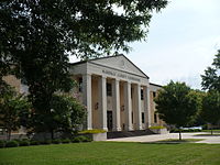 Marengo County Courthouse in Linden, Alabama
Location in the state of Alabama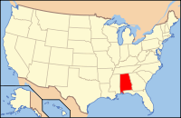
Alabama's location in the U.S.Founded February 6, 1818 Named for Battle of Marengo[1] Seat Linden Largest city Demopolis Area
- Total
- Land
- Water
982.85 sq mi (2,546 km²)
977.04 sq mi (2,531 km²)
5.80 sq mi (15 km²),Population
- (2010)
- Density
21,027
21/sq mi (8.3/km²)Time zone Central: UTC-6/-5 Marengo County is a county of the U.S. state of Alabama. It is named in honor of a battlefield near Turin, Italy, where the French defeated the Austrians on June 14, 1800. As of 2010 the population was 21,027. The largest city is Demopolis, the county seat is Linden.[1]
Contents
History
Marengo County was created by the Alabama Territorial legislature on February 6, 1818, from land acquired from the Choctaw Indians by the Treaty of Fort St. Stephens on October 24, 1816.[2] The name of the county commemorates Napoleon's victory at the Battle of Marengo over the Austrian armies on June 14, 1800.[1] This name was chosen as a compliment to the first Caucasian settlers, exiled French Bonapartists who in 1817 settled the area around Demopolis in an effort to establish a Vine and Olive Colony.[2][3] The county seat was originally known as the Town of Marengo, but in 1823 the name was changed to Linden.[1] Linden is a shortened version of Hohenlinden, scene of another Napoleonic victory in Bavaria in 1800.[1]
Situated in Alabama's Black Belt and having a naturally rich soil, the county became home to numerous cotton plantations and consequently a large number of slaves.[2] In 1860 the population consisted of 24,409 slaves, 6761 free whites including 944 slave owners, and just 1 "free person of color" for a total combined population of 31,171.[4] At this time there were 778 farms in the county.[4] Demopolis was home to the fourth oldest Jewish congregation in Alabama, B'nai Jeshurun. It was established in 1858.[5] After the American Civil War, the economy continued to be based on agriculture with the former plantations turning to sharecropping.[2]
The population began to diminish rapidly after World War II, with people leaving the farms for manufacturing jobs elsewhere.[2] The former cotton fields were gradually converted to pastures for cattle and horses, woodlands for timber, and commercial catfish ponds for grain fed catfish.[2] Beginning in the 1960s industry began to move into the area and the working force came to be employed by paper mills, lumber mills, and chemical plants.[2] Courthouse fires occurred in 1848 and 1965, the courthouse records were largely saved in both instances.[1]
Geography

 Dayton Town Hall (built 1858) in Dayton. On the Alabama Register of Landmarks and Heritage.
Geographic features
Marengo County is situated in the west-central area of the state.[1] According to the 2000 census, the county has a total area of 982.85 square miles (2,545.6 km2), of which 977.04 square miles (2,530.5 km2) (or 99.41%) is land and 5.80 square miles (15.0 km2) (or 0.59%) is water.[6] The entire western county border is formed by the Tombigbee River and a small northwestern portion is formed by the Black Warrior River.
Major highways
 U.S. Highway 43
 U.S. Highway 80
 State Route 10
 State Route 25
 State Route 28
 State Route 69
Adjacent counties
- Hale County (north)
- Perry County (northeast)
- Dallas County (east)
- Wilcox County (southeast)
- Clarke County (south)
- Choctaw County (southwest)
- Sumter County (northwest)
- Greene County (north-northwest)
Demographics
Marengo County, Alabama Year Pop. ±% 1820 2,933 — 1830 7,700 +162.5% 1840 17,264 +124.2% 1850 27,831 +61.2% 1860 31,171 +12.0% 1870 26,151 −16.1% 1880 30,890 +18.1% 1890 33,095 +7.1% 1900 38,315 +15.8% 1910 39,923 +4.2% 1920 36,065 −9.7% 1930 36,426 +1.0% 1940 35,736 −1.9% 1950 29,494 −17.5% 1960 27,098 −8.1% 1970 23,819 −12.1% 1980 25,047 +5.2% 1990 23,084 −7.8% 2000 22,539 −2.4% 2010 21,027 −6.7% Sources: "American FactFinder". United States Census Bureau. http://factfinder2.census.gov/faces/nav/jsf/pages/index.xhtml. through 1960 In 2000 there were 22,539 people, 8,767 households, and 6,277 families residing in the county.[7] The population density was 23 people per square mile (9/km2). There were 10,127 housing units at an average density of 10 per square mile (4/km2).[7] The racial makeup of the county was 51.71% Black or African American, 47.28% White, 0.08% Native American, 0.18% Asian, 0.01% Pacific Islander, 0.25% from other races, and 0.47% from two or more races. 0.97% of the population were Hispanic or Latino of any race.[7]
There were 8,767 households out of which 34.70% had children under the age of 18 living with them, 48.40% were married couples living together, 19.40% had a female householder with no husband present, and 28.40% were non-families.[7] 26.50% of all households were made up of individuals and 12.10% had someone living alone who was 65 years of age or older.[7] The average household size was 2.55 and the average family size was 3.08.[7]
In the county the population was spread out with 28.50% under the age of 18, 8.00% from 18 to 24, 26.00% from 25 to 44, 22.90% from 45 to 64, and 14.60% who were 65 years of age or older.[7] The median age was 36 years.[7] For every 100 females there were 88.30 males.[7] For every 100 females age 18 and over, there were 82.20 males.[7]
The median income for a household in the county was $27,025, and the median income for a family was $35,475.[7] Males had a median income of $36,053 versus $19,571 for females.[7] The per capita income for the county was $15,308.[7] About 22.20% of families and 25.90% of the population were below the poverty line, including 33.70% of those under age 18 and 25.30% of those age 65 or over.[7]
Culture
Events
- Candlelight Evening at Gaineswood, part of Christmas in the Canebrake, in Demopolis[8]
- Christmas on the River in Demopolis[8]
- Faunsdale Biker Rally in Faunsdale[9]
- Alabama Crawfish Festival in Faunsdale[10]
- Harvest Festival in Demopolis[8]
- Historic Demopolis Spring Pilgrimage in Demopolis[8]
- Rural Fun Day in Thomaston[11]
- Southern Literary Trail in Demopolis[8]
Places of interest
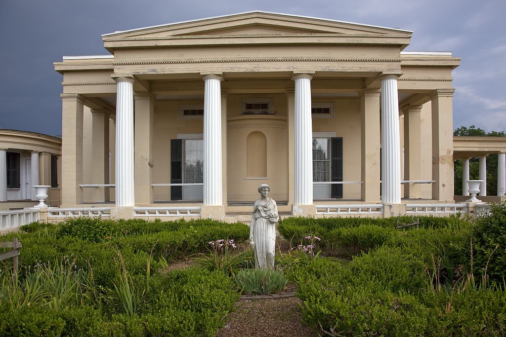
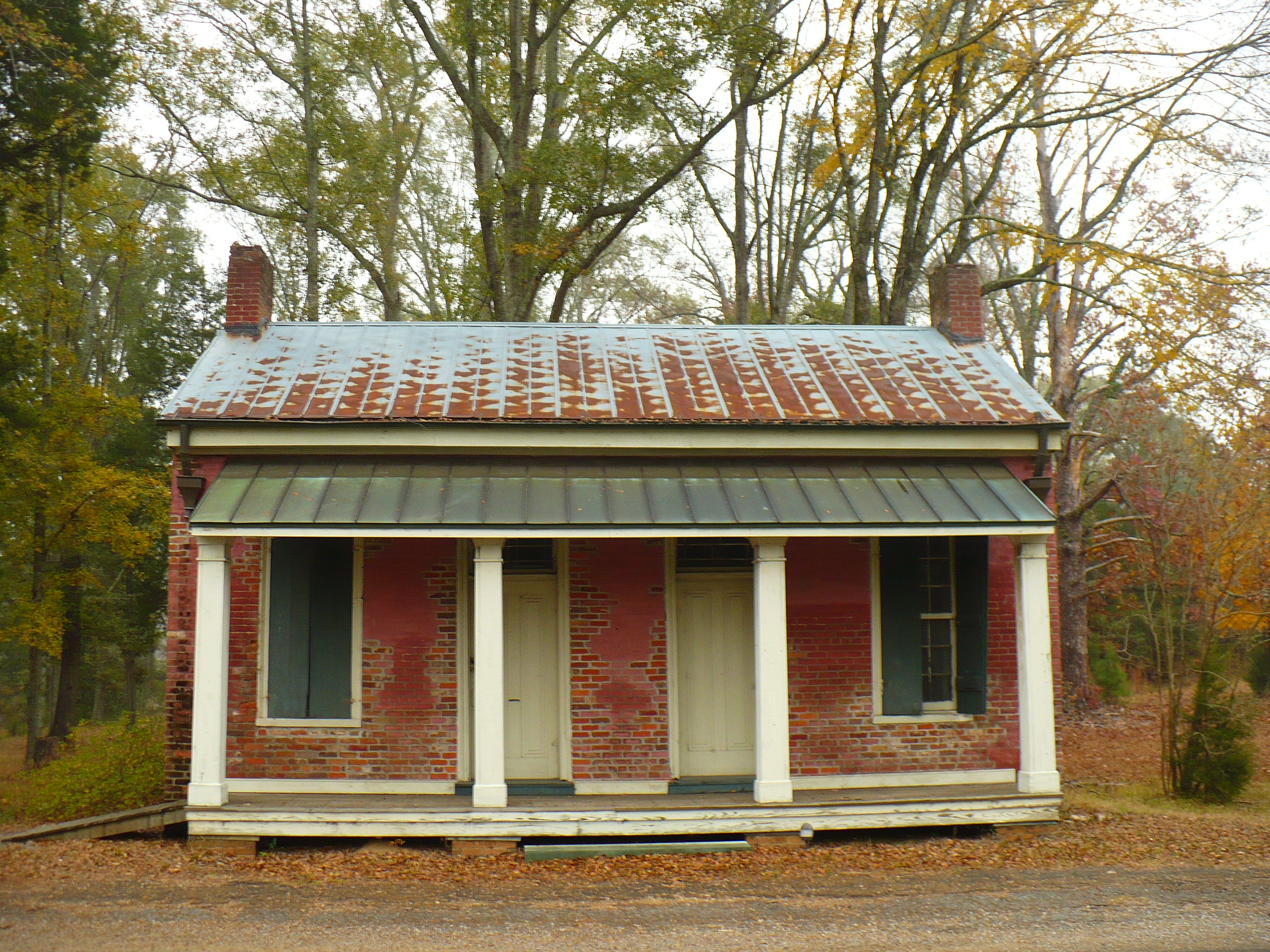
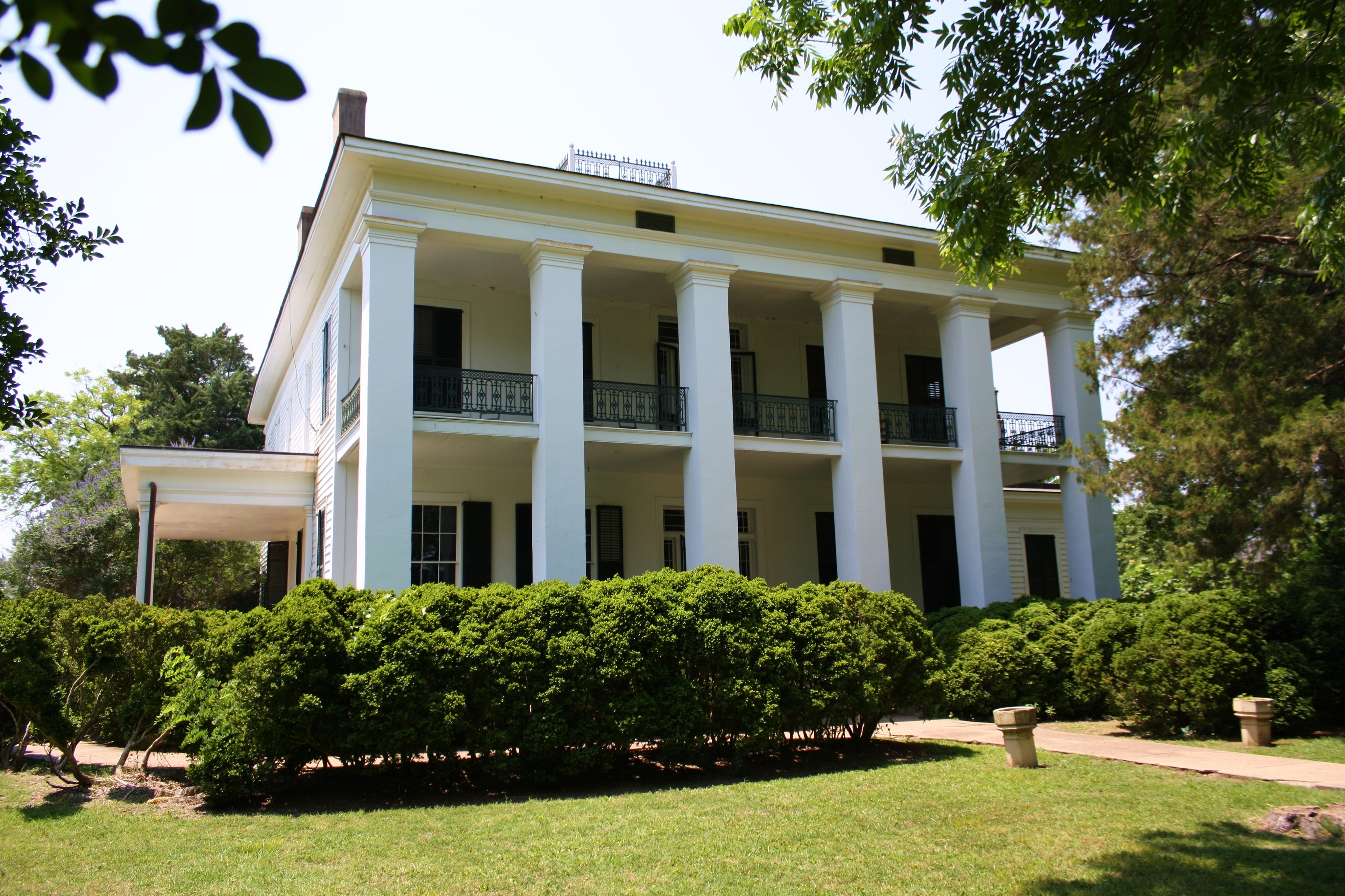
Marengo County is home to the Alabama Rural Heritage Center and Chickasaw State Park. The Tombigbee River and Black Warrior River form portions of the western and northern county borders and provide recreational opportunities. Marengo County has 28 sites listed on the National Register of Historic Places, one of which is also a National Historic Landmark.[12] Additionally, 19 sites are listed on the Alabama Register of Landmarks and Heritage.[13]
Settlements
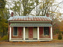
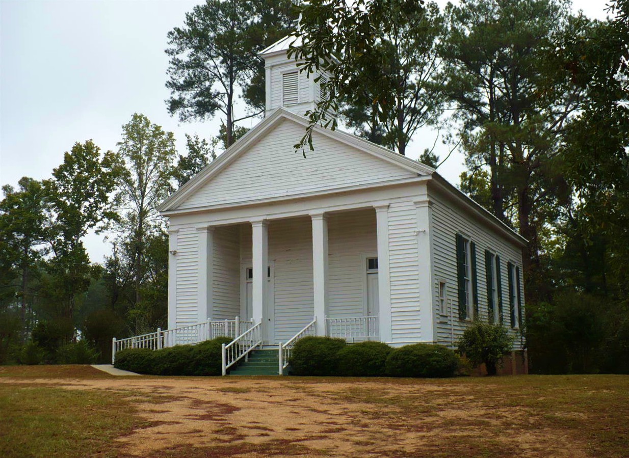
 Jefferson Methodist Church (built 1856) in Jefferson. On the National Register of Historic Places as part of the Jefferson Historic District.
 Lyon Hall (built 1853) in Demopolis. On the National Register of Historic Places.
Cities
Towns
Unincorporated communities
- Aimwell
- Alfalfa
- Clayhill
- Consul
- Coxheath
- Dixons Mills
- Exmoor
- Half Acre
- Half Chance
- Hampden
- Hoboken
- Hugo
- Jefferson
- Lasca
- McKinley
- Magnolia
- Marengo
- Moores Valley
- Moscow
- Nanafalia
- Nicholsville
- Octagon
- Old Spring Hill
- Pin Hook
- Putnam
- Rembert
- Salt Well
- Shiloh
- Siddonsville
- Surginer
- Vangale
- Vineland
- Wayne
Ghost town
- Aigleville
Education
The Marengo County School System operates four K–12 schools.[14] Demopolis and Linden have city-run school systems.[15] High schools run by the county include Amelia Love Johnson High School, John Essex High School, Marengo High School, and Sweet Water High School.[14]
See also
- National Register of Historic Places listings in Marengo County, Alabama
- Properties on the Alabama Register of Landmarks and Heritage in Marengo County, Alabama
References
- ^ a b c d e f g "Alabama Counties: Marengo County". "Alabama Department of Archives and History". http://www.archives.state.al.us/counties/marengo.html. Retrieved 2007-11-30.
- ^ a b c d e f g Marengo County Heritage Book Committee. The Heritage of Marengo County, Alabama, pages 1-4. Clanton, Alabama: Heritage Publishing Consultants, 2000. ISBN 189164758X
- ^ Smith, Winston. Days of Exile: The Story of the Vine and Olive Colony in Alabama, page 9. Tuscaloosa, Alabama: W. B. Drake and Son, 1967.
- ^ a b "Census Data for the Year 1860". "Inter-University Consortium for Political and Social Research". http://fisher.lib.virginia.edu/cgi-local/censusbin/census/cen.pl?year=860. Retrieved 2007-11-30.
- ^ "Alabama". Encyclopedia of Southern Jewish Communities. Goldring / Woldenberg Institute of Southern Jewish Life. http://www.isjl.org/history/archive/main_al.htm. Retrieved 5 October 2010.
- ^ "Census 2000 U.S. Gazetteer Files: Counties". United States Census. http://www.census.gov/tiger/tms/gazetteer/county2k.txt. Retrieved 2011-02-13.
- ^ a b c d e f g h i j k l m n "Fact Sheet: Marengo County 2000". "U.S. Census Bureau". http://factfinder.census.gov/servlet/SAFFFacts?_event=&geo_id=05000US01091&_geoContext=01000US%7C04000US01%7C05000US01091&_street=&_county=marengo&_cityTown=marengo&_state=04000US01&_zip=&_lang=en&_sse=on&ActiveGeoDiv=geoSelect&_useEV=&pctxt=fph&pgsl=050&_submenuId=factsheet_1&ds_name=null&_ci_nbr=null&qr_name=null®=null%3Anull&_keyword=&_industry=&show_2003_tab=&redirect=Y. Retrieved 2007-11-30.
- ^ a b c d e "Demopolis". Alabama Tourism Department - Official Web Site. http://www.800alabama.com/areas-to-visit/river-heritage/city.cfm?cityid=60. Retrieved 6 December 2008.
- ^ "Faunsdale Biker Rally - Alabama's wildest biker event". "Bama Rides". 2008-04-26. http://articles.bamarides.com/2008/04/faunsdale-biker-rally-alabama-wildest.html. Retrieved 2008-10-07.[dead link]
- ^ "Annual Faunsdale Crawfish Festival". Alabama Tourism Department - Official Web Site. http://www.800alabama.com/things-to-do/events/details.cfm?id=9513. Retrieved 6 December 2008.
- ^ "Rural Heritage Day & Pepper Jelly Festival, 2nd". Alabama Tourism Department - Official Web Site. http://www.800alabama.com/things-to-do/events/details.cfm?ID=7457. Retrieved 6 December 2008.
- ^ "National Register Information System". National Register of Historic Places. National Park Service. 2008-04-15. http://nrhp.focus.nps.gov/natreg/docs/All_Data.html.
- ^ "Properties on the Alabama Register of Landmarks & Heritage". Alabama Historical Commission. www.preserveala.org. May 31, 2011. Archived from the original on 6 June 2011. http://www.webcitation.org/5zFoCCAPl. Retrieved 6 June 2011.
- ^ a b "Schools". Marengo County Schools. School In Sites. http://www.marengo.k12.al.us/?PN=Schools2. Retrieved 2 October 2010.
- ^ "Marengo County". Encyclopedia of Alabama. Auburn University. http://encyclopediaofalabama.org/face/Article.jsp?id=h-1199. Retrieved 2 October 2010.

Greene County Greene County and Hale County Perry County 
Dallas County  Marengo County, Alabama

Choctaw County Clarke County Wilcox County Municipalities and communities of Marengo County, Alabama County seat: Linden Cities 
Towns Dayton | Faunsdale | Myrtlewood | Providence | Sweet Water | Thomaston
Unincorporated
communitiesAimwell | Alfalfa | Beaver Creek | Clay Hill | Consul | Coxheath | Dixons Mills | Exmoor | Half Acre | Half Chance | Hampden | Hoboken | Hugo | Jefferson | Lasca | McKinley | Magnolia | Marengo | Moores Valley | Moscow | Nanafalia | Nicholsville | Octagon | Old Spring Hill | Pin Hook | Putnam | Rembert | Salt Well | Shiloh | Siddonsville | Surginer | Vangale | Vineland | Wayne
Ghost town Aigleville
 State of Alabama
Montgomery (capital) Topics Index · History · Geography · People · Delegations · Government · Governors · Lieutenant Governors · Metropolitan Areas · Visitor Attractions · National Historic Landmarks
Regions Atlantic Coastal Plain · Birmingham District · Black Belt · Central Alabama · Cumberland Plateau · Greater Birmingham · Gulf Coastal Plain · Lower Alabama · Mobile Bay · North Alabama · Northeast Alabama · Northwest Alabama · Piedmont · Ridge and Valley · River Region · South Alabama · Tennessee Valley · Wiregrass Region
Metros Greater Birmingham · Montgomery Metro Area · Mobile Metro Area · Huntsville Metro Area
Larger cities Anniston · Auburn · Birmingham · Decatur · Dothan · Florence · Gadsden · Hoover · Huntsville · Madison · Mobile · Montgomery · Tuscaloosa
Counties Autauga · Baldwin · Barbour · Bibb · Blount · Bullock · Butler · Calhoun · Chambers · Cherokee · Chilton · Choctaw · Clarke · Clay · Cleburne · Coffee · Colbert · Conecuh · Coosa · Covington · Crenshaw · Cullman · Dale · Dallas · DeKalb · Elmore · Escambia · Etowah · Fayette · Franklin · Geneva · Greene · Hale · Henry · Houston · Jackson · Jefferson · Lamar · Lauderdale · Lawrence · Lee · Limestone · Lowndes · Macon · Madison · Marengo · Marion · Marshall · Mobile · Monroe · Montgomery · Morgan · Perry · Pickens · Pike · Randolph · Russell · Shelby · St. Clair · Sumter · Talladega · Tallapoosa · Tuscaloosa · Walker · Washington · Wilcox · Winston
Coordinates: 32°14′31″N 87°47′22″W / 32.24194°N 87.78944°W
Categories:- Alabama counties
- Marengo County, Alabama
- Counties of the United States with African American majority populations
- 1818 establishments in the United States
- Populated places established in 1818


Wikimedia Foundation. 2010.