- Thomaston, Alabama
Infobox Settlement
official_name = Thomaston, Alabama
settlement_type =Town
imagesize =
image_caption =
image_
imagesize =
image_caption =
image_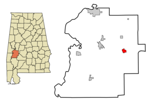
mapsize = 250px
map_caption = Location in Marengo County and the state ofAlabama
mapsize1 =
map_caption1 =
subdivision_type = Country
subdivision_type1 = State
subdivision_type2 = County
subdivision_name =United States
subdivision_name1 =Alabama
subdivision_name2 = Marengo
government_type =
leader_title =
leader_name =
established_date =
area_magnitude =
area_total_km2 = 5.2
area_total_sq_mi = 2
area_land_km2 = 5.2
area_land_sq_mi = 2
area_water_km2 = 0
area_water_sq_mi = 0
elevation_ft = 187
elevation_m = 57
population_as_of = 2000
population_footnotes =
population_total = 383
population_metro =
population_density_km2 = 73.7
population_density_sq_mi = 191.5
timezone = Central (CST)
utc_offset = -6
latd = 32 |latm = 16 |lats = 10 |latNS = N
longd = 87 |longm = 37 |longs = 30 |longEW = W
timezone_DST = CDT
utc_offset_DST = -5
postal_code_type =ZIP code
postal_code = 36783
area_code = 334
blank_name = FIPS code
blank_info = 01-75936
blank1_name = GNIS feature ID
blank1_info = 0127881
footnotes =
website =Thomaston is a town in Marengo County,
Alabama ,United States . At the 2000 census the population was 383. The area was first settled in the early 1800s by people fromVirginia and the Carolinas who migrated to the area in search of land. The community was named in 1892, and the town of Thomaston was incorporated in 1901. Thomaston has one historic district, theThomaston Central Historic District , which encompasses the core of the town. Additionally, there are three individually listed properties on theNational Register of Historic Places : theThomaston Colored Institute ,C. S. Golden House , andPatrick Farrish House .cite web|title="Alabama: Marengo County "|work="Nationalhistoricalregister.com"
url=http://www.nationalhistoricalregister.com/al/marengo/state.html|accessdate=2008-03-05] The town is home to theAlabama Rural Heritage Center , and the Thomaston Community Market, both community projects of Auburn University'sRural Studio .cite web|title="Alabama Rural Heritage Foundation"|work="Alabama Technology Network-Auburn University"|url=http://www.craftsofalabama.com/|accessdate=2008-02-25]Geography
Thomaston is located at coor dms|32|16|10|N|87|37|30|W|city (32.269495, -87.624865)GR|1. According to the
U.S. Census Bureau , the town has a total area of 2.0square mile s (5.2km² ), all of it land.Demographics
As of the
census of 2000, there were 383 people, 163 households, and 105 families residing in the town. Thepopulation density was 190.3 people per square mile (73.6/km²). There were 212 housing units at an average density of 105.3/sq mi (40.7/km²). The racial makeup of the town was 50.13% Black or African American, 48.56% White, and 1.31% from two or more races. 2.35% of the population were Hispanic or Latino of any race.There were 163 households out of which 27.0% had children under the age of 18 living with them, 39.9% were married couples living together, 23.3% had a female householder with no husband present, and 35.0% were non-families. 33.7% of all households were made up of individuals and 25.2% had someone living alone who was 65 years of age or older. The average household size was 2.35 and the average family size was 3.01.
In the town the population was spread out with 24.0% under the age of 18, 9.4% from 18 to 24, 24.0% from 25 to 44, 20.6% from 45 to 64, and 21.9% who were 65 years of age or older. The median age was 40 years. For every 100 females there were 79.0 males. For every 100 females age 18 and over, there were 69.2 males.
The median income for a household in the town was $25,972, and the median income for a family was $31,250. Males had a median income of $32,404 versus $21,750 for females. The
per capita income for the town was $13,390. About 22.1% of families and 29.2% of the population were below thepoverty line , including 43.2% of those under age 18 and 33.8% of those age 65 or over.Government
Police protection is provided by the Thomaston Police Department and fire and emergency medical services are provided by the Thomaston Volunteer Fire and Rescue Department.
References
External links
* [http://www.thomastonal.net/ Thomaston Volunteer Fire & Rescue Department]
* [http://www.craftsofalabama.com/ Alabama Rural Heritage Foundation]
Wikimedia Foundation. 2010.