- National Register of Historic Places listings in Marengo County, Alabama
-
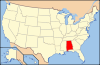
 Location of Marengo County in Alabama
This is a list of the National Register of Historic Places listings in Marengo County, Alabama.
This is intended to be a complete list of the properties and districts on the National Register of Historic Places in Marengo County, Alabama, United States. Latitude and longitude coordinates are provided for many National Register properties and districts; these locations may be seen together in a Google map.[1]
There are 28 properties and districts listed on the National Register in the county, including 1 National Historic Landmark.
-
- This National Park Service list is complete through NPS recent listings posted November 10, 2011.[2]
Current listings
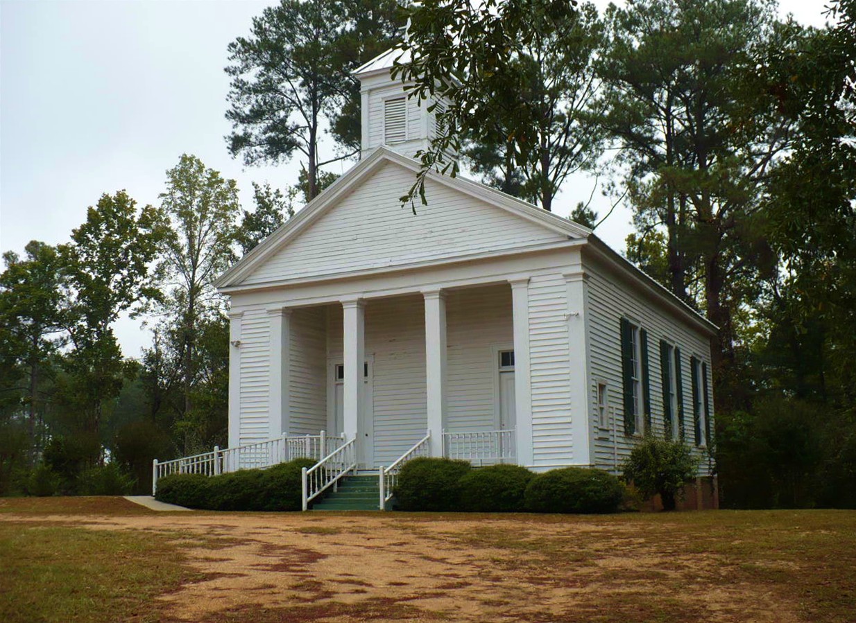
[3] Landmark name Image Date listed Location City or town Summary 1 Allen Grove 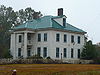
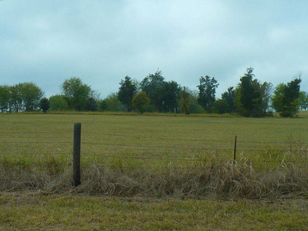
July 7, 1994 County Road 1, south of Old Spring Hill
32°25′44″N 87°46′30″W / 32.428889°N 87.775°WOld Spring Hill A historic district including a Greek Revival style main house (c. 1857), two other buildings and 50 acres (20 ha). 2 Altwood 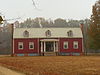
July 13, 1993 West of County Road 51, south of its junction with County Road 54
32°25′26″N 87°40′28″W / 32.423889°N 87.674444°WFaunsdale Plantation house with Tidewater Virginia influences, built in 1836. 3 Ashe Cottage 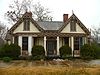
October 19, 1978 307 N. Commissioners Ave.
32°31′09″N 87°50′25″W / 32.519167°N 87.840278°WDemopolis Town house built in 1832 and remodeled in the Carpenter Gothic style in 1858. 4 Bluff Hall 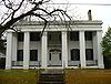
July 28, 1970 405 N. Commissioners Ave.
32°30′55″N 87°50′23″W / 32.515278°N 87.839722°WDemopolis Federal style mansion built in 1832 for Francis Strother Lyon and wife, Sarah Serena Glover, by her father, Allen Glover. Remodeled in the Greek Revival style in the 1840s. 5 Cedar Crest 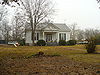
August 5, 1993 Eastern side of County Road 51, 0.5 miles (0.80 km) south of County Road 54
32°25′41″N 87°39′37″W / 32.428056°N 87.660278°WFaunsdale Greek Revival style plantation house built in 1850 for Kimbrough C. Dubose. 6 Cedar Grove Plantation 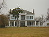
July 13, 1993 County Road 78 east of its junction with State Route 25
32°26′51″N 87°34′31″W / 32.4475°N 87.575278°WFaunsdale Large plantation house built in 1848 in the Greek Revival style. Known, in part, for its association with Nicola Marschall. 7 Cedar Haven 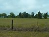
July 13, 1993 County Road 61 southeast of its junction with State Route 25
32°24′56″N 87°35′20″W / 32.415556°N 87.588889°WFaunsdale Greek Revival style plantation house built in 1850 and destroyed in the 21st century. The site remains listed on the register. 8 Confederate Park 
October 29, 1975 Bounded by Main, Capitol, Walnut, and Washington Sts.
32°31′04″N 87°50′17″W / 32.517778°N 87.838056°WDemopolis Town square of Demopolis, established in 1819. Covering one city block, it is one of the oldest public squares known in Alabama. 9 Cuba Plantation 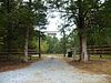
July 13, 1993 County Road 54 west of its junction with State Route 25
32°26′28″N 87°39′07″W / 32.441111°N 87.651944°WFaunsdale Plantation established by Andrew Pickens Calhoun, son of John C. Calhoun. Sold to Tristram Bethea in 1863, it has remained in the Bethea family to the present day. 10 Curtis House 
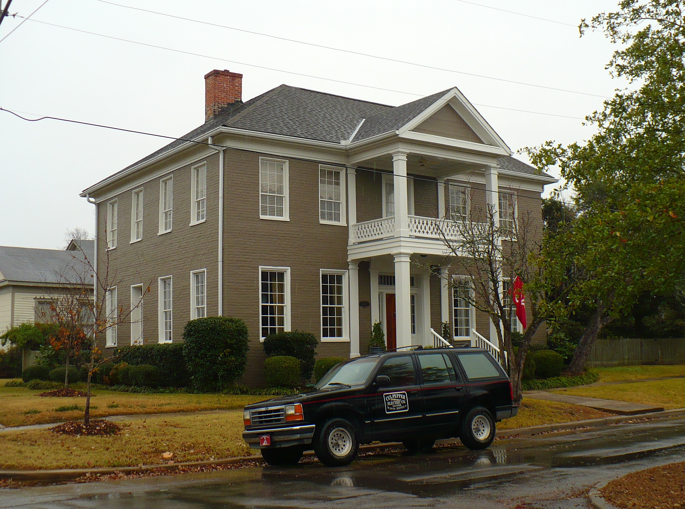
April 11, 1977 510 N. Main
32°31′17″N 87°50′18″W / 32.521389°N 87.838333°WDemopolis Federal style town house built in 1840 by Samuel Curtis, a Revolutionary War veteran. 11 Demopolis Historic Business District 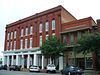
October 25, 1979 Roughly bounded by Capital and Franklin Sts. and Desnouettes and Cedar Aves.
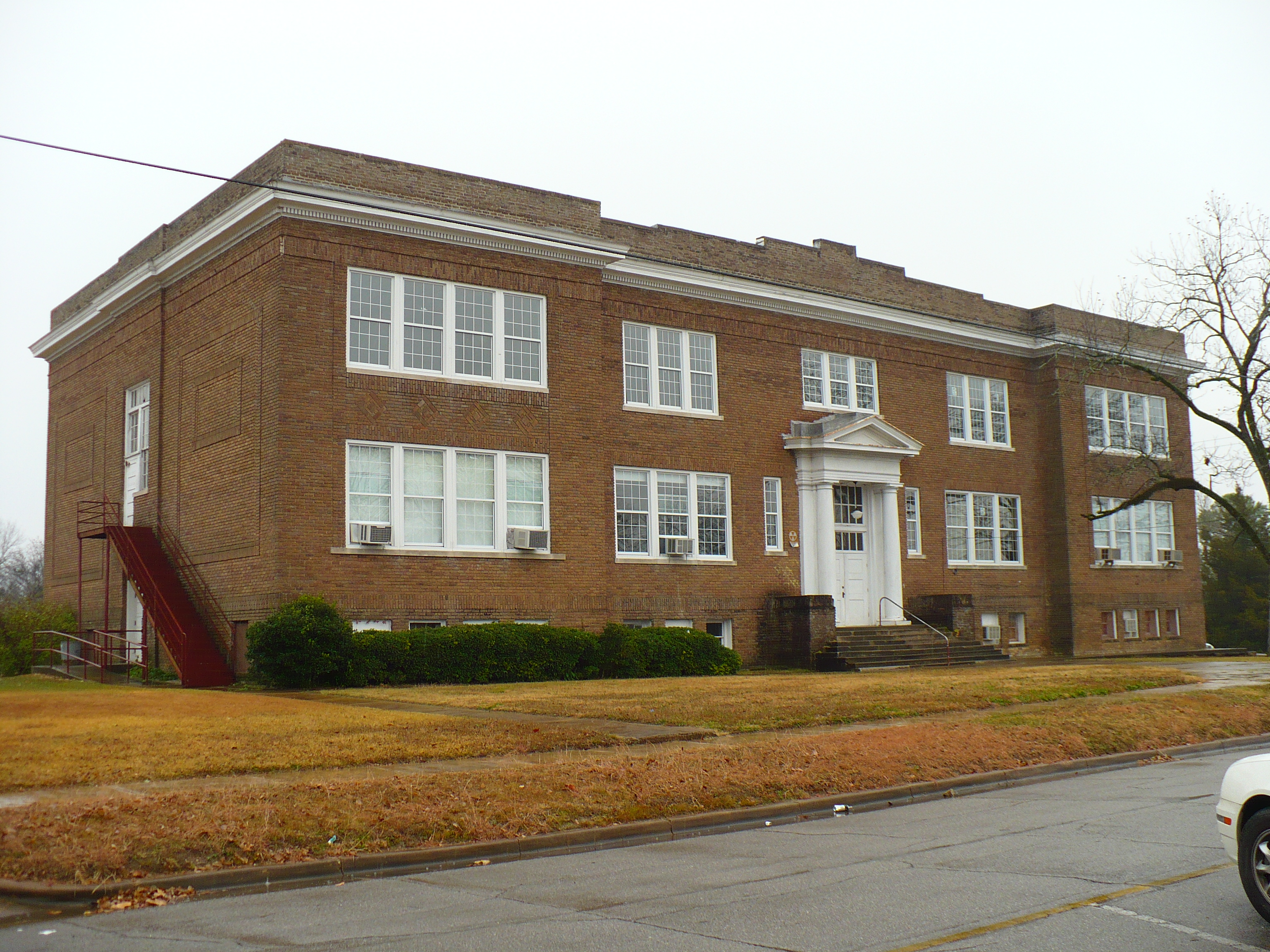
32°31′03″N 87°50′21″W / 32.5175°N 87.839167°WDemopolis Ten block historic district in downtown Demopolis with a variety of late 19th and early 20th century commercial buildings. 12 Demopolis Public School 
October 28, 1983 601 S. Main Ave.
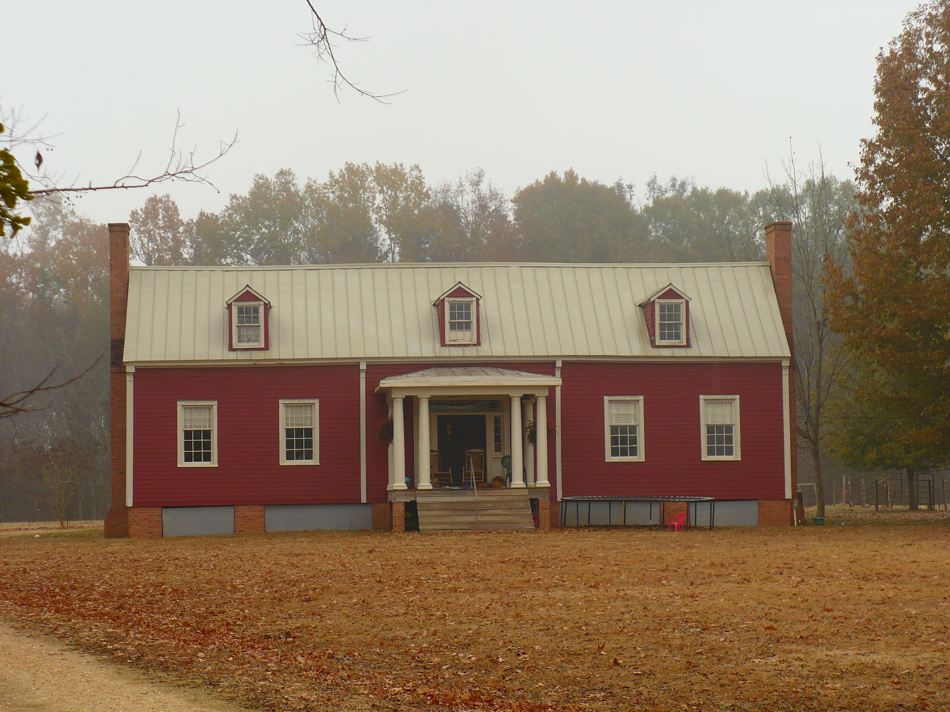
32°30′38″N 87°50′18″W / 32.510556°N 87.838333°WDemopolis Beaux-Arts style public school building, completed in 1914. 13 Patrick Farrish House 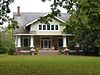
August 31, 2000 177 East St.
32°16′09″N 87°37′09″W / 32.269167°N 87.619167°WThomaston Craftsman style house built in 1926. 14 Faunsdale Plantation 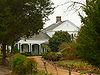
July 13, 1993 County Road 54 just west of its junction with State Route 25
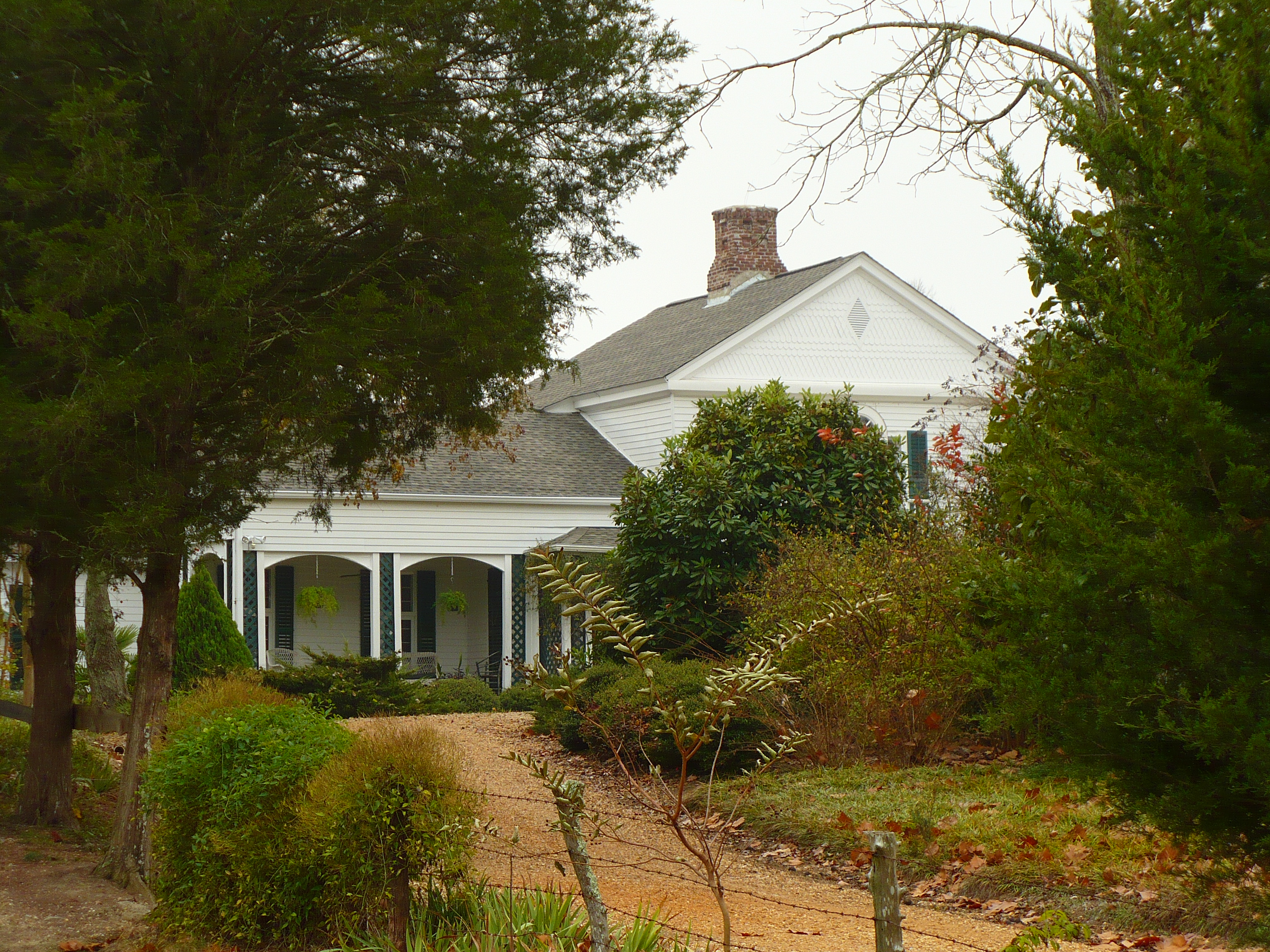
32°26′07″N 87°36′07″W / 32.435278°N 87.601944°WFaunsdale Historic district with a Greek Revival style main house, built in 1844, and several slave quarters built in the Carpenter Gothic style. 15 Foscue-Whitfield House 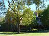
January 21, 1974 West of Demopolis on U.S. Route 80
32°29′06″N 87°52′01″W / 32.485°N 87.866944°WDemopolis Federal style brick house built in 1840 for Augustus Foscue. 16 Gaineswood 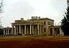
January 5, 1972 805 S. Cedar St.
32°30′20″N 87°50′04″W / 32.505556°N 87.834444°WDemopolis Built by Nathan Bryan Whitfield from 1843 to 1860, this plantation house is considered by architectural historians as one of the most elaborate and significant examples of Greek Revival architecture in Alabama. 17 Glover Mausoleum 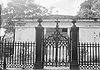
January 21, 1974 Riverside Cemetery
32°30′54″N 87°50′59″W / 32.515°N 87.849722°WDemopolis Elaborate Greek Revival style mausoleum, completed in 1845 by Mary Anne Glover for the burial of her husband, Allen Glover. 18 C. S. Golden House 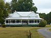
August 31, 2000 540 7th Ave.
32°16′25″N 87°37′27″W / 32.273611°N 87.624167°WThomaston Queen Anne style house built in 1898. 19 Half-Chance Bridge 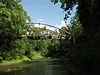
September 14, 1972 State Route 39 over the Chickasaw Bogue Creek
32°18′39″N 87°41′59″W / 32.310833°N 87.699722°WDayton Iron bridge built by the King Iron Bridge Manufacturing Company of Cleveland, Ohio in 1880. 20 Jefferson Historic District 
November 13, 1976 State Route 28
32°23′05″N 87°53′49″W / 32.384722°N 87.896944°WJefferson Collection of thirteen Greek Revival buildings in the village of Jefferson that reflect the pre-Civil War plantation economy of Alabama. 21 Lyon-Lamar House 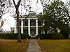
January 21, 1974 102 S. Main Ave.
32°30′56″N 87°50′21″W / 32.515556°N 87.839167°WDemopolis Greek Revival style mansion completed in 1853 by George Gaines Lyon and his wife, Anne Glover. 22 Old Courthouse 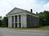
January 18, 1974 300 W. Cahaba Ave.
32°18′43″N 87°48′03″W / 32.311944°N 87.800833°WLinden The third courthouse for Marengo County, this Greek Revival style building was completed in 1850. 23 William Poole House 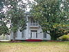
July 7, 1994 Junction of State Route 25 and Palmetto Rd.
32°20′58″N 87°38′41″W / 32.349444°N 87.644722°WDayton Greek Revival style plantation house built in 1848. 24 Roseland Plantation 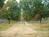
January 20, 1994 County Road 54, about 2 miles (3.2 km) southeast of Faunsdale.
32°26′40″N 87°34′03″W / 32.444444°N 87.5675°WFaunsdale The site of a historic plantation. The Greek Revival style main house was completed in 1850. It has been destroyed, but several outbuildings remain. 25 Thomaston Central Historic District 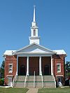
September 14, 2000 Roughly bounded by Chestnut St., 6th Ave., 7th Ave., Short St., and the CSX railroad line
32°16′04″N 87°37′31″W / 32.267778°N 87.625278°WThomaston Historic district covering much of the town of Thomaston. Its contains examples of early 20th century architecture. 26 Thomaston Colored Institute 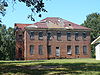
August 31, 2000 1120 7th Ave.
32°16′22″N 87°37′49″W / 32.272778°N 87.630278°WThomaston Completed in 1910 by West Alabama Primitive Baptist Association as a school for African Americans. 27 U.S. Post Office 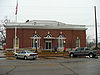
July 28, 1984 100 W. Capitol St.
32°31′06″N 87°50′16″W / 32.518333°N 87.837778°WDemopolis Neoclassical style post office built in 1914. 28 White Bluff 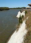
August 25, 1970 Arch St.
32°31′12″N 87°50′42″W / 32.52°N 87.845°WDemopolis Historic bluff above the Tombigbee River in Demopolis, first named Ecor Blanc by 18th century French explorers. See also
- Plantation Houses of the Alabama Canebrake and Their Associated Outbuildings Multiple Property Submission
- List of National Historic Landmarks in Alabama
- National Register of Historic Places listings in Alabama
References
- ^ The latitude and longitude information provided in this table was derived originally from the National Register Information System, which has been found to be fairly accurate for about 99% of listings. For about 1% of NRIS original coordinates, experience has shown that one or both coordinates are typos or otherwise extremely far off; some corrections may have been made. A more subtle problem causes many locations to be off by up to 150 yards, depending on location in the country: most NRIS coordinates were derived from tracing out latitude and longitudes off of USGS topographical quadrant maps created under the North American Datum of 1927, which differs from the current, highly accurate WGS84 GPS system used by Google maps. Chicago is about right, but NRIS longitudes in Washington are higher by about 4.5 seconds, and are lower by about 2.0 seconds in Maine. Latitudes differ by about 1.0 second in Florida. Some locations in this table may have been corrected to current GPS standards.
- ^ "National Register of Historic Places: Weekly List Actions". National Park Service, United States Department of the Interior. Retrieved on November 10, 2011.
- ^ Numbers represent an ordering by significant words. Various colorings, defined here, differentiate National Historic Landmark sites and National Register of Historic Places Districts from other NRHP buildings, structures, sites or objects.
U.S. National Register of Historic Places in Alabama Lists by county Autauga • Baldwin • Barbour • Bibb • Blount • Bullock • Butler • Calhoun • Chambers • Cherokee • Chilton • Choctaw • Clarke • Clay • Cleburne • Coffee • Colbert • Conecuh • Coosa • Covington • Crenshaw • Cullman • Dale • Dallas • DeKalb • Elmore • Escambia • Etowah • Fayette • Franklin • Geneva • Greene • Hale • Henry • Houston • Jackson • Jefferson • Lamar • Lauderdale • Lawrence • Lee • Limestone • Lowndes • Macon • Madison • Marengo • Marion • Marshall • Mobile • Monroe • Montgomery • Morgan • Perry • Pickens • Pike • Randolph • Russell • St. Clair • Shelby • Sumter • Talladega • Tallapoosa • Tuscaloosa • Walker • Washington • Wilcox • Winston
Lists by city Other lists National Register of Historic Places in Marengo County, Alabama National Historic Landmark 
Historic districts Other properties Altwood | Ashe Cottage | Bluff Hall | Cedar Crest | Cedar Haven | Confederate Park | Curtis House | Demopolis Public School | Patrick Farrish House | Foscue-Whitfield House | Glover Mausoleum | C. S. Golden House | Half-Chance Bridge | Lyon-Lamar House | Old Courthouse | Roseland Plantation | Thomaston Colored Institute | U.S. Post Office | White Bluff
See also: National Register of Historic Places listings in Marengo County, Alabama and List of National Historic Landmarks in AlabamaMunicipalities and communities of Marengo County, Alabama Cities 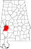
Towns Dayton | Faunsdale | Myrtlewood | Providence | Sweet Water | Thomaston
Unincorporated
communitiesAimwell | Alfalfa | Beaver Creek | Clay Hill | Consul | Coxheath | Dixons Mills | Exmoor | Half Acre | Half Chance | Hampden | Hoboken | Hugo | Jefferson | Lasca | McKinley | Magnolia | Marengo | Moores Valley | Moscow | Nanafalia | Nicholsville | Octagon | Old Spring Hill | Pin Hook | Putnam | Rembert | Salt Well | Shiloh | Siddonsville | Surginer | Vangale | Vineland | Wayne
Ghost town Aigleville
Categories:- National Register of Historic Places in Marengo County, Alabama
-


Wikimedia Foundation. 2010.