- National Register of Historic Places listings in Limestone County, Alabama
-
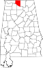
 Location of Limestone County in Alabama
This is a list of the National Register of Historic Places listings in Limestone County, Alabama.
This is intended to be a complete list of the properties and districts on the National Register of Historic Places in Limestone County, Alabama, United States. Latitude and longitude coordinates are provided for many National Register properties and districts; these locations may be seen together in a Google map.[1]
There are 13 properties and districts listed on the National Register in the county.
-
- This National Park Service list is complete through NPS recent listings posted November 10, 2011.[2]
Current listings
[3] Landmark name Image Date listed Location City or town Summary 1 Athens Courthouse Square Commercial Historic District 
October 10, 1997 Roughly bounded by Clinton, Hobbs, Madison, and Green Sts.
34°48′10″N 86°58′16″W / 34.802778°N 86.971111°WAthens 2 Athens State College Historic District 
February 14, 1985 202-212 and 311 N. Beaty St., central Athens State University campus area roughly bounded by Beaty, Pryor, and Hobbs Sts.
34°48′20″N 86°58′00″W / 34.805556°N 86.966667°WAthens 3 Belle Mina 
October 31, 1972 South of Belle Mina on the Mooresville-Elkton Rd.
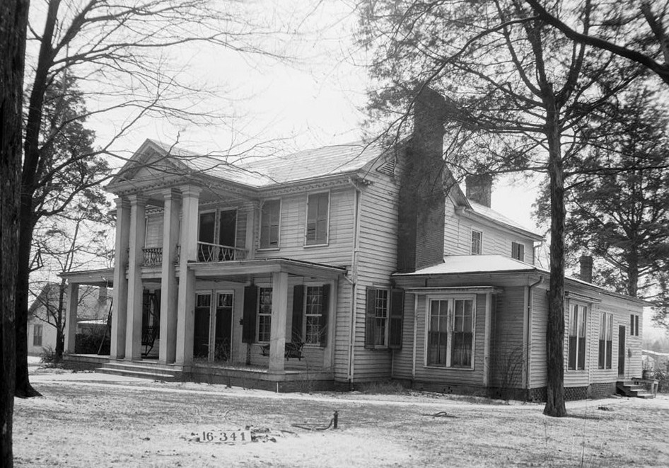
34°38′41″N 86°52′49″W / 34.644722°N 86.880278°WBelle Mina 4 Blackburn House September 20, 1984 West of Athens
34°47′32″N 87°03′16″W / 34.792222°N 87.054444°WAthens 5 Robert Donnell House 
September 19, 1973 601 S. Clinton St.
34°47′46″N 86°58′05″W / 34.796111°N 86.968056°WAthens 6 Joel Eddins House September 12, 1996 U.S. Route 72, approximately 0.5 miels northwest of the junction of State Route 53 and Elkwood Section Rd. Ardmore Now located at Burritt Museum in Huntsville[4] 7 George S. Houston Historic District July 20, 1989 Roughly 2nd Ave., Jefferson St., McClellan St., Marion St., Hobbs St., Madison St., Washington St., and Houston St.
34°48′23″N 86°58′22″W / 34.806389°N 86.972778°WAthens 8 Governor George Smith Houston House 
May 15, 1986 101 N. Houston St.
34°48′22″N 86°58′41″W / 34.806111°N 86.978056°WAthens 9 Mooresville 
April 13, 1972 Off U.S. Route 72 (State Route 20)
34°37′26″N 86°52′39″W / 34.623889°N 86.8775°WMooresville 10 Old Athens, Alabama Main Post Office February 18, 1982 310 W. Washington St.
34°48′09″N 86°58′22″W / 34.8025°N 86.972778°WAthens 11 Robert Beaty Historic District 
August 30, 1984 Roughly bounded by the former Louisville and Nashville railroad line and Forrest, East, and Washington Sts.
34°48′01″N 86°58′01″W / 34.800278°N 86.966944°WAthens 12 Sulphur Trestle Fort Site May 8, 1973 1 mile south of Elkmont
34°54′40″N 86°58′13″W / 34.911111°N 86.970278°WElkmont 13 Woodside February 19, 1982 Southwest of Belle Mina
34°39′06″N 86°52′24″W / 34.651667°N 86.873333°WBelle Mina See also
- List of National Historic Landmarks in Alabama
- National Register of Historic Places listings in Alabama
References
- ^ The latitude and longitude information provided in this table was derived originally from the National Register Information System, which has been found to be fairly accurate for about 99% of listings. For about 1% of NRIS original coordinates, experience has shown that one or both coordinates are typos or otherwise extremely far off; some corrections may have been made. A more subtle problem causes many locations to be off by up to 150 yards, depending on location in the country: most NRIS coordinates were derived from tracing out latitude and longitudes off of USGS topographical quadrant maps created under the North American Datum of 1927, which differs from the current, highly accurate WGS84 GPS system used by Google maps. Chicago is about right, but NRIS longitudes in Washington are higher by about 4.5 seconds, and are lower by about 2.0 seconds in Maine. Latitudes differ by about 1.0 second in Florida. Some locations in this table may have been corrected to current GPS standards.
- ^ "National Register of Historic Places: Weekly List Actions". National Park Service, United States Department of the Interior. Retrieved on November 10, 2011.
- ^ Numbers represent an ordering by significant words. Various colorings, defined here, differentiate National Historic Landmark sites and National Register of Historic Places Districts from other NRHP buildings, structures, sites or objects.
- ^ "The Joel Eddins House". http://www.burrittonthemountain.com/index.php?option=com_content&view=article&id=33&Itemid=126. Retrieved 10 May 2011.
U.S. National Register of Historic Places in Alabama Lists by county Autauga • Baldwin • Barbour • Bibb • Blount • Bullock • Butler • Calhoun • Chambers • Cherokee • Chilton • Choctaw • Clarke • Clay • Cleburne • Coffee • Colbert • Conecuh • Coosa • Covington • Crenshaw • Cullman • Dale • Dallas • DeKalb • Elmore • Escambia • Etowah • Fayette • Franklin • Geneva • Greene • Hale • Henry • Houston • Jackson • Jefferson • Lamar • Lauderdale • Lawrence • Lee • Limestone • Lowndes • Macon • Madison • Marengo • Marion • Marshall • Mobile • Monroe • Montgomery • Morgan • Perry • Pickens • Pike • Randolph • Russell • St. Clair • Shelby • Sumter • Talladega • Tallapoosa • Tuscaloosa • Walker • Washington • Wilcox • Winston
Lists by city Other lists Municipalities and communities of Limestone County, Alabama Cities Athens | Decatur‡ | Huntsville‡ | Madison‡
Towns Ardmore | Elkmont | Lester | Mooresville
Unincorporated
communitiesBelle Mina | Capshaw | Greenbrier | Oakland (near Athens) | Oakland (near Madison) | Tanner
Footnotes ‡This populated place also has portions in an adjacent county or counties
Categories:- National Register of Historic Places in Limestone County, Alabama
-


Wikimedia Foundation. 2010.