- National Register of Historic Places listings in Dallas County, Alabama
-
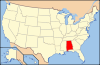
 Location of Dallas County in Alabama
This is a list of the National Register of Historic Places listings in Dallas County, Alabama.
This is intended to be a complete list of the properties and districts on the National Register of Historic Places in Dallas County, Alabama, United States. Latitude and longitude coordinates are provided for many National Register properties and districts; these locations may be seen together in a Google map.[1]
There are 29 properties and districts listed on the National Register in the county, including 1 National Historic Landmark.
-
- This National Park Service list is complete through NPS recent listings posted November 10, 2011.[2]
Current listings
[3] Landmark name Image Date listed Location City or town Summary 1 Adams Grove Presbyterian Church 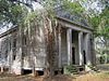
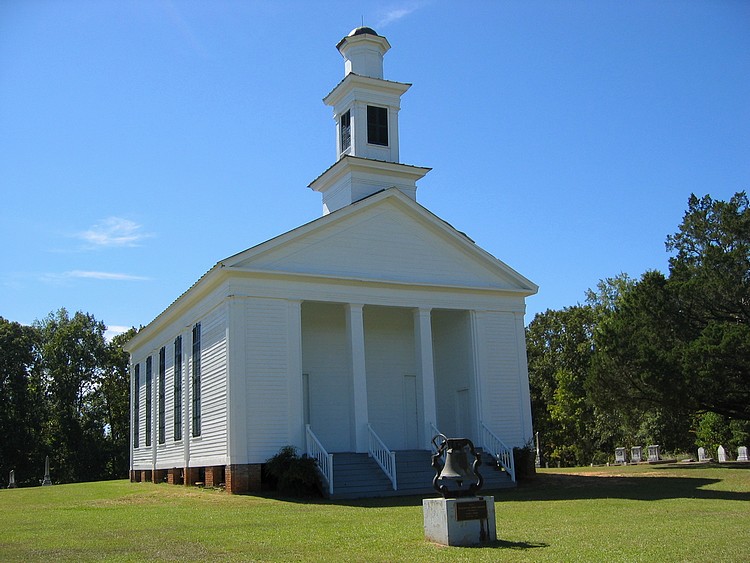
June 5, 1986 Southern side of Cahaba-Greenville Rd.
32°16′20″N 87°01′51″W / 32.272222°N 87.030833°WSardis Wooden-framed Presbyterian church, built in the Greek Revival style in 1853. 2 Antique Store January 29, 1987 Off State Route 22
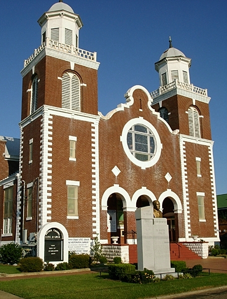
32°39′31″N 86°55′22″W / 32.658611°N 86.922778°WPlantersville 3 Brown Chapel African Methodist Episcopal Church 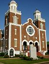
February 4, 1982 410 Martin Luther King, Jr. St.
32°24′45″N 87°00′58″W / 32.4125°N 87.016111°WSelma Brick African Methodist Episcopal church, built in 1908. Known for its association with the Civil Rights Movement and Selma to Montgomery marches. 4 Cahaba 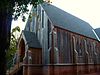
May 8, 1973 11 miles (17.6 km) southwest of Selma at the junction of the Cahaba and Alabama Rivers Cahaba First permanent state capital of Alabama (1820-1825); today a ghost town. 5 Carlowville Historic District 
January 18, 1978 17 miles (27 km.) south of Selma on State Route 89 Carlowville 6 Christian Church and Parsonage January 29, 1987 Off State Route 22
32°39′24″N 86°55′29″W / 32.656667°N 86.924722°WPlantersville 7 Dallas County Courthouse 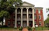
June 20, 1975 109 Union St.
32°24′18″N 87°01′33″W / 32.405°N 87.025833°WSelma Three-story brick building in the Greek Revival style, built as the Central Masonic Institute in 1847. It later served as the county courthouse and as a hospital. 8 Doctor's Office January 29, 1987 Junction of 1st Ave. north of Oak St. and 1st Ave.
32°41′03″N 86°55′24″W / 32.684167°N 86.923333°WPlantersville 9 Driskell-Martin House January 29, 1987 Northwestern corner of the junction of Cherry St. and 1st Ave.
32°39′36″N 86°55′26″W / 32.66°N 86.923889°WPlantersville 10 First Baptist Church September 20, 1979 709 Martin Luther King, Jr. St.
32°24′51″N 87°01′04″W / 32.414167°N 87.017778°WSelma Historically African American Baptist church, built in the Gothic Revival style in 1894. Known for its association with the Civil Rights Movement. 11 J. Bruce Hain House November 30, 2001 5826 State Route 41
32°17′17″N 86°59′14″W / 32.288056°N 86.987222°WSardis 12 Icehouse Historic District June 28, 1990 Roughly bounded by Jefferson Davis and Dallas Aves., Union and Lapsley Sts., and Valley Creek Selma 13 Marshall's Grove February 4, 1982 State Route 22
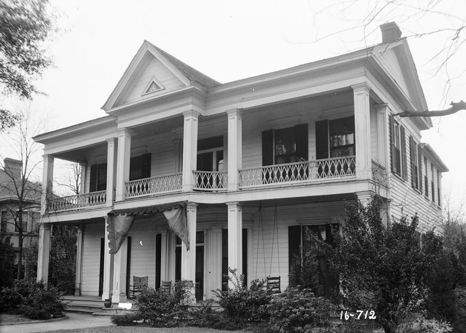
32°27′58″N 87°00′23″W / 32.466111°N 87.006389°WSelma 14 John Tyler Morgan House 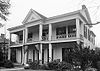
September 27, 1972 719 Tremont St.
32°24′49″N 87°01′39″W / 32.413611°N 87.0275°WSelma 15 Old Town Historic District 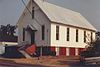
May 3, 1978 Roughly bounded by the Alabama River, Jefferson Davis Ave., Pettus, Broad, and Franklin Sts.; also Jefferson Davis Ave.; an area roughly bounded by Broad, Dallas, U.S. Route 80, and Franklin; Selma Ave.; and Franklin St. Selma Boundaries after the "also" represent a boundary increase of December 15, 2003 16 Wesley Plattenburg House 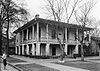
February 3, 1993 601 Washington St.
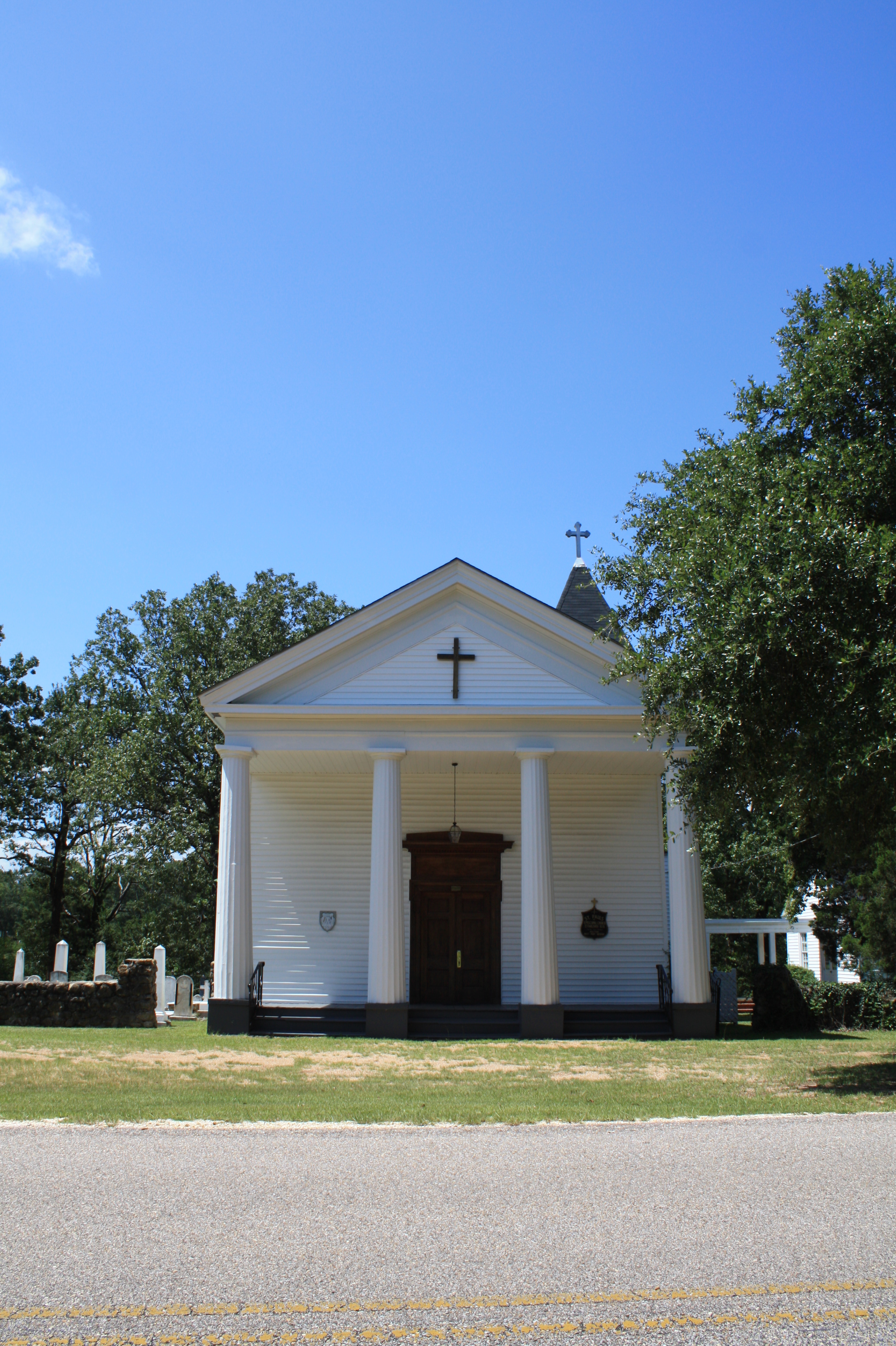
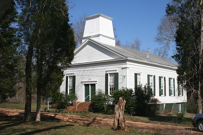
32°24′50″N 87°01′20″W / 32.413889°N 87.022222°WSelma 17 Pleasant Hill Presbyterian Church 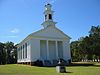
April 22, 1999 0.2 miles east of the junction of County Roads 7 and 12
32°09′53″N 86°54′30″W / 32.164722°N 86.908333°WPleasant Hill Wooden-framed Presbyterian church, built in the Greek Revival style in 1851. 18 Riverdale September 10, 1979 Northeast of Selma on River Rd.
32°26′02″N 86°52′11″W / 32.433889°N 86.869722°WSelma 19 Riverview Historic District June 28, 1990 Roughly bounded by Selma Ave., Satterfield and Lapsley Sts., and the Alabama River Selma 20 St. Luke's Episcopal Church 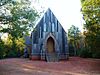
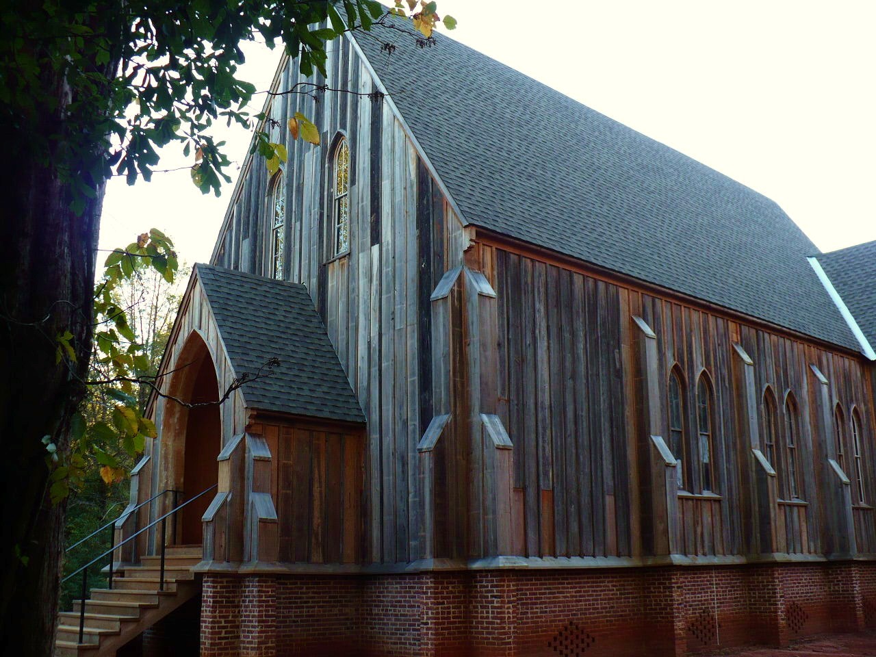
March 25, 1982 Beech St. (Cahaba Rd.) near intersection with Capitol Ave.
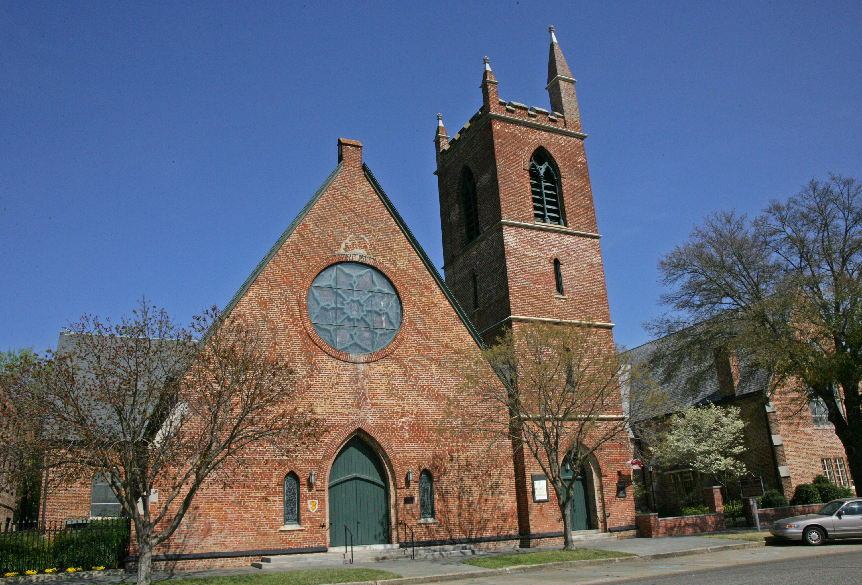
32°19′09″N 87°06′19″W / 32.319167°N 87.105278°WCahaba Wooden-framed Episcopal church, built in the Carpenter Gothic style in 1854. 21 St. Paul's Episcopal Church 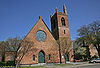
March 25, 1975 210 Lauderdale St.
32°24′31″N 87°01′18″W / 32.408611°N 87.021667°WSelma Brick Episcopal church, built in the Gothic Revival style in 1875. 22 Marcus Meyer Skinner House August 27, 1987 2612 Summerfield Rd.
32°26′15″N 87°02′01″W / 32.437431°N 87.033540°WSelma 23 Street Manual Training School July 28, 1999 263 County Road 38
32°06′49″N 87°03′34″W / 32.113657°N 87.059557°WRichmond and Minter 24 Sturdivant Hall 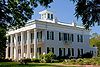
January 18, 1973 713 Mabry St.
32°24′47″N 87°01′44″W / 32.413056°N 87.028889°WSelma Greek Revival style mansion designed by Thomas Helm Lee and completed in 1856. 25 Summerfield District 
March 1, 1982 Selma-Summerfield and Marion Rds., Centenary and College Sts. Summerfield 26 Todd House January 29, 1987 Southern side of Oak St. west of 1st Ave.
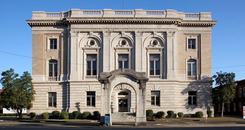
32°39′21″N 86°55′52″W / 32.655833°N 86.931111°WPlantersville 27 U.S. Post Office Building 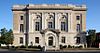
March 26, 1976 908 Alabama Ave.
32°24′27″N 87°01′15″W / 32.4075°N 87.020833°WSelma Beaux-Arts style Federal Government building designed by James Knox Taylor and completed in 1909. 28 Valley Creek Presbyterian Church 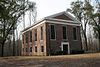
May 28, 1976 North of Selma on Valley Creek Rd.
32°28′14″N 87°01′28″W / 32.470556°N 87.024444°WValley Grande Brick Presbyterian church, built in the Greek Revival style in 1857. 29 Water Avenue Historic District 
December 26, 1972 Water Ave.; also Water Ave. bounded by Lauderdale, MLK Boulevard, Beech Creek, and the Alabama River Selma Second set of boundaries represents a boundary increase of July 7, 2005 See also
- List of National Historic Landmarks in Alabama
- National Register of Historic Places listings in Alabama
References
- ^ The latitude and longitude information provided in this table was derived originally from the National Register Information System, which has been found to be fairly accurate for about 99% of listings. For about 1% of NRIS original coordinates, experience has shown that one or both coordinates are typos or otherwise extremely far off; some corrections may have been made. A more subtle problem causes many locations to be off by up to 150 yards, depending on location in the country: most NRIS coordinates were derived from tracing out latitude and longitudes off of USGS topographical quadrant maps created under the North American Datum of 1927, which differs from the current, highly accurate WGS84 GPS system used by Google maps. Chicago is about right, but NRIS longitudes in Washington are higher by about 4.5 seconds, and are lower by about 2.0 seconds in Maine. Latitudes differ by about 1.0 second in Florida. Some locations in this table may have been corrected to current GPS standards.
- ^ "National Register of Historic Places: Weekly List Actions". National Park Service, United States Department of the Interior. Retrieved on November 10, 2011.
- ^ Numbers represent an ordering by significant words. Various colorings, defined here, differentiate National Historic Landmark sites and National Register of Historic Places Districts from other NRHP buildings, structures, sites or objects.
U.S. National Register of Historic Places in Alabama Lists by county Autauga • Baldwin • Barbour • Bibb • Blount • Bullock • Butler • Calhoun • Chambers • Cherokee • Chilton • Choctaw • Clarke • Clay • Cleburne • Coffee • Colbert • Conecuh • Coosa • Covington • Crenshaw • Cullman • Dale • Dallas • DeKalb • Elmore • Escambia • Etowah • Fayette • Franklin • Geneva • Greene • Hale • Henry • Houston • Jackson • Jefferson • Lamar • Lauderdale • Lawrence • Lee • Limestone • Lowndes • Macon • Madison • Marengo • Marion • Marshall • Mobile • Monroe • Montgomery • Morgan • Perry • Pickens • Pike • Randolph • Russell • St. Clair • Shelby • Sumter • Talladega • Tallapoosa • Tuscaloosa • Walker • Washington • Wilcox • Winston
Lists by city Other lists National Register of Historic Places in Dallas County, Alabama National Historic Landmark 
Historic districts Carlowville Historic District | Icehouse Historic District | Old Town Historic District | Riverview Historic District | Summerfield District | Water Avenue Historic District
Other properties Adams Grove Presbyterian Church | Antique Store | Cahaba | Christian Church and Parsonage | Dallas County Courthouse | Doctor's Office | Driskell-Martin House | First Baptist Church | J. Bruce Hain House | Marshall's Grove | John Tyler Morgan House | Wesley Plattenburg House | Pleasant Hill Presbyterian Church | Riverdale | St. Luke's Episcopal Church | St. Paul's Episcopal Church | Marcus Meyer Skinner House | Street Manual Training School | Sturdivant Hall | Todd House | U.S. Post Office Building | Valley Creek Presbyterian Church
See also: National Register of Historic Places listings in Dallas County, Alabama and List of National Historic Landmarks in AlabamaMunicipalities and communities of Dallas County, Alabama Cities 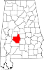
Town CDP Unincorporated
communitiesBeloit | Bogue Chitto | Browns | Carlowville | Crumptonia | Elm Bluff | Marion Junction | Minter | Plantersville | Pleasant Hill | Richmond | Safford | Sardis | Summerfield | Tyler
Ghost town Categories:- National Register of Historic Places in Dallas County, Alabama
-


Wikimedia Foundation. 2010.