- National Register of Historic Places listings in Madison County, Alabama
-
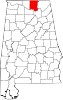
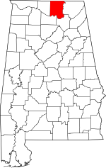 Location of Madison County in Alabama
This is a list of the National Register of Historic Places listings in Madison County, Alabama.
This is intended to be a complete list of the properties and districts on the National Register of Historic Places in Madison County, Alabama, United States. Latitude and longitude coordinates are provided for many National Register properties and districts; these locations may be seen together in a Google map.[1]
There are 81 properties and districts listed on the National Register in the county, including 6 National Historic Landmarks. 70 of these sites, including all of the National Historic Landmarks, are located in Huntsville, and are listed separately; the remaining 11 sites are listed here.
-
- This National Park Service list is complete through NPS recent listings posted November 10, 2011.[2]
Current listings
Huntsville
Outside of Huntsville
[3] Landmark name Image Date listed Location City or town Summary 1 James H. Bibb House 
April 12, 1984 11 Allen St.
34°41′33″N 86°45′13″W / 34.6925°N 86.753611°WMadison 2 Butlers' Store August 31, 1992 5498 Main Dr.
34°32′13″N 86°24′20″W / 34.536944°N 86.405556°WNew Hope 3 Gurley Historic District June 2, 2004 Section Line St., Railroad St., Maple Boulevard and Church St. between Gurley Pike and Jackson St.
34°42′00″N 86°22′25″W / 34.7°N 86.373611°WGurley 4 Madison Station Historic District 
March 29, 2006 Roughly bounded by the Wall Triana Highway, Mill Rd., Church St., Maple St., Martin St., and Bradley St.
34°41′46″N 86°44′51″W / 34.696111°N 86.7475°WMadison 5 McCartney-Bone House 
December 16, 1977 3 miles northeast of Maysville on Hurricane Rd.
34°47′39″N 86°24′32″W / 34.794167°N 86.408889°WMaysville 6 New Market Historic District March 31, 2004 Roughly bounded by Mountain Fork, College St., Davis St., Winchester Rd. to Cochran St., and parts of Cochran St. and Cedar St.
34°54′30″N 86°25′43″W / 34.908333°N 86.428611°WNew Market 7 New Market Presbyterian Church August 25, 1988 1723 New Market Rd.
34°54′37″N 86°25′46″W / 34.910278°N 86.429444°WNew Market 8 New Market United Methodist Church June 14, 1990 310 Hurricane Rd.
34°54′26″N 86°25′36″W / 34.907222°N 86.426667°WNew Market 9 William Madison Otey House 
January 19, 1982 South of Meridianville
34°50′10″N 86°34′13″W / 34.836111°N 86.570278°WMeridianville 10 Warden's Residence May 17, 2010 151 Stone St.
34°35′11″N 86°44′00″W / 34.586522°N 86.733361°WTriana vicinity 11 Whitman-Cobb House January 18, 1982 Winchester Rd.
34°54′13″N 86°25′43″W / 34.903611°N 86.428611°WNew Market See also
- List of National Historic Landmarks in Alabama
- National Register of Historic Places listings in Alabama
References
- ^ The latitude and longitude information provided in this table was derived originally from the National Register Information System, which has been found to be fairly accurate for about 99% of listings. For about 1% of NRIS original coordinates, experience has shown that one or both coordinates are typos or otherwise extremely far off; some corrections may have been made. A more subtle problem causes many locations to be off by up to 150 yards, depending on location in the country: most NRIS coordinates were derived from tracing out latitude and longitudes off of USGS topographical quadrant maps created under North American Datum of 1927, which differs from the current, highly accurate GPS system used by Google maps. Chicago is about right, but NRIS longitudes in Washington are higher by about 4.5 seconds, and are lower by about 2.0 seconds in Maine. Latitudes differ by about 1.0 second in Florida. Some locations in this table may have been corrected to current GPS standards.
- ^ "National Register of Historic Places: Weekly List Actions". National Park Service, United States Department of the Interior. Retrieved on November 10, 2011.
- ^ Numbers represent an ordering by significant words. Various colorings, defined here, differentiate National Historic Landmark sites and National Register of Historic Places Districts from other NRHP buildings, structures, sites or objects.
U.S. National Register of Historic Places in Alabama Lists by county Autauga • Baldwin • Barbour • Bibb • Blount • Bullock • Butler • Calhoun • Chambers • Cherokee • Chilton • Choctaw • Clarke • Clay • Cleburne • Coffee • Colbert • Conecuh • Coosa • Covington • Crenshaw • Cullman • Dale • Dallas • DeKalb • Elmore • Escambia • Etowah • Fayette • Franklin • Geneva • Greene • Hale • Henry • Houston • Jackson • Jefferson • Lamar • Lauderdale • Lawrence • Lee • Limestone • Lowndes • Macon • Madison • Marengo • Marion • Marshall • Mobile • Monroe • Montgomery • Morgan • Perry • Pickens • Pike • Randolph • Russell • St. Clair • Shelby • Sumter • Talladega • Tallapoosa • Tuscaloosa • Walker • Washington • Wilcox • Winston
Lists by city Other lists Keeper of the Register • History of the National Register of Historic Places • Property types • Historic district • Contributing property Municipalities and communities of Madison County, Alabama County seat: Huntsville Cities Huntsville‡ | Madison‡ | New Hope
Towns CDPs Unincorporated
communitiesFootnotes ‡This populated place also has portions in an adjacent county or counties
Categories:- National Register of Historic Places in Madison County, Alabama
-


Wikimedia Foundation. 2010.