- Gurley, Alabama
Infobox Settlement
official_name = Gurley, Alabama
settlement_type =Town
imagesize =
image_caption =
image_
imagesize =
image_caption =
image_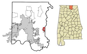
mapsize = 250px
map_caption = Location in Madison County and the state ofAlabama
mapsize1 =
map_caption1 =
subdivision_type = Country
subdivision_type1 = State
subdivision_type2 = County
subdivision_name =United States
subdivision_name1 =Alabama
subdivision_name2 = Madison
government_type =
leader_title =
leader_name =
established_date =
area_magnitude =
area_total_km2 = 7.2
area_total_sq_mi = 2.8
area_land_km2 = 7.2
area_land_sq_mi = 2.8
area_water_km2 = 0
area_water_sq_mi = 0
elevation_ft = 640
elevation_m = 195
population_as_of = 2000
population_footnotes =
population_total = 876
population_metro =
population_density_km2 = 121.7
population_density_sq_mi = 312.9
timezone = Central (CST)
utc_offset = -6
latd = 34 |latm = 42 |lats = 0 |latNS = N
longd = 86 |longm = 22 |longs = 35 |longEW = W
timezone_DST = CDT
utc_offset_DST = -5
postal_code_type =ZIP code
postal_code = 35748
area_code = 256
blank_name = FIPS code
blank_info = 01-32440
blank1_name = GNIS feature ID
blank1_info = 0119509
footnotes =
website =Gurley is a town in Madison County,
Alabama ,United States , and is included in theHuntsville-Decatur Combined Statistical Area . As of the 2000 census, the population of the town is 876.History
The community takes its name from the Gurley family, who settled in the area in 1817. The town gradually formed around a water and coaling stop of the
Memphis & Charleston Railroad and was originally known as Gurley's Tank. Gurley was incorporated in 1891 with 250 residents. Soon after, the population peaked at 1,000. In 1896, thepost office opened, and the name was changed to Gurleysville. It was later shortened back to Gurley. The business district was nearly destroyed by fire in 1923, when a bucket brigade was able to save only two businesses. Most of the town is now included in the Gurley Historic District, which was awarded national recognition in 2003.Geography
Gurley is located at coor dms|34|42|1|N|86|22|35|W|city (34.700164, -86.376469)GR|1.
According to the
U.S. Census Bureau , the town has a total area of 2.8square mile s (7.2km² ), all of it land.Demographics
As of the
census GR|2 of 2000, there were 876 people, 346 households, and 241 families residing in the town. Thepopulation density was 313.9 people per square mile (121.2/km²). There were 379 housing units at an average density of 135.8/sq mi (52.4/km²). The racial makeup of the town was 81.85% White, 15.41% Black or African American, 0.46% Native American, 0.34% Asian, 0.57% from other races, and 1.37% from two or more races. 2.05% of the population were Hispanic or Latino of any race.There were 346 households out of which 34.7% had children under the age of 18 living with them, 48.0% were married couples living together, 17.9% had a female householder with no husband present, and 30.1% were non-families. 26.9% of all households were made up of individuals and 13.0% had someone living alone who was 65 years of age or older. The average household size was 2.53 and the average family size was 3.09.
In the town the population was spread out with 28.5% under the age of 18, 7.8% from 18 to 24, 27.1% from 25 to 44, 21.3% from 45 to 64, and 15.3% who were 65 years of age or older. The median age was 35 years. For every 100 females there were 86.8 males. For every 100 females age 18 and over, there were 85.8 males.
The median income for a household in the town was $23,831, and the median income for a family was $26,875. Males had a median income of $31,146 versus $20,000 for females. The
per capita income for the town was $13,271. About 23.4% of families and 21.4% of the population were below thepoverty line , including 28.3% of those under age 18 and 31.1% of those age 65 or over.Public Services
As an incorporated town, Gurley enjoys its own police and fire departments. The city also maintains a small sewer system. Education in Gurley, however, is run by the Madison County School System [http://www.madison.k12.al.us] . Only one K-8 school (Madison County Elementary) operates within the city limits. Gurley secondary school students are sent to Madison County High School, a school of 583 a few miles west of the city on US 72.
=Fraternal
Gurley has its own Masonic Lodge -- Gurley Lodge #521 F & AM, a Lions Club, a Lioness Club, and a Founders Club.
References
External links
* [http://www.contactez.net/gurleyalabama/ Gurley Community & Town History]
* [http://gurleyonline.com/ City of Gurley]
Wikimedia Foundation. 2010.