- National Register of Historic Places listings in Sumter County, Alabama
-
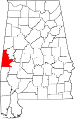 Location of Sumter County in Alabama
This is a list of the National Register of Historic Places listings in Sumter County, Alabama.
This is intended to be a complete list of the properties and districts on the National Register of Historic Places in Sumter County, Alabama, United States. Latitude and longitude coordinates are provided for many National Register properties and districts; these locations may be seen together in a Google map.[1]
There are 13 properties and districts listed on the National Register in the county.
-
- This National Park Service list is complete through NPS recent listings posted November 10, 2011.[2]
Current listings
[3] Landmark name Image Date listed Location City or town Summary 1 Dr. James Alvis Beavers House August 31, 2000 Old Livingston Rd.
32°26′20″N 88°21′42″W / 32.438889°N 88.361667°WCuba 2 Coffin Shop 
October 29, 1985 McKee and Monroe Sts.
32°49′17″N 88°09′29″W / 32.821389°N 88.158056°WGainesville 3 Colgin Hill October 3, 1985 Off State Route 39
32°48′40″N 88°09′19″W / 32.811111°N 88.155278°WGainesville 4 Fort Tombecbee 
October 2, 1973 Address Restricted Epes 5 Gainesville Historic District 
October 3, 1985 Roughly bounded by North Carolina, Church, School, and Lafayette Sts., end of the town grid, and Webster St.
32°48′47″N 88°09′36″W / 32.813056°N 88.16°WGainesville 6 Gibbs House October 3, 1985 Southwest of Spruce and Webster Sts.
32°48′46″N 88°09′53″W / 32.812778°N 88.164722°WGainesville 7 Main–Yankee Street Historic District 
October 3, 1985 Roughly bounded by Main, Washington, and School Sts.
32°49′20″N 88°09′12″W / 32.822222°N 88.153333°WGainesville 8 Col. Green G. Mobley House 
January 18, 1982 Webster and Pearl Sts.
32°49′05″N 88°09′37″W / 32.818056°N 88.160278°WGainesville 9 Oakhurst January 6, 1987 Gainesville-Lacy's Ford Rd., approximately 3 mi (4.8 km) southwest of State Route 116
32°46′45″N 88°16′06″W / 32.779167°N 88.268333°WEmelle 10 Park and Bandstand October 29, 1985 State and McKee Sts.
32°49′20″N 88°09′31″W / 32.822222°N 88.158611°WGainesville 11 Sumter County Courthouse 
March 24, 1972 U.S. Route 11
32°34′55″N 88°11′18″W / 32.581944°N 88.188333°WLivingston 12 Dr. H. B. Ward House August 14, 1998 202 4th Ave.
32°25′41″N 88°22′42″W / 32.428056°N 88.378333°WCuba 13 Laura Watson House October 3, 1985 Epes Rd.
32°48′51″N 88°09′11″W / 32.814167°N 88.153056°WGainesville See also
- List of National Historic Landmarks in Alabama
- National Register of Historic Places listings in Alabama
References
- ^ The latitude and longitude information provided in this table was derived originally from the National Register Information System, which has been found to be fairly accurate for about 99% of listings. For about 1% of NRIS original coordinates, experience has shown that one or both coordinates are typos or otherwise extremely far off; some corrections may have been made. A more subtle problem causes many locations to be off by up to 150 yards, depending on location in the country: most NRIS coordinates were derived from tracing out latitude and longitudes off of USGS topographical quadrant maps created under North American Datum of 1927, which differs from the current, highly accurate GPS system used by Google maps. Chicago is about right, but NRIS longitudes in Washington are higher by about 4.5 seconds, and are lower by about 2.0 seconds in Maine. Latitudes differ by about 1.0 second in Florida. Some locations in this table may have been corrected to current GPS standards.
- ^ "National Register of Historic Places: Weekly List Actions". National Park Service, United States Department of the Interior. Retrieved on November 10, 2011.
- ^ Numbers represent an ordering by significant words. Various colorings, defined here, differentiate National Historic Landmark sites and National Register of Historic Places Districts from other NRHP buildings, structures, sites or objects.
U.S. National Register of Historic Places in Alabama Lists by county Autauga • Baldwin • Barbour • Bibb • Blount • Bullock • Butler • Calhoun • Chambers • Cherokee • Chilton • Choctaw • Clarke • Clay • Cleburne • Coffee • Colbert • Conecuh • Coosa • Covington • Crenshaw • Cullman • Dale • Dallas • DeKalb • Elmore • Escambia • Etowah • Fayette • Franklin • Geneva • Greene • Hale • Henry • Houston • Jackson • Jefferson • Lamar • Lauderdale • Lawrence • Lee • Limestone • Lowndes • Macon • Madison • Marengo • Marion • Marshall • Mobile • Monroe • Montgomery • Morgan • Perry • Pickens • Pike • Randolph • Russell • St. Clair • Shelby • Sumter • Talladega • Tallapoosa • Tuscaloosa • Walker • Washington • Wilcox • Winston
Lists by city Other lists Keeper of the Register • History of the National Register of Historic Places • Property types • Historic district • Contributing property Municipalities and communities of Sumter County, Alabama County seat: Livingston Cities 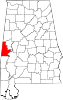
Towns Cuba | Emelle | Epes | Gainesville | Geiger
CDP Bellamy
Unincorporated
communitiesIntercourse | Panola
Categories:- National Register of Historic Places in Sumter County, Alabama
-


Wikimedia Foundation. 2010.