- Tanner, Alabama
-
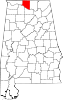
Tanner, Alabama — Unincoporated Community — Coordinates: 34°43′53″N 86°58′14″W / 34.73139°N 86.97056°W Country United States State Alabama County Limestone Elevation 666 ft (203 m) Time zone Central (CST) (UTC-6) – Summer (DST) CDT (UTC-5) ZIP code 35671 Area code(s) 256 GNIS feature ID 0153647 Tanner is a small town in central southern Limestone County, Alabama, United States, and is included in the Huntsville-Decatur Combined Statistical Area. It lies along the Tennessee River, next to the city of Athens.
Tanner is home to Tanner High School (The Rattlers), a 2A school in the state's classification system. The school's basketball boys and girls teams both won state titles in 2011.
History
Tanner was settled along the Louisville and Nashville Railroad in the 19th century and was originally named McDonald's Station, then Rowland. A Rowland post office was established in 1878. In 1913, the Tanner post office was established, named after Samuel Tanner who was the first mayor of nearby Athens. [1]
1974 and 2011 Super Outbreaks
On April 3, 1974, the area was struck by the Super Outbreak; two violent tornadoes that were both one-third of a mile wide large cones hit the community within 30 minutes. The two tornadoes were classified as both F5 events in the city itself on the Fujita scale, respectively.[2] After the first tornado passed through the area, a second tornado surprised the rescue effort. In total, 50 were killed by those tornadoes. On April 27, 2011, during what some meteorologists call "Super Outbreak II", Tanner and other surrounding communities were hit by a large violent tornado that has been given an official rating of EF5.[3] 11 people perished from the wedge tornado which was over 1 mile wide. The tornado marks the third F5 or EF5 to strike Tanner and the surrounding communities in Limestone County.
References
- ^ Foscue, Virginia. Place Names in Alabama. University: University of Alabama Press, 1989.
- ^ "Superoutbreak April 3-4, 1974". http://www.xeniatornado.com/superoutbreak.htm. Retrieved 2008-06-20.
- ^ "National Weather Service Huntsville Alabama -- Franklin AL, Lawrence AL, Limestone AL, Madison AL, Frankin TN Tornado Survey Information". NOAA's National Weather Service. 2011-05-02. http://www.srh.noaa.gov/hun/?n=franklin-al_lawrence_limestone_madison_franklin-tn_counties. Retrieved 2011-05-02.
Communities of the Huntsville-Decatur Area Population over 100,000 Population over 50,000 Population over 20,000 Population over 10,000 Population over 5,000 Population over 2,000 Population over 1,000 Population over 500 Population over 200 Population under 200 Unincorporated areas Belle Mina · Caddo · Danville · Hulaco · Lacey's Spring · Meridianville · Morgan City · Moulton Heights · New Market · Tanner · ToneyCounties Municipalities and communities of Limestone County, Alabama Cities Athens | Decatur‡ | Huntsville‡ | Madison‡
Towns Ardmore | Elkmont | Lester | Mooresville
Unincorporated
communitiesBelle Mina | Capshaw | Greenbrier | Oakland (near Athens) | Oakland (near Madison) | Tanner
Footnotes ‡This populated place also has portions in an adjacent county or counties
Coordinates: 34°43′53″N 86°58′14″W / 34.73139°N 86.97056°W
Categories:- Alabama geography stubs
- Unincorporated communities in Alabama
- Populated places in Limestone County, Alabama
- Huntsville–Decatur Combined Statistical Area

Wikimedia Foundation. 2010.