- Ardmore, Alabama
Infobox Settlement
official_name = Ardmore, Alabama
settlement_type =Town
imagesize =
image_caption =
image_
imagesize =
image_caption =
image_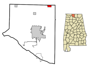
mapsize = 250px
map_caption = Location in Limestone County and the state ofAlabama
mapsize1 =
map_caption1 =
subdivision_type = Country
subdivision_type1 = State
subdivision_type2 = County
subdivision_name =United States
subdivision_name1 =Alabama
subdivision_name2 = Limestone
government_type =
leader_title =
leader_name =
established_date =
area_magnitude =
area_total_km2 = 5.3
area_total_sq_mi = 2
area_land_km2 = 5.3
area_land_sq_mi = 2
area_water_km2 = 0
area_water_sq_mi = 0
elevation_ft = 883
elevation_m = 269
population_as_of =2007
population_footnotes = cite web|url=http://www.census.gov/popest/cities/tables/SUB-EST2007-04-01.csv|title=Annual Estimates of the Population for Incorporated Places in Alabama|publisher=United States Census Bureau |date=2008-07-10|accessdate=2008-07-14]
population_total =1189
population_metro =
population_density_km2 = 195.1
population_density_sq_mi = 517
timezone = Central (CST)
utc_offset = -6
latd = 34 |latm = 59 |lats = 13 |latNS = N
longd = 86 |longm = 50 |longs = 35 |longEW = W
timezone_DST = CDT
utc_offset_DST = -5
postal_code_type =ZIP code
postal_code = 35739
area_code = 256
blank_name = FIPS code
blank_info = 01-02260
blank1_name = GNIS feature ID
blank1_info = 0113204
footnotes =
website =Ardmore is a town in Limestone County,
Alabama ,United States , and is included in theHuntsville-Decatur Metro Area . As of the 2000 census, the population of the town is 1,034. According to the 2005U.S. Census estimates, the town had a population of 1,106. [http://www.census.gov/popest/cities/files/SUB-EST2005-all.csv] It borders its sister city ofArdmore, Tennessee .Geography
Ardmore is located at coor dms|34|59|13|N|86|50|36|W|city (34.987052, -86.843228)GR|1. According to the
U.S. Census Bureau , the town has a total area of 2.0square mile s (5.3km² ), all of it land.Demographics
As of the
census GR|2 of 2000, there were 1,034 people, 460 households, and 276 families residing in the town. Thepopulation density was 506.8 people per square mile (195.7/km²). There were 506 housing units at an average density of 248.0/sq mi (95.8/km²). The racial makeup of the town was 96.23% White, 0.87% Black or African American, 0.48% Native American, 0.77% Asian, 0.10% Pacific Islander, 1.16% from other races, and 0.39% from two or more races. 1.74% of the population were Hispanic or Latino of any race.There were 460 households out of which 27.0% had children under the age of 18 living with them, 43.0% were married couples living together, 11.5% had a female householder with no husband present, and 39.8% were non-families. 36.5% of all households were made up of individuals and 21.1% had someone living alone who was 65 years of age or older. The average household size was 2.25 and the average family size was 2.96.
In the town the population was spread out with 25.0% under the age of 18, 8.3% from 18 to 24, 25.7% from 25 to 44, 24.6% from 45 to 64, and 16.4% who were 65 years of age or older. The median age was 37 years. For every 100 females there were 81.4 males. For every 100 females age 18 and over, there were 78.0 males.
The median income for a household in the town was $28,352, and the median income for a family was $40,673. Males had a median income of $29,531 versus $19,875 for females. The
per capita income for the town was $18,447. About 10.7% of families and 17.9% of the population were below thepoverty line , including 20.2% of those under age 18 and 30.7% of those age 65 or over.References
External links
Wikimedia Foundation. 2010.