- Faunsdale, Alabama
Infobox Settlement
official_name = Faunsdale, Alabama
settlement_type =Town
imagesize =
image_caption =
image_
imagesize =
image_caption =
image_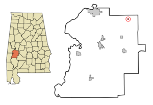
mapsize = 250px
map_caption = Location in Marengo County and the state ofAlabama
mapsize1 =
map_caption1 =
subdivision_type = Country
subdivision_type1 = State
subdivision_type2 = County
subdivision_name =United States
subdivision_name1 =Alabama
subdivision_name2 = Marengo
government_type =
leader_title =
leader_name =
established_date =
area_magnitude =
area_total_km2 = 0.6
area_total_sq_mi = 0.2
area_land_km2 = 0.6
area_land_sq_mi = 0.2
area_water_km2 = 0
area_water_sq_mi = 0
elevation_ft = 220
elevation_m = 67
population_as_of = 2000
population_footnotes =
population_total = 87
population_metro =
population_density_km2 = 145
population_density_sq_mi = 435
timezone = Central (CST)
utc_offset = -6
latd = 32 |latm = 27 |lats = 33 |latNS = N
longd = 87 |longm = 35 |longs = 35 |longEW = W
timezone_DST = CDT
utc_offset_DST = -5
postal_code_type =ZIP code
postal_code = 36738
area_code = 334
blank_name = FIPS code
blank_info = 01-25816
blank1_name = GNIS feature ID
blank1_info = 0118220
footnotes =
website =Faunsdale is a town in Marengo County,
Alabama , U.S. At the 2000 census the population was 87. The town was named for nearbyFaunsdale Plantation .Marengo County Heritage Book Committee: "The heritage of Marengo County, Alabama", pages 17-18. Clanton, Alabama: Heritage Publishing Consultants, 2000. ISBN 189164758X]Geography
Faunsdale is located at coor dms|32|27|33|N|87|35|36|W|cityGR|1. According to the
U.S. Census Bureau , the town has a total area of 0.2 square miles (0.6 km²), all of it land. The elevation is convert|220|ft|m.Attractions
Every spring the town sponsors the annual Faunsdale Crawfish Festival, serving authentic Southern cooking on the street, with music and dancing. The same week, the bi-annual Faunsdale Biker Rally is within walking distance. It is an adult-only event, with bikers from all over the state in attendance.cite web|title="Faunsdale Biker Rally - Alabama's wildest biker event "|work="Bama Rides"|date=2008-04-26|url=http://articles.bamarides.com/2008/04/faunsdale-biker-rally-alabama-wildest.html
accessdate=2008-10-07]Demographics
As of the
census GR|2 of 2000, there were 87 people, 34 households, and 24 families residing in the town. Thepopulation density was 389.2 people per square mile (152.7/km²). There were 36 housing units at an average density of 161.1/sq mi (63.2/km²). The racial makeup of the town was 54.02% White and 45.98% Black or African American. 4.60% of the population were Hispanic or Latino of any race.cite web|title="2000 census for Faunsdale, Alabama"|work="U.S. Census Bureau"|url=http://factfinder.census.gov/servlet/SAFFFacts?_event=Search&geo_id=04000US01&_geoContext=01000US%7C04000US01%7C16000US0150000&_street=&_county=faunsdale&_cityTown=faunsdale&_state=04000US01&_zip=&_lang=en&_sse=on&ActiveGeoDiv=geoSelect&_useEV=&pctxt=fph&pgsl=040&_submenuId=factsheet_1&ds_name=ACS_2006_SAFF&_ci_nbr=null&qr_name=null®=null%3Anull&_keyword=&_industry=&show_2003_tab=&redirect=Y|accessdate=2007-10-14]There were 34 households out of which 41.2% had children under the age of 18 living with them, 64.7% were married couples living together, 8.8% had a female householder with no husband present, and 26.5% were non-families. 20.6% of all households were made up of individuals and 8.8% had someone living alone who was 65 years of age or older. The average household size was 2.56 and the average family size was 3.04.
In the town the population was spread out with 29.9% under the age of 18, 3.4% from 18 to 24, 28.7% from 25 to 44, 19.5% from 45 to 64, and 18.4% who were 65 years of age or older. The median age was 37 years. For every 100 females there were 93.3 males. For every 100 females age 18 and over, there were 96.8 males.
The median income for a household in the town was $28,750, and the median income for a family was $50,417. Males had a median income of $30,833 versus $19,500 for females. The
per capita income for the town was $14,697. There were no families and 3.2% of the population living below thepoverty line , including no under eighteens and none of those over 64.References
Wikimedia Foundation. 2010.