- Black Warrior River
Infobox_River
river_name = Black Warrior River

image_size = 288px
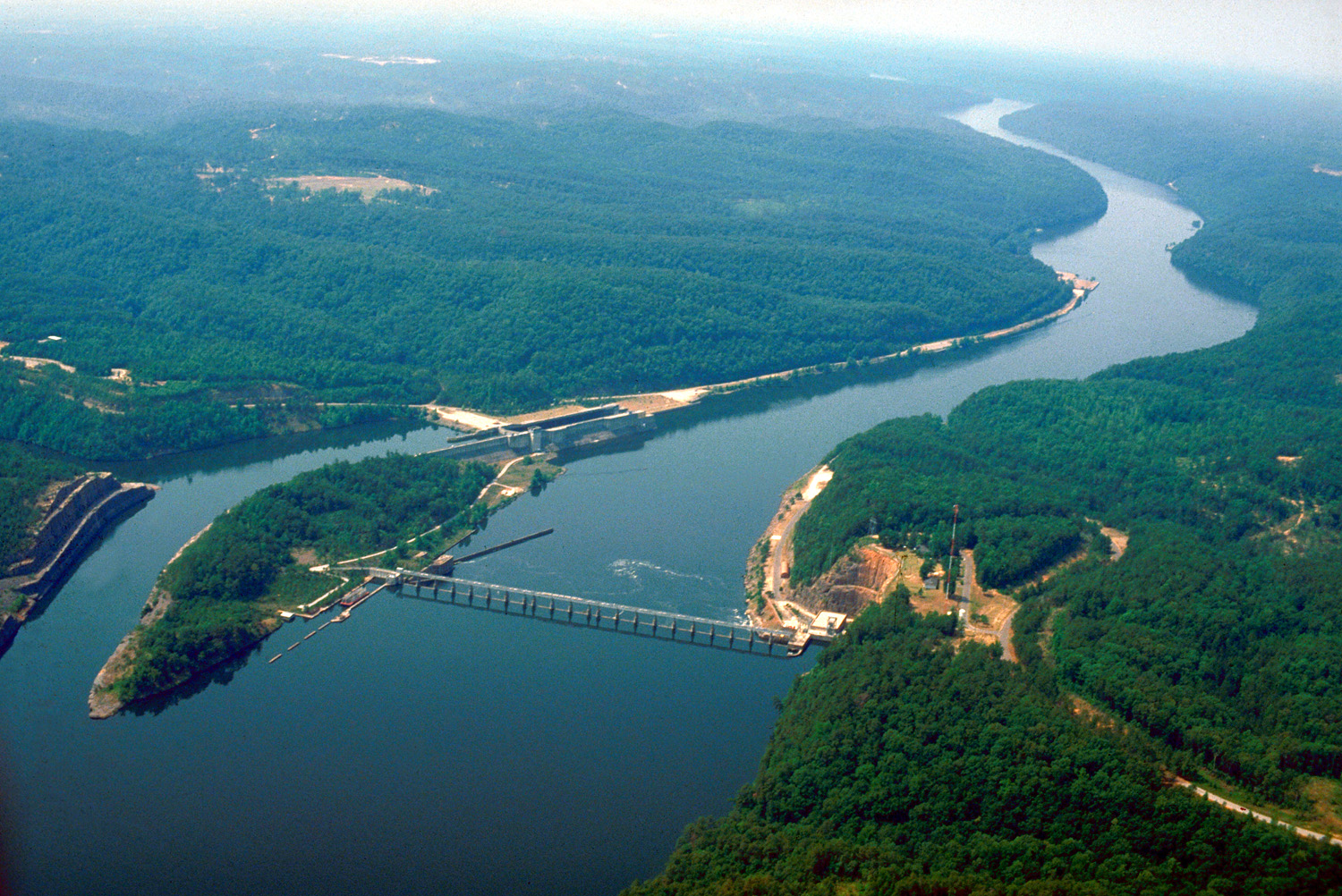
caption =Bankhead Lock and Dam , impoundingBankhead Lake on the Black Warrior River in Tuscaloosa County
origin = Confluence of the Mulberry and Locust forks
mouth =Tombigbee River northeast of Demopolis
basin_countries =
length = 178 mi (286 km)
elevation =
mouth_elevation =
discharge =
watershed =ImageStackRight|275
The Black Warrior River is a tributary of theTombigbee River , approximately 178 mi (286 km) long, in west centralAlabama in theUnited States . It drains an area of 6,275 sq mi (16,250 km²) with its upper watershed encompassing a forested area of high bluffs at the extreme southern end of theAppalachian Mountains north and west of the city of Birmingham. In its lower reaches it flows across the forests of thecoastal plain . It is impounded along nearly its entire course in a chain of narrow reservoirs forhydroelectricity , drinking water, and as an aid to navigation.Description
The river is formed approximately 25 mi (40 km) west of Birmingham by the confluence of the Mulberry and Locust forks, which join as arms of
Bankhead Lake , a narrow reservoir on the upper river formed by the Bankhead Lock and Dam. Bankhead Lake andHolt Lake , formed by the Holt Lock and Dam, encompass the entire course of the river for its upper 50 mi (80 km) stretching southeast into central Tuscaloosa County, northwest of Tuscaloosa. The Black Warrior flows westward past downtown Tuscaloosa, the largest city on the river, then flows generally south in a highlymeander ing course, joining the Tombigbee from the northeast at Demopolis. The lower 30 mi (48 km) of the river are part of the narrowLake Demopolis .Early Development
To develop the coal industries of Central Alabama the Federal Government in the 1880s began building a system of dressed rock lock and
dam s that concluded in 17 locks and dams. The first 16 locks and dams were constructed ofSandstone quarried from the banks of the river and the river bed itself. Huge blocks of stone were hand shaped with hammer and chisel to construct the locks and dams, and a few of these dams were in service until the 1960s. One example of the craftsmanship of the stone locks is at University Park on Jack Warner Parkway in Tuscaloosa, Alabama. The bank side wall of Lock 3 (Later renumbered Lock 12 and today largely disassembled) is the last remnant of the locks and dams made of this dressed rock from the 1880s-90s. A concrete dam completed in 1915, Lock 17 (John Hollis Bankhead Lock and Dam) is the last and only existing of the original dams, and has been modernized over the years with the addition of spillway gates, and a larger single lift lock. Lock 17 andHolt Lock and Dam also have hydro generating plants owned byAlabama Power suppling electricity for the Birmingham and Tuscaloosa, Alabama areas. This lock and dam system made the Black Warrior River navigable along its entire course and one of the longest channelized waterways in the United States, forming part of the extended system that link theGulf of Mexico toBirmingham, Alabama . Birmingham became the "Pittsburgh of the South", shippingIron andsteel products via the Black Warrior River through thePanama Canal to the West Coast and the world.Coal is barged to Mobile and is shipped throughout the world today making Mobile the largest coal port in the South.The Black Warrior River receives the North River from the north approximately 1 mi (1.6) northwest of Tuscaloosa. North River was dammed in 1968 to form
Lake Tuscaloosa and is main source for water for the City of Tuscaloosa.Variant names of the Black Warrior River include Apotaka Hacha River, Bance River, Chocta River, Pafallaya River, Patagahatche River, Tascaloosa River, Tuskaloosa River, and Warrior River.
References
*Gnis|159191 Black Warrior River
*The Harnessing of the Black Warrior River by Kenneth Willis
* Honoree Fanonne Jeffers. " [http://www.southernspaces.org/contents/2005/jeffers/1a.htm Tuscaloosa: Riversong] " "Southern Spaces"ee also
*
List of Alabama rivers
*List of crossings of the Black Warrior River External links
* [http://www.warriorcwp.org/ Black Warrior Clean Water Partnership]
* [http://www.blackwarriorriver.org/ Black Warrior Riverkeepers]
Wikimedia Foundation. 2010.
