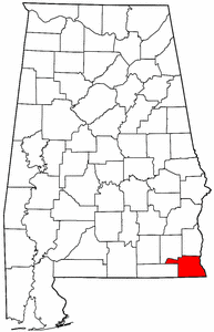
- Houston County, Alabama
Infobox U.S. County
county = Houston County
state = Alabama
map size = 150
founded =February 9 ,1903
seat = Dothan| largest city = Dothan
area_total_sq_mi =582
area_land_sq_mi =580
area_water_sq_mi =1
area percentage =0.22%
census yr = 2000
pop = 88787
density_km2 = 26
web =
|Houston County is a
county of the State ofAlabama . As of 2000 the population was 88,787. Itscounty seat is Dothan.Houston County is part of the Dothan Metropolitan Statistical Area.
History
Houston County was established on
February 9 ,1903 from parts of Dale County, Geneva County and Henry County. It was named afterGeorge Smith Houston , aGovernor of Alabama .Geography
According to the U.S. Census Bureau, the county has a total area of 582
square mile s (1,507km² ), of which, 580 square miles (1,503 km²) of it is land and 1 square miles (3 km²) of it (0.22%) is water.Major highways
*
*
*
*
*
*Adjacent counties
*Henry County (north)
*Early County, Georgia (east)
*Seminole County, Georgia (southeast)
*Jackson County, Florida (south)
*Geneva County (west)
*Dale County (northwest)Demographics
As of the
census GR|2 of 2000, there were 88,787 people, 35,834 households, and 25,119 families residing in the county. Thepopulation density was 153 people per square mile (59/km²). There were 39,571 housing units at an average density of 68 per square mile (26/km²). The racial makeup of the county was 73.08% White, 24.60% Black or African American, 0.37% Native American, 0.62% Asian, 0.02% Pacific Islander, 0.39% from other races, and 0.92% from two or more races. 1.26% of the population were Hispanic or Latino of any race.There were 35,834 households out of which 33.00% had children under the age of 18 living with them, 52.50% were married couples living together, 14.10% had a female householder with no husband present, and 29.90% were non-families. 26.40% of all households were made up of individuals and 10.10% had someone living alone who was 65 years of age or older. The average household size was 2.45 and the average family size was 2.95.
In the county the population was spread out with 25.90% under the age of 18, 8.20% from 18 to 24, 28.70% from 25 to 44, 23.50% from 45 to 64, and 13.70% who were 65 years of age or older. The median age was 37 years. For every 100 females there were 90.50 males. For every 100 females age 18 and over, there were 86.20 males.
The median income for a household in the county was $34,431, and the median income for a family was $42,437. Males had a median income of $32,092 versus $21,409 for females. The
per capita income for the county was $18,759. About 11.80% of families and 15.00% of the population were below thepoverty line , including 21.10% of those under age 18 and 16.30% of those age 65 or over.Cities and towns
*Ashford
*Avon
*Columbia
*Cottonwood
*Cowarts
*Dothan (parts of Dothan are in Dale County and in Henry County)
*Gordon
*Kinsey
*Madrid
*Rehobeth
*Taylor
*WebbReferences
External links
* [http://www.houstoncounty.org/ Houston County web site]
* [http://www.wiregrasslive.com WiregrassLive.com - Citizen-driven news and messages]
Wikimedia Foundation. 2010.