- Columbia, Alabama
-
Columbia, Alabama — Town — Location in Houston County and the state of Alabama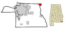
Coordinates: 31°17′32″N 85°6′43″W / 31.29222°N 85.11194°WCoordinates: 31°17′32″N 85°6′43″W / 31.29222°N 85.11194°W Country United States State Alabama County Houston Area – Total 4 sq mi (10.4 km2) – Land 3.9 sq mi (10.2 km2) – Water 0.1 sq mi (0.2 km2) Elevation 223 ft (68 m) Population (2000) – Total 804 – Density 201/sq mi (77.3/km2) Time zone Central (CST) (UTC-6) – Summer (DST) CDT (UTC-5) ZIP code 36319 Area code(s) 334 FIPS code 01-16744 GNIS feature ID 0116457 Columbia is a town in Houston County, Alabama, United States. It is part of the Dothan, Alabama Metropolitan Statistical Area. At the 2000 census the population was 804.
Contents
Geography
Columbia is located at 31°17′32″N 85°06′44″W / 31.292283°N 85.112123°W.[1] According to the U.S. Census Bureau, the town has a total area of 4.0 square miles (10 km2), of which, 3.9 square miles (10 km2) of it is land and 0.1 square miles (0.26 km2) of it (1.75%) is water.
Demographics
As of the census[2] of 2000, there were 804 people, 344 households, and 226 families residing in the town. The population density was 204.8 people per square mile (79.0/km2). There were 462 housing units at an average density of 117.7 per square mile (45.4/km2). The racial makeup of the town was 74.38% White, 24.50% Black or African American, 0.62% Native American, 0.12% from other races, and 0.37% from two or more races. 0.50% of the population were Hispanic or Latino of any race.
There were 344 households out of which 27.9% had children under the age of 18 living with them, 49.4% were married couples living together, 12.2% had a female householder with no husband present, and 34.3% were non-families. 33.7% of all households were made up of individuals and 18.9% had someone living alone who was 65 years of age or older. The average household size was 2.34 and the average family size was 2.98.
In the town the population was spread out with 25.7% under the age of 18, 6.5% from 18 to 24, 24.0% from 25 to 44, 22.1% from 45 to 64, and 21.6% who were 65 years of age or older. The median age was 41 years. For every 100 females there were 87.9 males. For every 100 females age 18 and over, there were 84.3 males.
The median income for a household in the town was $27,500, and the median income for a family was $36,339. Males had a median income of $29,821 versus $18,393 for females. The per capita income for the town was $15,248. About 12.3% of families and 18.0% of the population were below the poverty line, including 24.0% of those under age 18 and 18.6% of those age 65 or over.
Notes of interest
- Despite its relative small size, Columbia was once the county seat of Henry County (before the county was divided to form Houston county.)
- Brothers John Anglin and Clarence Anglin, made famous for escaping from Alcatraz Island, robbed the Columbia bank of $19,000 in January, 1959 [1].
Notable residents
- Monte Irvin, born in Columbia, member of the Baseball Hall of Fame[3]
- B'Ho Kirkland, born in Columbia, played for the Alabama Crimson Tide and went on to play for the Brooklyn Dodgers (NFL).
References
- ^ "US Gazetteer files: 2010, 2000, and 1990". United States Census Bureau. 2011-02-12. http://www.census.gov/geo/www/gazetteer/gazette.html. Retrieved 2011-04-23.
- ^ "American FactFinder". United States Census Bureau. http://factfinder.census.gov. Retrieved 2008-01-31.
- ^ Reichler, Joseph L., ed (1979) [1969]. The Baseball Encyclopedia (4th edition ed.). New York: Macmillan Publishing. ISBN 0-02-578970-8.
Municipalities and communities of Houston County, Alabama City 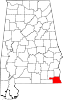
Towns Footnotes ‡This populated place also has portions in an adjacent county or counties
Categories:- Populated places in Houston County, Alabama
- Towns in Alabama
- Dothan metropolitan area


Wikimedia Foundation. 2010.