- Carroll County, Georgia
Infobox U.S. County
county = Carroll County
state = Georgia
seallink =
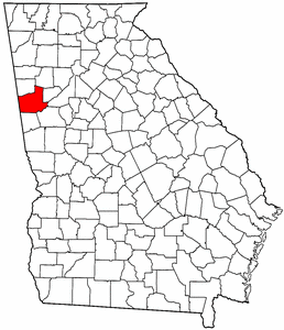
map size = 225
founded = 1826
seat = Carrollton
largest city = Carrollton
area_total_sq_mi = 504
area_total_km2 = 1305
area_land_sq_mi = 499
area_land_km2 = 1292
area_water_sq_mi = 5
area_water_km2 = 13
area percentage = .97%
census estimate yr = 2006
pop = 107325
density_sq_mi = 175
density_km2 = 68
time zone = Eastern
UTC offset = -5
DST offset = -4
web = www.carrollcountyga.comCarroll County is a
county located in theU.S. state of Georgia. As of the 2000census , thepopulation was 87,268. The 2007 Census Estimate shows a population of 111,954 [http://www.census.gov/popest/counties/tables/CO-EST2007-01-13.xls] . Thecounty seat is Carrollton, GeorgiaGR|6.Carroll County is included in the Atlanta-Sandy Springs-Marietta, Georgia
Metropolitan Statistical Area .Geography
According to the
U.S. Census Bureau , the county has a total area of 504square mile s (1,305km² ), of which, 499 square miles (1,292 km²) of it is land and 5 square miles (13 km²) of it (0.97%) is water.Major highways
*
*
*
*
*
*
*
*
*
*Adjacent counties
*Paulding County, Georgia - north
*Douglas County, Georgia - east
*Fulton County, Georgia - east
*Coweta County, Georgia - southeast
*Heard County, Georgia - south
*Randolph County,Alabama - southwest
*Cleburne County,Alabama - west
*Haralson County, Georgia - northwestDemographics
As of the
census GR|2 of 2000, there were 87,268 people, 31,568 households, and 23,013 families residing in the county. Thepopulation density was 175 people per square mile (68/km²). There were 34,067 housing units at an average density of 68 per square mile (26/km²). The racial makeup of the county was 80.52% White, 16.32% Black or African American, 0.27% Native American, 0.62% Asian, 0.02% Pacific Islander, 1.12% from other races, and 1.14% from two or more races. 2.57% of the population were Hispanic or Latino)of any race.There were 31,568 households out of which 35.20% had children under the age of 18 living with them, 56.30% were married couples living together, 12.30% had a female householder with no husband present, and 27.10% were non-families. 21.20% of all households were made up of individuals and 7.60% had someone living alone who was 65 years of age or older. The average household size was 2.66 and the average family size was 3.09.
In the county the population was spread out with 25.90% under the age of 18, 12.90% from 18 to 24, 29.90% from 25 to 44, 21.20% from 45 to 64, and 10.00% who were 65 years of age or older. The median age was 32 years. For every 100 females there were 95.10 males. For every 100 females age 18 and over, there were 91.50 males.
The median income for a household in the county was $38,799, and the median income for a family was $44,642. Males had a median income of $33,102 versus $22,538 for females. The
per capita income for the county was $17,656. About 10.00% of families and 13.70% of the population were below thepoverty line , including 15.40% of those under age 18 and 16.00% of those age 65 or over.History
The land for Lee, Muscogee, Troup, Coweta, and Carroll counties was ceded by the
Creek people in the 1825Treaty of Indian Springs . This land was the last remaining portion of the Creek's Georgia territory, and was ceded byWilliam McIntosh , chief of the Lower Creeks orWhite Sticks . This cession resulted in his murder atMcIntosh Reserve near present day Whitesburg by fellow Creeks from northern Alabama calledRed Sticks or Upper Creeks.The county's boundaries were created by the
Georgia General Assembly onJune 9 , but they were not named untilDecember 14 of 1826. Carroll County was named for Charles Carroll ofMaryland , at that time the last surviving signer of theU.S. Declaration of Independence when the county was created in 1826. Carrollton, the county seat, was also named for this reason.The county originally extended from the
Chattahoochee River to the Alabama state line on the East and West with the northern boundary just north of present dayI-20 with the Cherokees. This land was carved up over time to become Carroll, Douglas, Heard, parts of Haralson and Troup counties. A portion that became Douglas was once Campbell County which no longer exists (divided between Douglas and Fulton counties).Because of the small slave population the county was known as the Free State of Carroll in the 1850s.
Even before the cession of the territory some white settlers were in the northern part of the county in the Villa Rica area.
During the American Civil War, the county provided the Bowdon Volunteers and the Carroll Boys, which were a part of
Cobb's Legion .In late August 2005,
Hurricane Katrina made landfall along the Gulf Coast and spawned numeroustornado es throughout the county that shredded dozens ofmobile home s and killed several.Cities and towns
*Bowdon
*Bremen
*Carrollton
*Mount Zion
*Roopville
*Temple
*Villa Rica
*Whitesburg
Wikimedia Foundation. 2010.