- Temple, Georgia
Infobox Settlement
official_name = Temple, Georgia
other_name =
native_name =
nickname =
settlement_type =City
motto =
imagesize =
image_caption =
flag_size =
image_
seal_size =
image_shield =
shield_size =
image_blank_emblem =
blank_emblem_type =
blank_emblem_size =
imagesize =
image_caption =
flag_size =
image_
seal_size =
image_shield =
shield_size =
image_blank_emblem =
blank_emblem_type =
blank_emblem_size =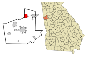
mapsize = 250px
map_caption = Location in Carroll County and the state of Georgia
mapsize1 =
map_caption1 =
image_dot_
dot_mapsize =
dot_map_caption =
dot_x =
dot_y =
pushpin_
pushpin_label_position =
pushpin_map_caption =
pushpin_mapsize =
subdivision_type = Country
subdivision_name =United States
subdivision_type1 = State
subdivision_name1 = Georgia
subdivision_type2 = Counties
subdivision_name2 = Carroll, Haralson
subdivision_type3 =
subdivision_name3 =
subdivision_type4 =
subdivision_name4 =
government_footnotes =
government_type =
leader_title =
leader_name =
leader_title1 =
leader_name1 =
leader_title2 =
leader_name2 =
leader_title3 =
leader_name3 =
leader_title4 =
leader_name4 =
established_title =
established_date =
established_title2 =
established_date2 =
established_title3 =
established_date3 =
area_magnitude =
unit_pref = Imperial
area_footnotes =
area_total_km2 = 17.7
area_land_km2 = 17.5
area_water_km2 = 0.2
area_total_sq_mi = 6.9
area_land_sq_mi = 6.8
area_water_sq_mi = 0.1
area_water_percent =
area_urban_km2 =
area_urban_sq_mi =
area_metro_km2 =
area_metro_sq_mi =
area_blank1_title =
area_blank1_km2 =
area_blank1_sq_mi =
population_as_of = 2000
population_footnotes =
population_note =
population_total = 2383
population_density_km2 = 134.6
population_density_sq_mi = 345.4
population_metro =
population_density_metro_km2 =
population_density_metro_sq_mi =
population_urban =
population_density_urban_km2 =
population_density_urban_sq_mi =
population_blank1_title =
population_blank1 =
population_density_blank1_km2 =
population_density_blank1_sq_mi =
timezone = Eastern (EST)
utc_offset = -5
timezone_DST = EDT
utc_offset_DST = -4
latd = 33 |latm = 44 |lats = 9 |latNS = N
longd = 85 |longm = 1 |longs = 38 |longEW = W
elevation_footnotes =
elevation_m = 357
elevation_ft = 1171
postal_code_type =ZIP code
postal_code = 30179
area_code = 770
blank_name = FIPS code
blank_info = 13-75832GR|2
blank1_name = GNIS feature ID
blank1_info = 0333205GR|3
website =
footnotes =Temple is a city in Carroll and Haralson Counties in the
U.S. state of Georgia. The population was 2,383 at the 2000 census. Census Estimates for 2005 show a population of 3,910.Geography
Temple is located at coor dms|33|44|9|N|85|1|38|W|city (33.735723, -85.027298)GR|1.
According to the
United States Census Bureau , the city has a total area of 6.9square mile s (17.8km² ), of which, 6.8 square miles (17.5 km²) of it is land and 0.1 square miles (0.3 km²) of it (1.46%) is water.Demographics
As of the
census GR|2 of 2000, there were 2,383 people, 864 households, and 664 families residing in the city. Thepopulation density was 352.3 people per square mile (136.1/km²). There were 956 housing units at an average density of 141.3/sq mi (54.6/km²). The racial makeup of the city was 84.47% White, 13.72% African American, 0.25% Native American, 0.17% Asian, 0.04% Pacific Islander, 0.38% from other races, and 0.97% from two or more races. Hispanic or Latino of any race were 1.80% of the population.There were 864 households out of which 39.4% had children under the age of 18 living with them, 57.2% were married couples living together, 12.6% had a female householder with no husband present, and 23.1% were non-families. 19.0% of all households were made up of individuals and 5.4% had someone living alone who was 65 years of age or older. The average household size was 2.76 and the average family size was 3.11.
In the city the population was spread out with 28.5% under the age of 18, 10.5% from 18 to 24, 32.8% from 25 to 44, 19.8% from 45 to 64, and 8.4% who were 65 years of age or older. The median age was 31 years. For every 100 females there were 91.7 males. For every 100 females age 18 and over, there were 96.9 males.
The median income for a household in the city was $39,063, and the median income for a family was $40,679. Males had a median income of $34,028 versus $22,963 for females. The
per capita income for the city was $15,301. About 5.5% of families and 8.3% of the population were below thepoverty line , including 13.4% of those under age 18 and 14.0% of those age 65 or over.2005
In 2005 Neo-Nazis held their annual Hammerfest outside of Temple, Georgia. [http://www.infoshop.org/inews/article.php?story=20050921212051318]
While this news story says that the Hammerfest was held outside of Temple, Georgia it was actually not. It was held in Draketown, which is close to Temple as well as Buchanan and Bremen Georgia. Racist haters are generally not welcomed in Temple Georgia.
References
External links
* [http://pchsm.org Paulding County Historical Society & Museum]
Wikimedia Foundation. 2010.