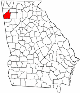
- Floyd County, Georgia
Infobox U.S. County
county = Floyd County
state = Georgia
seallink =
map size = 225
founded = 1832
seat = Rome
largest city = Rome
area_total_sq_mi = 518
area_total_km2 = 1343
area_land_sq_mi = 513
area_land_km2 = 1329
area_water_sq_mi = 5
area_water_km2 = 14
area percentage = 1.03%
census estimate yr = 2005
pop = 94198
density_sq_mi = 68
density_km2 = 176
time zone = Eastern
UTC offset = -5
DST offset = -4
web =Floyd County is a
county located in theU.S. state of Georgia. As of 2000, the population was 90,565. Census estimates for 2007 show a population of 95,618 [http://www.census.gov/popest/counties/tables/CO-EST2007-01-13.xls] . Thecounty seat is Rome, GeorgiaGR|6.It is part of the 'Rome, Georgia
Metropolitan Statistical Area ' which encompasses all of Floyd County, Georgia.History
The county was established on
December 3 ,1832 , by an act of theGeorgia General Assembly and was created from land that was part of Cherokee County at the time. The county is named afterUnited States Congressman John Floyd.Geography
According to the
U.S. Census Bureau , the county has a total area of 518square mile s (1,343km² ), of which, 513 square miles (1,329 km²) of it is land and 5 square miles (14 km²) of it (1.03%) is water.Major highways
*
*
*
*
*
*
*
*
*
*Adjacent counties
*Walker County, Georgia - north
*Gordon County, Georgia - northeast
*Bartow County, Georgia - east
*Polk County, Georgia - south
*Cherokee County,Alabama - west
*Chattooga County, Georgia - northwestNational
protected area *
Chattahoochee National Forest (part)Demographics
As of the
census GR|2 of 2000, there were 90,565 people, 34,028 households, and 24,227 families residing in the county. Thepopulation density was 176 people per square mile (68/km²). There were 36,615 housing units at an average density of 71 per square mile (28/km²). The racial makeup of the county was 81.34% White, 13.31% Black or African American, 0.31% Native American, 0.93% Asian, 0.09% Pacific Islander, 2.88% from other races, and 1.14% from two or more races. 5.50% of the population were Hispanic or Latino of any race.There were 34,028 households out of which 32.10% had children under the age of 18 living with them, 53.60% were married couples living together, 13.00% had a female householder with no husband present, and 28.80% were non-families. 24.50% of all households were made up of individuals and 10.80% had someone living alone who was 65 years of age or older. The average household size was 2.55 and the average family size was 3.02.
In the county the population was spread out with 24.60% under the age of 18, 10.80% from 18 to 24, 28.50% from 25 to 44, 22.20% from 45 to 64, and 13.90% who were 65 years of age or older. The median age was 36 years. For every 100 females there were 93.80 males. For every 100 females age 18 and over, there were 90.30 males.
The median income for a household in the county was $35,615, and the median income for a family was $42,302. Males had a median income of $31,659 versus $23,244 for females. The
per capita income for the county was $17,808. About 10.80% of families and 14.40% of the population were below thepoverty line , including 19.40% of those under age 18 and 13.80% of those age 65 or over.Cities and towns
*Cave Spring
*Lindale
*Livingston
*Mount Berry
*Rome
*Shannon
* Silver CreekReferences
* [http://www.floydcountyga.org/ Floyd County Government Online]
* [http://www.cviog.uga.edu/Projects/gainfo/histcountymaps/floydhistmaps.htm Georgia Info History of Floyd County]
Wikimedia Foundation. 2010.